geo.wikisort.org - Island
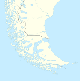
Desolación Island (Spanish: Isla Desolación) (Spanish for Desolation) is an island at the western end of the Strait of Magellan in the Magallanes y la Antártica Chilena Region, Chile.
 Desolation Island | |
| Geography | |
|---|---|
| Location | Chile |
| Archipelago | Tierra del Fuego |
| Area | 1,352 km2 (522 sq mi) |
| Coastline | 866.1 km (538.17 mi) |
| Highest elevation | 1,128 m (3701 ft) |
| Highest point | Monte Harte Dyke |
| Administration | |
Chile | |
| Demographics | |
| Population | 0 |
| Additional information | |
| NGA UFI=-879556 | |
Its northwestern point is called Cabo Pilar (Cape Pillar), and marks the entrance to the Strait of Magellan. Off Cape Pillar are three rocks in the sea, called Islotes Evangelistas (the Apostles).[1][2]
Desolación Island in fiction
The Douglas Preston and Lincoln Child novel The Ice Limit described an expedition to Isla Desolacion near Cape Horn in Chile. The map in the (paperback) edition incorrectly identifies easterly Isla Wollastone as Isla Desolacion. The authors, in a note, say this is intentional.
James Michener's novel Hawaii depicts an attempt by a sailing ship to pass the Straits of Magellan, describing the western exit past Desolation Island as the most difficult part of the passage.
In Herman Melville's novel Moby-Dick, narrator Ishmael recalls a marble tablet at a whalemen's chapel in New Bedford which pays homage to a whaleman named John Talbot, who lost overboard "near the Isle of Desolation, off Patagonia".
In Patrick O'Brian's novel Blue at the Mizzen, a British man-of-war is sent on a peace time mission to Chile and the Straits of Magellan.
In the Jackie Chan Adventures animated television series in Season 2 Episode 24 - Scouts Honor, Jackie Chan teleport the episode's villain, Vanessa Barone, with the Eye of Aurora to Desolacion Island, saying that it is a little island off the coast of Chile and is "one of the most remote spots on earth".
See also
References
- J. David Williams (1873). "Patagonia". The Peoples' Pictorial Atlas (map). New York. Retrieved 2012-01-10.
- J. H. Colton (1857). "Patagonia" (map). New York. Retrieved 2012-01-10.
External links
- Islands of Chile @ United Nations Environment Programme
- World island information @ WorldIslandInfo.com
- South America Island High Points above 1000 meters
- United States Hydrographic Office, South America Pilot (1916)
- UN SYSTEM-WIDE EARTHWATCH Web Site
На других языках
[de] Isla Desolación
Die Isla Desolación ist eine Insel im Süden Chiles. Die langgestreckte Insel bildet einen Teil der Südküste der Magellanstraße. Sie ist die westlichste der Patagonien gegenüberliegenden, die Meerenge bildenden Inseln. Durch den Canal Abra ist sie von der östlich gelegenen Isla Santa Inés getrennt. Ihr nordwestliches Kap markiert die Ausfahrt in den Pazifischen Ozean. Die Küstenlinie ist durch Fjorde stark gegliedert.- [en] Desolación Island
[es] Isla Desolación
La isla Desolación [Nota 1] forma parte del archipiélago de Tierra del Fuego ubicado en la región austral de Chile. Pertenece al sector que para su estudio se ha denominado como de las islas del NO. [Nota 2][fr] Île Desolación
L'île Desolación (en espagnol : Isla Desolation) est une île située à l'extrémité occidentale du détroit de Magellan, dans la Région de Magallanes et de l'Antarctique chilienne, au Chili.[it] Isola Desolación
L'isola della Desolazione (in spagnolo Isla Desolación) è un'isola del estremo meridione del Cile, nell'arcipelago della Terra del Fuoco, inquadrata amministrativamente nella regione di Magellano e dell'Antartide Cilena. Si trova immediatamente a sud della bocca più settentrionale e occidentale dello stretto di Magellano, sull'oceano Pacifico a nord dell'isola Santa Inés.Другой контент может иметь иную лицензию. Перед использованием материалов сайта WikiSort.org внимательно изучите правила лицензирования конкретных элементов наполнения сайта.
WikiSort.org - проект по пересортировке и дополнению контента Википедии