geo.wikisort.org - Island
The Calamian Islands or the Calamianes is a group of islands in the province of Palawan, Philippines. It includes:
- Busuanga Island
- Coron Island
- Culion Island
- Calauit Island
- Malcapuya Island
- Banana Island
- Pass Island
- Calumbuyan Island
- several minor islets
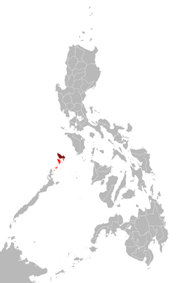 Map of the Philippines showing the location of the Calamianes (in red) and Busuanga Island (in maroon) | |
 Calamianes Location within Palawan | |
| Geography | |
|---|---|
| Coordinates | 11°54′N 120°14′E |
| Adjacent bodies of water |
|
| Major islands |
|
| Administration | |
Philippines | |
| Region | Mimaropa |
| Province | Palawan |
History
Historically, the Calamianes was site of the Spanish politico-militar Provincia de Calamianes. It became the site of a Presidio or a Spanish military garrison, and the small group of islands received, almost 100 Spanish and Mexican soldier-colonists in the 1670s.[1] The Spanish Empire later purchased mainland Paragua from the Sultan of Borneo. During the American occupation (1898-1948), the old Provincia de Calamianes was dissolved and jointly administered with the Island of Paragua as the new Province of Palawan.
During the American occupation and up until recently, Culion Island was host to a leper colony. Busuanga Island hosts the largest town, Coron, in the Calamian Islands. Coron Island is known for having the cleanest inland body of water in the Philippines, called Kayangan Lake. Calauit Island is known for hosting a number of endangered African animal species. Diving spots, with coral reefs and sunken World War II Japanese shipwrecks, also lies within the waters of these islands.
Geology
Part of the North Palawan Block, Busuanga and Culon islands consist mainly of the Liminangcong Formation, a Permian to Late Jurassic chert. This chert forms the distinguishing mountain ranges, with the Middle-Late Jurassic Guinlo Formation clastics forming the valleys on Busuanga. Coron Island is distinguished by its Late Triassic Coron Limestone.[2]
References
- Convicts or Conquistadores? Spanish Soldiers in the Seventeenth-Century Pacific By Stephanie J. Mawson AGI, México, leg. 25, núm. 62; AGI, Filipinas, leg. 8, ramo 3, núm. 50; leg. 10, ramo 1, núm. 6; leg. 22, ramo 1, núm. 1, fos. 408 r –428 v ; núm. 21; leg. 32, núm. 30; leg. 285, núm. 1, fos. 30 r –41 v .
- Zamoras, Lawrence; Matsuoka, Atsushi (January 2001). "The Malampaya Sound Group in the Calamian Islands, North Palawan Block (Philippines)". ResearchGate GmbH. Retrieved 2 June 2022.
External links
 Calamian Islands travel guide from Wikivoyage
 Geographic data related to Calamian Islands at OpenStreetMap
This article about a location in Mimaropa region is a stub. You can help Wikipedia by expanding it. |
На других языках
[de] Calamian-Inseln
Die Calamian-Inseln bestehen aus 128 Inseln und gehören zur Provinz Palawan im Westen der Philippinen.- [en] Calamian Islands
[fr] Îles Calamian
Les îles Calamian forment un ensemble d'îles, aux Philippines au nord-est de l'île de Palawan et faisant partie de la province de Palawan.[it] Calamian
Le Calamian sono un arcipelago che si trova nel Mar Cinese meridionale, tra le isole Mindoro a nord-est e Palawan a sud-ovest. Hanno una superficie totale di 1 753 km²ed una popolazione di circa 88 000 abitanti (2007). Amministrativamente appartengono alle Filippine, Provincia di Palawan.[ru] Каламианские острова
Каламианские острова (тагальск. и англ. Calamian) — группа островов в Южно-Китайском море, в архипелаге Филиппинских островов.Другой контент может иметь иную лицензию. Перед использованием материалов сайта WikiSort.org внимательно изучите правила лицензирования конкретных элементов наполнения сайта.
WikiSort.org - проект по пересортировке и дополнению контента Википедии