geo.wikisort.org - Island
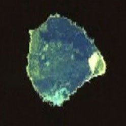
Bolshoi Tyuters (Russian: Большой Тютерс; Finnish: Tytärsaari; Estonian: Suur Tütarsaar; Swedish: Tyterskär) is an island in the Gulf of Finland of the Baltic Sea, located 75 km (47 mi) away from the coast of Finland, to the south-east from Hogland. The island is a part of the Leningrad Oblast, Russia. The area is approximately 8.3 km2 (3.2 sq mi). There are no permanent inhabitants, save for a lighthouse keeper.
This article may be expanded with text translated from the corresponding article in Finnish. (November 2015) Click [show] for important translation instructions.
|
This article relies largely or entirely on a single source. (November 2018) |
 | |
| Geography | |
|---|---|
| Location | Gulf of Finland |
| Coordinates | 59°51′N 27°12′E |
| Area | 8.3 km2 (3.2 sq mi) |
| Administration | |
Russia | |
| Leningrad Oblast | |
| Demographics | |
| Population | 1 |
History
The island was populated by Finns from the 16th century to 1939. After the Soviet Union attacked Finland in the Winter War, the island, along with other Finnish islands in the Gulf of Finland and communities in Finnish Karelia, was ceded to the Soviet Union under the Moscow Peace Treaty of 1940. Islanders were among the Finnish evacuees, and after World War II they were not permitted to return to their homes.
Before the war, the island was a lively Finnish fishing and trading community, with a population of 436 in 1939. Many cargo and fishing ships were registered to the island. It had a wooden church built in 1772, a Finnish graveyard, a school, a lighthouse built in 1904, a Finnish Coast Guard station and a weather forecast station. Tourism was a growing business in 1920–39. The name Tytärsaari means "Daughter Island" in Finnish.
Bolshoi Tyuters is sometimes referred to as the "mined island" because its World War II minefields have not been cleared. Thousands of rusting pieces of German equipment and weaponry, including artillery and ammunition, are scattered on the island.[1]
References
External links
- The Mined Island (in Russian)
- The Map of Tytärsaari (in Finnish)
На других языках
[de] Bolschoi Tjuters
Groß Tütters oder Bolschoi Tjuters (russisch Большой Тютерс; finn. Tytärsaari; estn. Suur Tütarsaar; schwed. Tyterskär) ist eine russische Insel im Finnischen Meerbusen der Ostsee.- [en] Bolshoy Tyuters
[fr] Tytärsaari
Tytärsaari (en russe : Большой Тютерс ; en finnois : Tytärsaari ; en suédois : Tyterskär ; en estonien : Suur Tütarsaar) est une île située dans le golfe de Finlande, à 75 km km de la côte méridionale de Finlande. L'île fait partie du raïon de Kingissepp de l'oblast de Léningrad en Russie[1].[it] Bol'šoj Tjuters
Bol'šoj Tjuters (in russo Большой Тютерс; in finlandese Tytärsaari; in estone Suur Tütarsaar; in svedese Tyterskär) è una piccola isola del mar Baltico situata nella parte orientale del Golfo di Finlandia, posta a 75 km a sud della costa finlandese ed a 20 km a sud-ovest di Gogland; appartiene alla Russia, e fa parte dell'Oblast' di Leningrado. L'isola ha una superficie di circa 8,3 km² ed è disabitata, salvo che per il personale del faro presente su di essa.[ru] Большой Тютерс
Большой Тютерс (фин. Tytärsaari; швед. Tyterskär; эст. Tütarsaar — дочерний остров) — российский остров в центральной части Финского залива, расположенный в 75 км от побережья Финляндии и к юго-востоку от Гогланда. Входит в состав Кингисеппского района Ленинградской области.Другой контент может иметь иную лицензию. Перед использованием материалов сайта WikiSort.org внимательно изучите правила лицензирования конкретных элементов наполнения сайта.
WikiSort.org - проект по пересортировке и дополнению контента Википедии