geo.wikisort.org - Island
Bergsøya is an island in the municipality of Herøy in Møre og Romsdal county, Norway. The island is the location of the town of Fosnavåg as well as the Eggesbønes industrial area. The island is connected to other islands via a network of bridges. The Nerlandsøy Bridge connects it to the island Nerlandsøya (to the northwest) and a small road bridge connects it to Leinøya (to the east). The Flåvær islands lie to the south. The highest point on the island is Igesundshetta which is 216 metres (709 ft) above sea level. The 7.6-square-kilometre (2.9 sq mi) island has a population of 3,558 in 2014.[1]
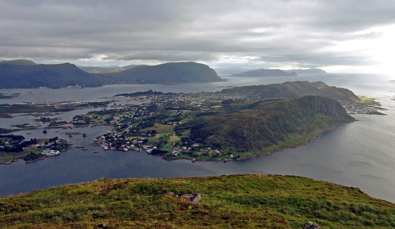 View of the island | |
 | |
 Bergsøya Location of the island  Bergsøya Bergsøya (Norway) | |
| Geography | |
|---|---|
| Location | Møre og Romsdal, Norway |
| Coordinates | 62.3324°N 5.6301°E |
| Area | 7.6 km2 (2.9 sq mi) |
| Length | 4.2 km (2.61 mi) |
| Width | 3 km (1.9 mi) |
| Highest elevation | 216 m (709 ft) |
| Highest point | Igesundshetta |
| Administration | |
Norway | |
| County | Møre og Romsdal |
| Municipality | Herøy Municipality |
| Demographics | |
| Population | 3,558 (2014) |
See also
References
- Thorsnæs, Geir, ed. (2015-10-14). "Bergsøya - øy i Herøy". Store norske leksikon (in Norwegian). Kunnskapsforlaget. Retrieved 2019-09-08.
This Møre og Romsdal location article is a stub. You can help Wikipedia by expanding it. |
На других языках
[de] Bergsøya (Herøy)
Bergsøya ist eine zur norwegischen Inselgruppe Sørøyane (Südinseln) gehörende Insel in der Kommune Herøy in der Provinz (Fylke) Møre og Romsdal.- [en] Bergsøya, Herøy
Текст в блоке "Читать" взят с сайта "Википедия" и доступен по лицензии Creative Commons Attribution-ShareAlike; в отдельных случаях могут действовать дополнительные условия.
Другой контент может иметь иную лицензию. Перед использованием материалов сайта WikiSort.org внимательно изучите правила лицензирования конкретных элементов наполнения сайта.
Другой контент может иметь иную лицензию. Перед использованием материалов сайта WikiSort.org внимательно изучите правила лицензирования конкретных элементов наполнения сайта.
2019-2025
WikiSort.org - проект по пересортировке и дополнению контента Википедии
WikiSort.org - проект по пересортировке и дополнению контента Википедии