geo.wikisort.org - Island
Austra is an island on the border between Trøndelag and Nordland counties in Norway. The 88-square-kilometre (34 sq mi) island is shared between the municipalities of Bindal, Leka, and Nærøysund. The highest point is the 588-metre-tall (1,929 ft) Romsskåla. The village of Årset lies on the southeastern shore, along the Årsetfjorden. The village of Bogen lies on the east coast of the island where the bridge connects it to the mainland. The village of Horsfjord lies on the northern coast. The village of Gutvik lies on the western coast[1]
This article relies largely or entirely on a single source. (August 2021) |
 Aerial view from the east towards west, of Bindal municipality in Nordland county, Norway. | |
 | |
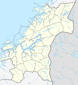 Austra Location of the island  Austra Austra (Nordland)  Austra Austra (Norway) | |
| Geography | |
|---|---|
| Location | Trøndelag and Nordland, Norway |
| Coordinates | 65.0837°N 11.8769°E |
| Area | 88 km2 (34 sq mi) |
| Length | 21 km (13 mi) |
| Width | 6.5 km (4.04 mi) |
| Coastline | 61 km (37.9 mi) |
| Highest elevation | 588 m (1929 ft) |
| Highest point | Romsskåla |
| Administration | |
Norway | |
| Counties | Trøndelag and Nordland |
| Municipality | Nærøysund, Leka, Bindal |
| Demographics | |
| Population | c. 300 (2001[1]) |
| Pop. density | 3.4/km2 (8.8/sq mi) |
See also
References
- Thorsnæs, Geir, ed. (13 November 2017). "Austra". Great Norwegian Encyclopedia (in Norwegian). Kunnskapsforlaget. Retrieved 30 April 2018.
This article about an island in Nordland is a stub. You can help Wikipedia by expanding it. |
This Trøndelag location article is a stub. You can help Wikipedia by expanding it. |
На других языках
- [en] Austra
[it] Austra (isola)
Austra è un'isola della Norvegia, situata sul confine tra le regioni di Trøndelag e Nord-Norge; la parte occidentale dell'isola ricade nell'area del comune di Leka, quella sud-orientale nel comune di Nærøysund (entrambi nella contea di Trøndelag, regione di Trøndelag) e quella nord-orientale appartiene al comune di Bindal (contea di Nordland, Nord-Norge)[1].Текст в блоке "Читать" взят с сайта "Википедия" и доступен по лицензии Creative Commons Attribution-ShareAlike; в отдельных случаях могут действовать дополнительные условия.
Другой контент может иметь иную лицензию. Перед использованием материалов сайта WikiSort.org внимательно изучите правила лицензирования конкретных элементов наполнения сайта.
Другой контент может иметь иную лицензию. Перед использованием материалов сайта WikiSort.org внимательно изучите правила лицензирования конкретных элементов наполнения сайта.
2019-2026
WikiSort.org - проект по пересортировке и дополнению контента Википедии
WikiSort.org - проект по пересортировке и дополнению контента Википедии