geo.wikisort.org - Island
Ōshima (大島) is an inhabited island in the Geiyo Islands in the Seto Inland Sea of Japan, lying between the larger islands of Honshū and Shikoku.
Native name: 大島 | |
|---|---|
 Mount Kirō on Ōshima | |
 Ōshima  Ōshima | |
| Geography | |
| Location | Seto Inland Sea |
| Coordinates | 34°9′10″N 133°3′30″E |
| Archipelago | Geiyo Islands |
| Area | 41.90 km2 (16.18 sq mi) |
| Highest elevation | 381.9 m (1253 ft) |
| Highest point | Mount Kirō |
| Administration | |
Japan | |
| Prefecture | Ehime |
| City | Imabari |
| Demographics | |
| Population | 6031 (2015) |
| Additional information | |
 | |
Overview
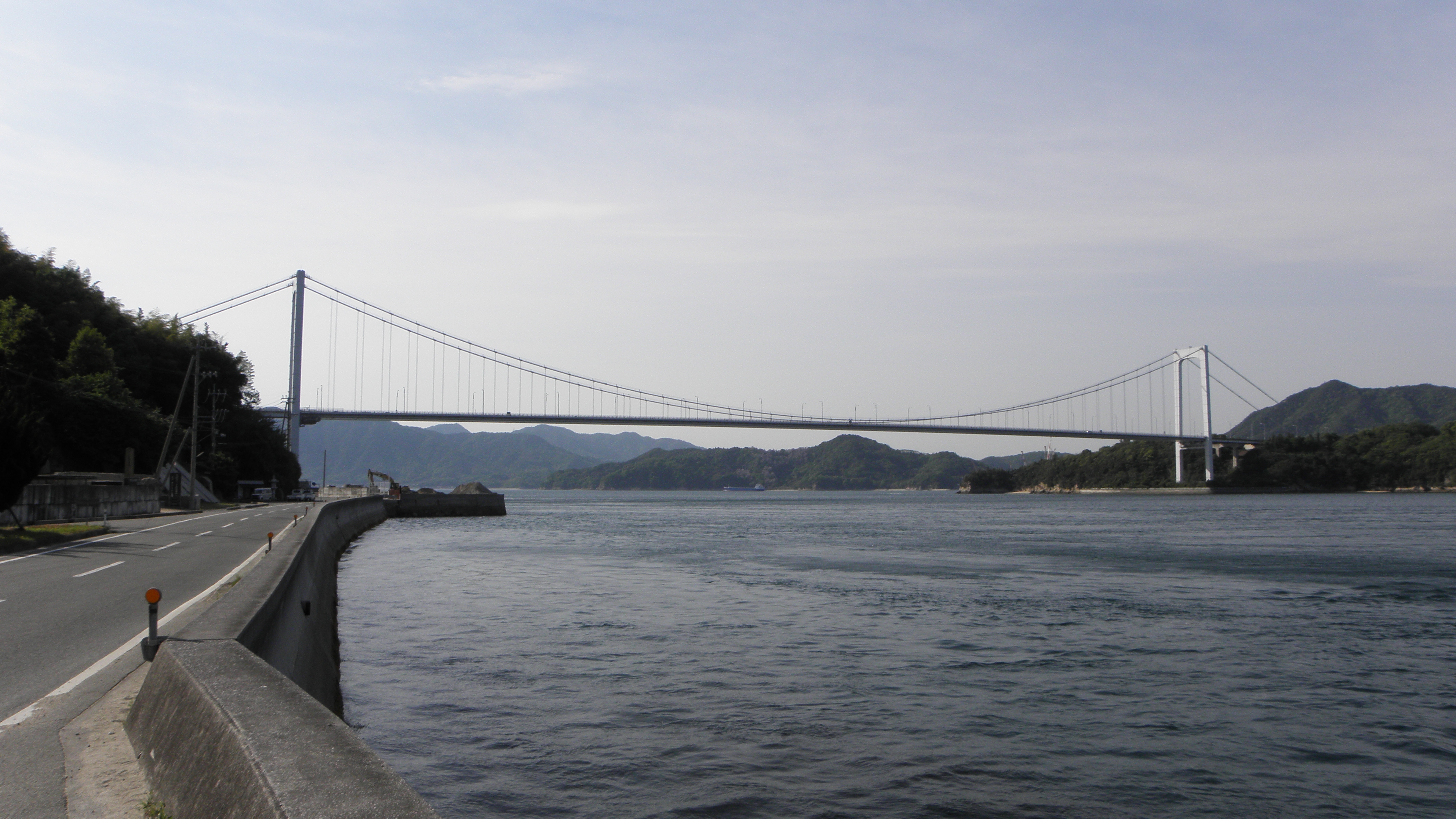
Ōshima is located in the north of Ehime prefecture, and has an area of 41.89 square kilometres (16.17 sq mi). Administratively, it was formerly divided between the towns of Yoshiumi and Miyakubo of Ochi District, Ehime; however, in January 16, 2005 both towns were absorbed into the city of Imabari. The highest elevation on the island is Mount Kirō, at 381.9 metres (1,253 ft). Compared to other islands in the Geiyo Archipelago, the island with many flat areas, which has permitted the developed of rice paddy fields. Other economic activities have traditionally included the cultivation of citrus fruits, mainly mikan, a small shipyard and stone quarries. The island is on the Shimanami Kaidō, an expressway between Honshū and Shikoku, and is linked to Hatakajima by the Hakata-Ōshima Bridge and Kurushima by the Kurushima-Kaikyō Bridge. The expressway has placed the island within commuting distance of Imabari.
This Ehime Prefecture location article is a stub. You can help Wikipedia by expanding it. |
На других языках
- [en] Ōshima (Ehime)
[es] Ōshima (Ehime)
La isla Ō (大島, Ō-shima?) es una isla japonesa habitada del archipiélago Geiyo (芸予諸島, Geiyo-shotō?) en el mar Interior de Seto. Está localizada en el norte de la prefectura de Ehime.[ru] Осима (Эхиме)
О́сима[1] (яп. 大島) — остров, принадлежащий Японии во Внутреннем Японском море, между крупными островами Хонсю и Сикоку. Относится к префектуре Эхиме. Высшая точка 382 м[1][2]. Площадь 41,86 км²[2]. На селение на 2000 год составляло 8372 человек[2]. Остров пересекает автострада Нисисето[en], между Ономити в префектуре Хиросима на острове Хонсю и Имабари в префектуре Эхиме на острове Сикоку. На остров ведут два моста, являющиеся частью автострады Нисисето, — мост Хаката — Осима[en], соединяющий с соседним островом Хакатадзима[ja], и мост Курусима-Кайкё над одноимённым проливом, отделяющим его от острова Сикоку.Другой контент может иметь иную лицензию. Перед использованием материалов сайта WikiSort.org внимательно изучите правила лицензирования конкретных элементов наполнения сайта.
WikiSort.org - проект по пересортировке и дополнению контента Википедии