geo.wikisort.org - Insel
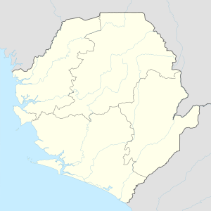
Die Turtle Islands (deutsch Schildkröten-Inseln), offiziell Turtle Island Group[1], sind eine Inselgruppe im Atlantischen Ozean vor der Küste des westafrikanischen Staates Sierra Leone. Sie liegen unmittelbar westlich der Sherbro-Insel und bestehen aus acht Inseln (![]() Karte mit allen Koordinaten: OSM | WikiMap ).[2]
Karte mit allen Koordinaten: OSM | WikiMap ).[2]
| Turtle Islands | ||
|---|---|---|
 | ||
| Gewässer | Atlantischer Ozean (Bucht von Yawri) | |
| Geographische Lage | 7° 37′ N, 13° 1′ W | |
|
| ||
| Anzahl der Inseln | 8 | |
| Hauptinsel | Baki | |
Die Turtle Islands sind als Brutgebiet für Meeresschildkröten bekannt.[3]
Geographie
Die Inseln sind allesamt flach und von tropischem Buschland sowie Kokospalmen bedeckt. Im Süden befinden sich auf allen Inseln ausgedehnte Sandstrände. Die größeren fünf Inseln werden von Fischern bewohnt.[4] Die größte Ansiedlung befindet sich auf der Insel Baki.[5][6]
Inseln
| Name | Koord. | Max. Ausdehnung (m × m) |
Fläche (km²) |
Einwohner | Einw/km² | Foto |
|---|---|---|---|---|---|---|
| Baki (Bakie, Bakay) |
7° 35′ 40,7″ N, 13° 0′ 43,8″ W | 2000 × 2000 | 1,35 | |||
| Baoma (Moot, Mut) |
7° 37′ 55,6″ N, 13° 3′ 10,9″ W | 5500 × 2000 | 5,3 | |||
| Bumpetuk | ||||||
| Chepo | 7° 35′ 17,7″ N, 12° 55′ 31,6″ W | 800 × 700 | 0,5 | |||
| Hoong | 7° 40′ 23,4″ N, 13° 3′ 55,6″ W | 1700 × 400 | 0,5 | |||
| Nyangei | 7° 37′ 47,4″ N, 12° 57′ 28″ W | 500 × 120 | 0,05 | ± 400[7] | 8000 | Foto |
| Sei | 7° 38′ 7,6″ N, 12° 59′ 47,7″ W | 1500 × 950 | 1,0 | |||
| Yele | 7° 34′ 54,5″ N, 12° 58′ 43,2″ W | 4000 × 2900 | 4,5 |
Anmerkung: Flächenangaben und Ausdehnung basieren auf Google Earth Pro sofern nicht anders angegeben.
Weblinks
- Turtle Islands auf VisitSierraLeone.org (englisch)
- In Pictures – Sierra Leone’s Turtle Islands (englisch)
- Artikel zu den Turtle Islands (englisch)
Einzelnachweise
- Annual Statistical Digest 2005/2006. Statistics Sierra Leone, 2006, S. 1.
- Katrina Manson, James Knight: Sierra Leone, Bradt Travel Guides, 2015, 3. Auflage. (online abrufbar)
- Persistence pays with sea turtle education and sensitisation in Sierra Leone. IUCN, 14. Dezember 2015.
- Paradise regained. The Guardian, 9. März 2008 abgerufen am 5. Februar 2013
- Turtle Islands, Sierra Leone., obtuseworks, 1. Juli 2013 abgerufen am 5. Februar 2013
- Easter at Turtle Islands, Sierra Leone.... Sandra's Latest, 10. Juni 2013 abgerufen am 5. Februar 2013
- Turtle Islands Odessey. Impressions of Sierra Leone. Abgerufen am 26. Februar 2018.
На других языках
- [de] Turtle Islands (Sierra Leone)
[en] Turtle Islands, Sierra Leone
The Turtle Islands are in the Atlantic Ocean, located west of Sherbro Island in the Southern Province of Sierra Leone. Of the eight islands, seven are inhabited. Sherbro is the predominant ethnic group. This eight-island archipelagos expands in a zone of 8 miles (13 km) over shallow waters and white sand banks.[1] Yele, Bakie, Bumpetuk, Chepo, Hoong, Mut, Nyangei and Sei are the names of the islands.[2][ru] Тертл (острова, Сьерра-Леоне)
Тертл[1] (англ. Turtle Islands) — группа островов в Атлантическом океане. Расположена у побережья Сьерра-Леоне в Западной Африке, у западной оконечности острова Шербро[2]. Административно относится к округу Бонте[en] Южной провинции.Другой контент может иметь иную лицензию. Перед использованием материалов сайта WikiSort.org внимательно изучите правила лицензирования конкретных элементов наполнения сайта.
WikiSort.org - проект по пересортировке и дополнению контента Википедии
