geo.wikisort.org - Insel
Sandbore Caye ist eine Insel im Belize District von Belize.
| Sandbore Caye | ||
|---|---|---|
| Gewässer | Karibisches Meer | |
| Geographische Lage | 17° 28′ N, 87° 29′ W | |
| ||
| Einwohner | 4 | |
Geographie
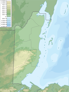
Sandbore Caye hat eine Fläche von 4 ha. Die Insel liegt 80 km vor der Küste von Belize und bildet die nördlichste und östlichste Insel des Lighthouse Reef Atolls und ist damit das östlichste Stück Land von Belize. Auf der Insel befindet sich ein Leuchtturm, der von einem Leuchtturmwärter mit Familie bewohnt wird. Etwa 1 km weiter südwestlich befindet sich die größere Insel Northern Caye.[1]
Einzelnachweise
На других языках
- [de] Sandbore Caye
[en] Sandbore Caye
Sandbore Caye is a small island with an area of 10 acres (4.0 ha) 50 miles (80 km) off the coast of Belize. It is the northernmost as well as easternmost islet of Lighthouse Reef Atoll, and at the same time the easternmost landmass of the state of Belize. It has a lighthouse occupied by a keeper and his family. The census of 2012 numbered 4. 0.66 miles (1.06 km) to the southwest is the larger island, Northern Caye.[fr] Caye Sandbore
La Caye Sandbore est une caye située à 80 km au large de la côte du Belize et fait partie du District de Belize.Текст в блоке "Читать" взят с сайта "Википедия" и доступен по лицензии Creative Commons Attribution-ShareAlike; в отдельных случаях могут действовать дополнительные условия.
Другой контент может иметь иную лицензию. Перед использованием материалов сайта WikiSort.org внимательно изучите правила лицензирования конкретных элементов наполнения сайта.
Другой контент может иметь иную лицензию. Перед использованием материалов сайта WikiSort.org внимательно изучите правила лицензирования конкретных элементов наполнения сайта.
2019-2026
WikiSort.org - проект по пересортировке и дополнению контента Википедии
WikiSort.org - проект по пересортировке и дополнению контента Википедии