geo.wikisort.org - Insel
Der San-Bernardo-Archipel, span. Archipiélago de San Bernardo, ist eine Inselgruppe im Karibischen Meer. Der Archipel besteht aus zehn Inseln, die alle zu Kolumbien gehören. Die Inseln liegen knapp 20 Kilometer vor der südamerikanischen Küste und ca. 80 Kilometer südwestlich der Stadt Cartagena. Der Archipel bildet zusammen mit den Islas del Rosario einen der 52 Naturparks Kolumbiens und ist von der Stadt Tolú aus mit dem Boot erreichbar. Administrativ gehört die Inselgruppe größtenteils zur Gemeinde Cartagena im Departamento de Bolívar.[1] Nur die Insel Boquerón gehört zur Gemeinde San Onofre im Departamento de Sucre.[2]
| San-Bernardo-Archipel | ||
|---|---|---|
 | ||
| Gewässer | Golf von Morrosquillo, Karibisches Meer | |
| Geographische Lage | 9° 45′ N, 75° 51′ W | |
| ||
| Anzahl der Inseln | 10 | |
| Hauptinsel | Santa Cruz del Islote | |
| Gesamte Landfläche | 4,5 km² | |
| Einwohner | 1300 | |
 | ||
Die Gesamtfläche der Inseln beträgt 4,5 km² oder 450 Hektar;[3] davon nimmt Tintipán (331,5 Hektar) fast drei Viertel (74 Prozent) ein.
Inseln
- Boquerón
- Ceycén
- Cabruna
- Mangle
- Maravilla
- Múcura (36,7 Hektar)
- Palma
- Panda
- Santa Cruz del Islote
- Tintipán (331,5 Hektar)
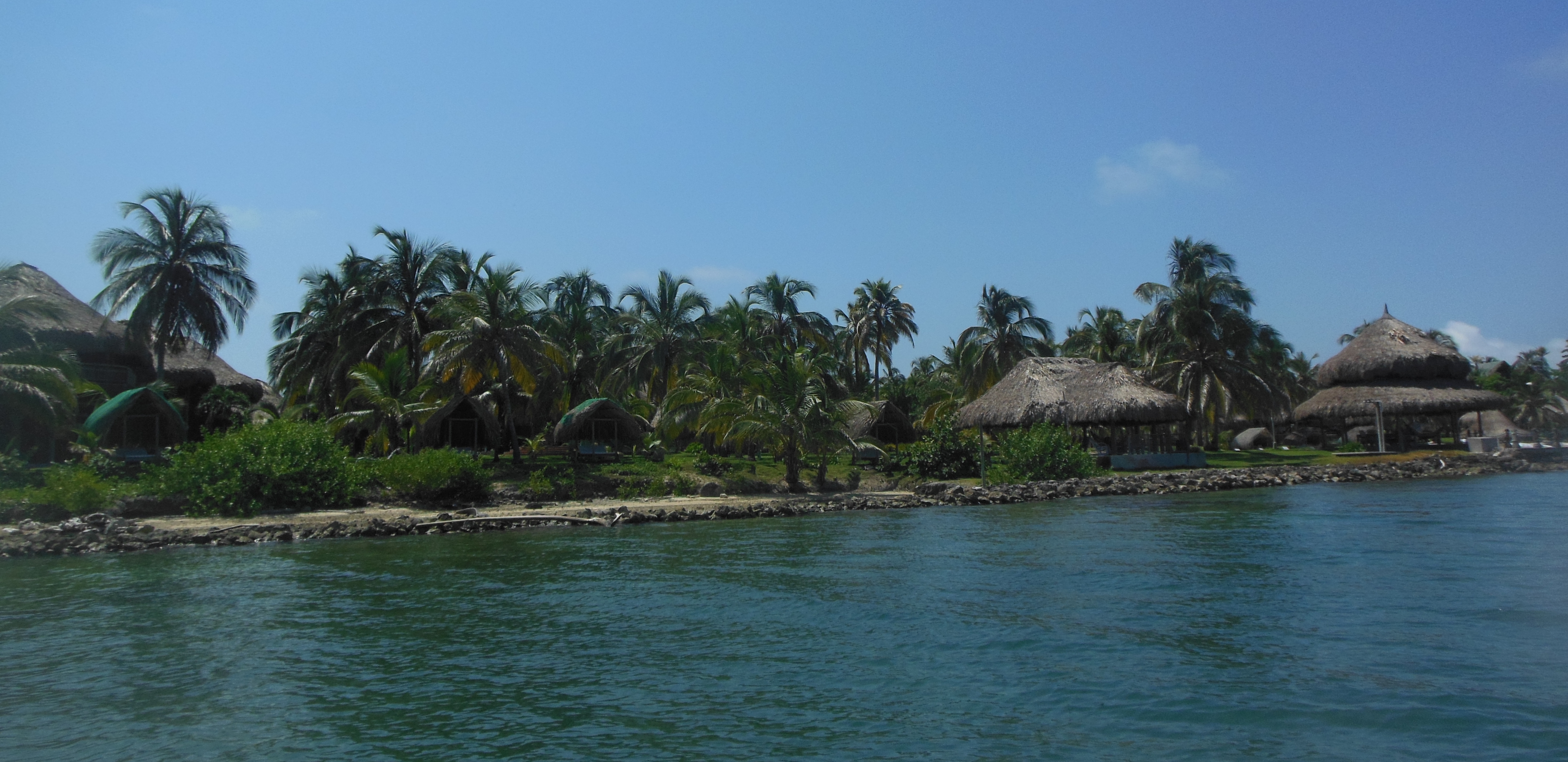
Die mit Abstand größte Insel ist Tintipán. Der größte Teil der rund 1300 Einwohner des Archipels lebt jedoch auf der winzigen Insel Santa Cruz del Islote[4], eine der dichtest besiedelten Inseln der Erde. Auf einigen der Inseln, etwa Múcura und Tintipán, gibt es touristische Infrastruktur.
Einzelnachweise
- Archivierte Kopie (Memento des Originals vom 5. März 2016 im Internet Archive) Info: Der Archivlink wurde automatisch eingesetzt und noch nicht geprüft. Bitte prüfe Original- und Archivlink gemäß Anleitung und entferne dann diesen Hinweis.
- Eduardo Rubiano Moncada: Das volle Leben. In: Geo Special: Inseln, Gruner u. Jahr, 2010, ISBN 978-3-570-19918-3.
Weblinks
На других языках
- [de] San-Bernardo-Archipel
[en] Archipelago of San Bernardo
The Archipelago of San Bernardo (Spanish: Archipiélago de San Bernardo, Islas de San Bernardo[1]) is a set of nine[2] coastal coral islands and one artificial island (ten in total)[3] belonging to and governed by Colombia, located in the Gulf of Morrosquillo in the Caribbean Sea, with an approximate area of 213 km2.[4] Administratively, the archipelago belongs to the Bolívar Department,[1] with the exception of Boquerón Island, which belongs to the Sucre Department.[5] It consists of Boquerón Island, Cabruna Island, Ceycén Island, Mangle Island, Múcura Island, Palma Island, Panda Island, Santa Cruz del Islote (English: Santa Cruz Islet, an artificial island), Tintipán Island and Maravilla Island. All the 10 islands are close to the towns Tolu and Coveñas.[6][fr] Archipel San Bernardo
L’archipel de San Bernardo est un ensemble de 10 îles côtières appartenant à la Colombie, situées dans le golfe de Morrosquillo en mer des Caraïbes, avec une superficie approximative de 213,3 Km2[1]. L'île principale, Tintipán, se trouve à 17 km au nord-ouest de la côte.Другой контент может иметь иную лицензию. Перед использованием материалов сайта WikiSort.org внимательно изучите правила лицензирования конкретных элементов наполнения сайта.
WikiSort.org - проект по пересортировке и дополнению контента Википедии