geo.wikisort.org - Insel
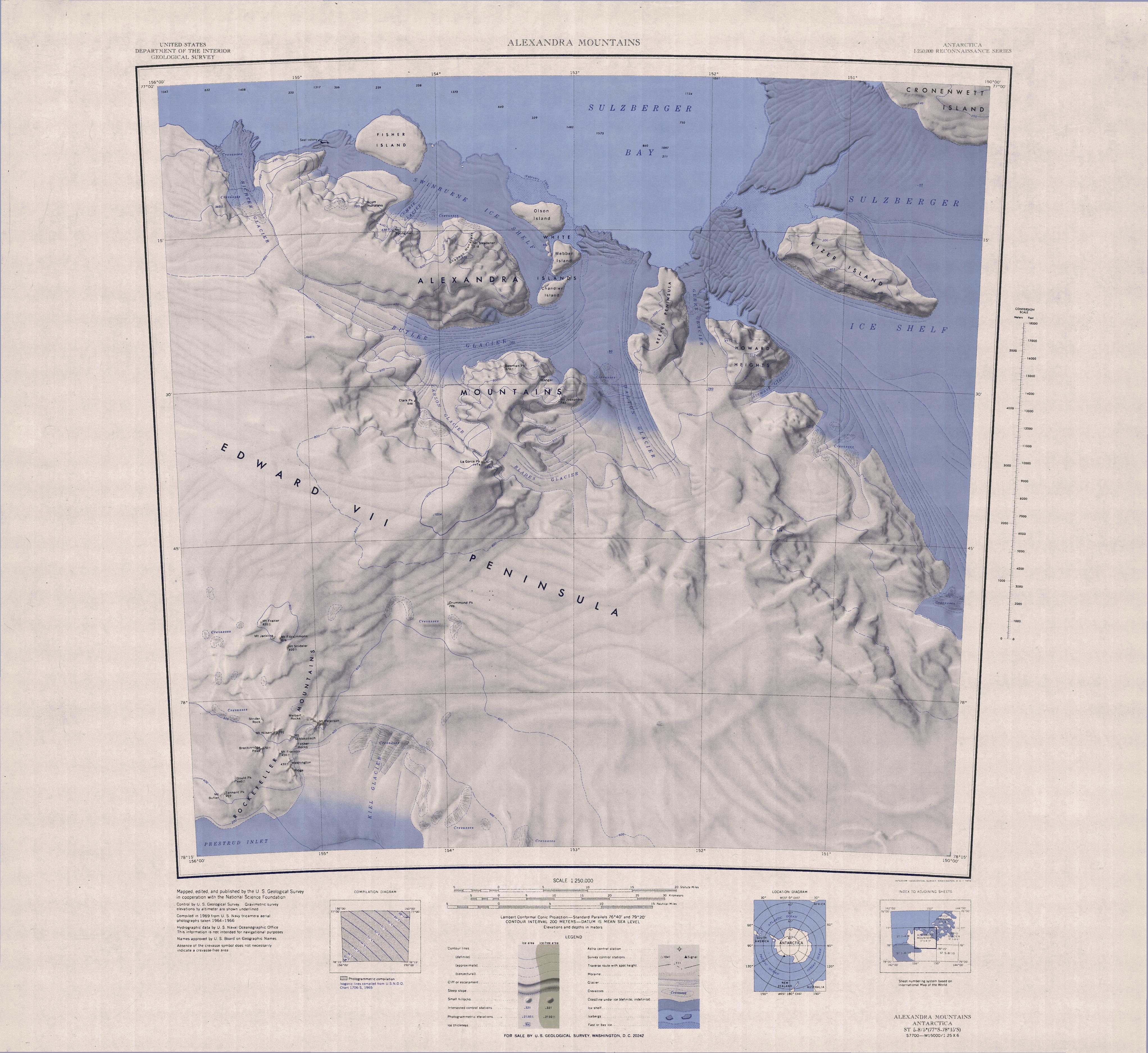
Olson Island ist eine Insel vor der Saunders-Küste des westantarktischen Marie-Byrd-Lands. Sie ist die nördlichste und größte Insel in der von Eis überdeckten Gruppe der White Islands am Kopfende der Sulzberger Bay.
| Olson Island | ||
|---|---|---|
 | ||
| Gewässer | Sulzberger Bay | |
| Inselgruppe | White Islands | |
| Geographische Lage | 77° 14′ S, 153° 17′ W | |
| ||
| Einwohner | unbewohnt | |

Der United States Geological Survey kartierte sie anhand eigener Vermessungen und Luftaufnahmen der United States Navy aus den Jahren von 1959 bis 1965. Das Advisory Committee on Antarctic Names benannte sie 1970 nach Michael L. Olson, Ionosphärenphysiker des United States Antarctic Program auf der Byrd-Station von 1968 bis 1969.
Weblinks
- Olson Island im Geographic Names Information System des United States Geological Survey (englisch)
- Olson Island auf geographic.org (englisch)
На других языках
- [de] Olson Island
[en] Olson Island
Olson Island is the largest and northernmost of the ice-covered White Islands, in southern Sulzberger Bay. The feature is rudely delineated on the map of the Byrd Antarctic Expedition, 1928–30, and is indicated as "low ice cliffs" that rise above the ice shelf in this part of the bay. It was mapped in detail by the United States Geological Survey (USGS) from surveys and U.S. Navy air photos, 1959–65. It was named for Michael L. Olson, United States Antarctic Research Program (USARP) ionospheric physicist at Byrd Station, winter party 1968, and a member of the Plateau Station summer party, 1968–69.[it] Isola Olson
L'isola Olson è un'isola rocciosa della Terra di Marie Byrd, in Antartide. L'isola, che è completamente ricoperta dai ghiacci, è situata in particolare nella parte della Terra di Marie Byrd che si sovrappone alla parte nord-orientale della Dipendenza di Ross e fa parte delle isole White, di cui è la più vasta e la più settentrionale; come le altre isole di questo arcipelago anch'essa si trova davanti alla costa di Saunders, nella parte meridionale della baia di Sulzberger, dove è quasi completamente circondata dai ghiacci della piattaforma glaciale Swinburne e dove giace poco a nord-est dell'isola Webber.[1]Текст в блоке "Читать" взят с сайта "Википедия" и доступен по лицензии Creative Commons Attribution-ShareAlike; в отдельных случаях могут действовать дополнительные условия.
Другой контент может иметь иную лицензию. Перед использованием материалов сайта WikiSort.org внимательно изучите правила лицензирования конкретных элементов наполнения сайта.
Другой контент может иметь иную лицензию. Перед использованием материалов сайта WikiSort.org внимательно изучите правила лицензирования конкретных элементов наполнения сайта.
2019-2026
WikiSort.org - проект по пересортировке и дополнению контента Википедии
WikiSort.org - проект по пересортировке и дополнению контента Википедии