geo.wikisort.org - Insel
Ilhéu de Cima ist eine kleine, unbewohnte Insel in der portugiesischen autonomen Region Madeira.
| Ilhéu de Cima | ||
|---|---|---|
 | ||
| Gewässer | Atlantischer Ozean | |
| Inselgruppe | Madeira | |
| Geographische Lage | 33° 3′ 17″ N, 16° 16′ 55″ W | |
| ||
| Länge | 1,2 km | |
| Breite | 500 m | |
| Fläche | 32 ha | |
| Höchste Erhebung | 111 m | |
| Einwohner | unbewohnt | |
 | ||
Geographie
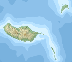
Die Insel liegt rund einen Kilometer östlich der zur Inselgruppe Madeira gehörenden Insel Porto Santo. Die langgestreckte Insel ist in Ost-West-Richtung etwa 1,2 km lang, bis zu 500 m breit und erreicht eine Höhe von 111 m über dem Meer. Mit einer Fläche von 32 ha (0,32 km²) ist sie nach der Ilhéu da Cal die zweitgrößte der Porto Santo vorgelagerten Eilande, der sogenannten Ilhéus do Porto Santo. Wie sämtliche dieser Eilande ist auch Ilhéu de Cima ein Natura-2000-Schutzgebiet.[1] Im Osten der Insel befindet sich der 1900 erbaute und 15 m hohe Leuchtturm Farol do Ilhéu de Cima.[2]
Weblinks
- Über die Fauna der Porto Santo vorgelagerten Inseln (port.; PDF)
Einzelnachweise
- Die portugiesischen Natura 2000-Gebiete (Karte und Liste; PDF; 2,7 MB)
- FARÓIS de PORTUGAL (Memento des Originals vom 26. Juni 2010 im Internet Archive) Info: Der Archivlink wurde automatisch eingesetzt und noch nicht geprüft. Bitte prüfe Original- und Archivlink gemäß Anleitung und entferne dann diesen Hinweis. (port.)
На других языках
- [de] Ilhéu de Cima (Madeira)
[en] Ilhéu de Cima (Porto Santo)
Ilhéu de Cima is a small island about 400 meters off the east coast of Porto Santo Island, Madeira, Portugal. Its area is 30.07 ha (74.3 acres).[1] The islet is 121 meters high, bare and nearly flat, with steep cliffs towards the sea.[2] It is the easternmost point of the Madeira archipelago. It is part of the Network of Marine Protected Areas of Porto Santo (RAMPPS), which covers the six islets around Porto Santo and the marine areas surrounding them.[3] There is a lighthouse on the northeastern part of the island.[2] It is a 15 m high masonry tower, with focal height 124 m.[4] It went into operation in 1901.[3][es] Islote de Cima
El Islote de Cima (en portugués: Ilhéu de Cima) es un islote portugués a menos de 380 metros al sureste de la isla de Porto Santo, en la Región Autónoma de Madera. El punto más alto mide 111 m. Es un islote rocoso, con una área de 32 hectáreas, cubierto por arbustos y flora costera de la Macaronesia, razón por la cual se encuentra protegido por el PDM, por la Red Natura 2000 y es, además, parte integrante del parque natural de Madera.[fr] Îlot de Cima
L'îlot de Cima (en portugais Ilhéu de Cima) est l'un des six îlots situés à 380 mètres de la rive de l'île de Porto Santo, faisant partie de l'archipel de Madère, région autonome du Portugal. Il se situe au nord-est de celle-ci et il est inhabité. Il est le plus proche des six îlots de Porto Santo.Текст в блоке "Читать" взят с сайта "Википедия" и доступен по лицензии Creative Commons Attribution-ShareAlike; в отдельных случаях могут действовать дополнительные условия.
Другой контент может иметь иную лицензию. Перед использованием материалов сайта WikiSort.org внимательно изучите правила лицензирования конкретных элементов наполнения сайта.
Другой контент может иметь иную лицензию. Перед использованием материалов сайта WikiSort.org внимательно изучите правила лицензирования конкретных элементов наполнения сайта.
2019-2025
WikiSort.org - проект по пересортировке и дополнению контента Википедии
WikiSort.org - проект по пересортировке и дополнению контента Википедии