geo.wikisort.org - Insel
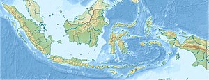
Bungin (indonesisch Pulau Bungin) ist eine Insel und Siedlung in der östlichen Balisee. Mit einem ca. 300 m langen Damm ist Bungin mit dem westlichen Teil der Insel Sumbawa verbunden.
| Bungin | ||
|---|---|---|
| Gewässer | Balisee, Indischer Ozean | |
| Geographische Lage | 8° 28′ 37″ S, 116° 59′ 41″ O | |
|
| ||
| Fläche | 8,5 ha | |
| Einwohner | 5025 (2014) 59.118 Einw./km² | |
| Hauptort | Pulau Bungin | |
Die Insel gilt als eine der am dichtesten besiedelten Inseln der Welt. Die komplette Insel ist dicht bebaut, sodass es kaum Vegetation gibt.[1]
Einzelnachweise
- BBC Indonesia: Bagaimana hidup di Pulau Bungin yang dijuluki terpadat? Abgerufen am 3. Februar 2019 (indonesisch).
На других языках
- [de] Bungin (Balisee)
[en] Bungin Island
Bungin Island (Indonesian: Pulau Bungin) is located in Alas District, Sumbawa Regency, West Nusa Tenggara in Indonesia.[1] The island is situated within Bali Sea, 70 kilometers west of the center of Sumbawa Besar sub-district.[2] The island is administratively one of the villages in the district. The island is mostly inhabited by the Bajo Tribe from South Sulawesi, who arrived here more than 200 years ago. With an area of around 8.5 hectares where about 3,400 people live. The island is connected by a causeway to the mainland of the regency. The island is one of the most densely populated island in the world.[3][4][5]Текст в блоке "Читать" взят с сайта "Википедия" и доступен по лицензии Creative Commons Attribution-ShareAlike; в отдельных случаях могут действовать дополнительные условия.
Другой контент может иметь иную лицензию. Перед использованием материалов сайта WikiSort.org внимательно изучите правила лицензирования конкретных элементов наполнения сайта.
Другой контент может иметь иную лицензию. Перед использованием материалов сайта WikiSort.org внимательно изучите правила лицензирования конкретных элементов наполнения сайта.
2019-2025
WikiSort.org - проект по пересортировке и дополнению контента Википедии
WikiSort.org - проект по пересортировке и дополнению контента Википедии
