geo.wikisort.org - Costa
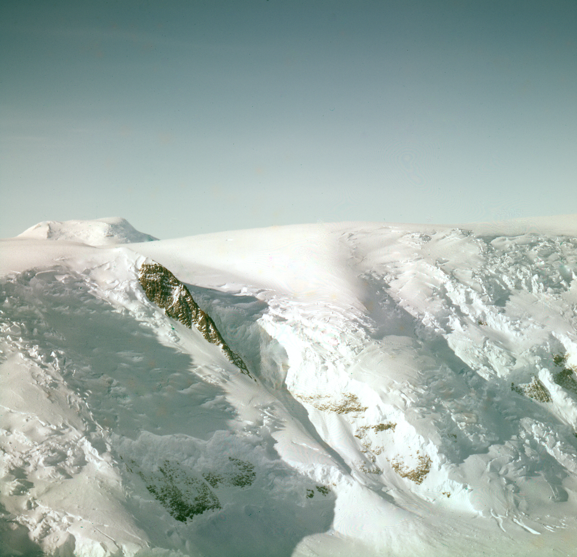
La costa di Amundsen (85°30′S 162°00′W) è una porzione della costa della Dipendenza di Ross, in Antartide. Lunga circa 225 km, la costa di Amundsen si trova a sud della Barriera di Ross, precisamente tra il versante occidentale del ghiacciaio Scott (85°45′S 153°00′W), a est, e il picco Morris (84°56′S 167°22′W), sul lato orientale del ghiacciaio Liv, a ovest, e confina a nord-est con la costa di Gould e a ovest con la costa di Dufek.[1]

Storia
Questo tratto di costa è stato così rinominato nel 1961 dal Comitato neozelandese per i toponimi antartici in onore del capitano Roald Amundsen, l'esploratore norvegese che condusse la prima spedizione capace di raggiungere il Polo Sud nel 1911–1912. Dopo aver approntato la Framheim, la base della spedizione, in una località chiamata Baia delle Balene, nella parte orientale della Barriera di Ross, la spedizione si diresse a sud attraverso la piattaforma stessa per poi scoprire una percorso attraverso il ghiacciaio Axel Heiberg proprio lungo quella che sarebbe divenuta la costa Amundsen, da lì la squadra di Amundsen raggiunse l'Altopiano Antartico e quindi, il 14 dicembre 1911, il Polo Sud.[2]
In onore di Roald Amundsen fu denominata anche la piana di Amundsen, una piana abissale dell'Antartide, che non va confusa con il bacino di Amundsen, che invece si trova dall'altra parte del globo nel Mar Glaciale Artico.
Note
- Costa di Amundsen, su geonames.org, GeoNames.Org (cc-by), 20 gennaio 2008. URL consultato il 25 gennaio 2017.
- (EN) Costa di Amundsen, in Geographic Names Information System, USGS.
Collegamenti esterni
- Mappa della Dipendenza di Ross Archiviato il 15 febbraio 2022 in Internet Archive.
На других языках
[de] Amundsen-Küste
Die Amundsen-Küste ist ein Küstenabschnitt in der antarktischen Ross Dependency. Sie liegt südlich des Ross-Schelfeises zwischen dem auf der Ostseite der Mündung des Liv-Gletschers aufragenden Morris Peak und der Westseite der Mündung des Scott-Gletschers. Im Osten schließt sich die Gould-Küste an, deren westlichster Teil der Scott-Gletscher ist, und im Westen die Dufek-Küste.[en] Amundsen Coast
Amundsen Coast is that portion of the coast to the south of the Ross Ice Shelf lying between Morris Peak, on the east side of Liv Glacier, and the west side of the Scott Glacier. Named by New Zealand Antarctic Place-Names Committee in 1961 for Captain Roald Amundsen, the Norwegian explorer who led his own expedition in 1910–12 to the Antarctic. Setting up a base at Framheim at the edge of the Ross Ice Shelf, he sledged southward across the shelf and discovered a route up the Axel Heiberg Glacier along this coast to reach the polar plateau. He was the first to reach the South Pole, December 14, 1911.- [it] Costa di Amundsen
Другой контент может иметь иную лицензию. Перед использованием материалов сайта WikiSort.org внимательно изучите правила лицензирования конкретных элементов наполнения сайта.
WikiSort.org - проект по пересортировке и дополнению контента Википедии