geo.wikisort.org - Coast
Vrmac (Serbian Cyrillic: Врмац) is a mountain in south-western Montenegro, overlooking the coastal town of Tivat and a peninsula dividing Tivat Bay from Kotor Bay.
| Vrmac | |
|---|---|
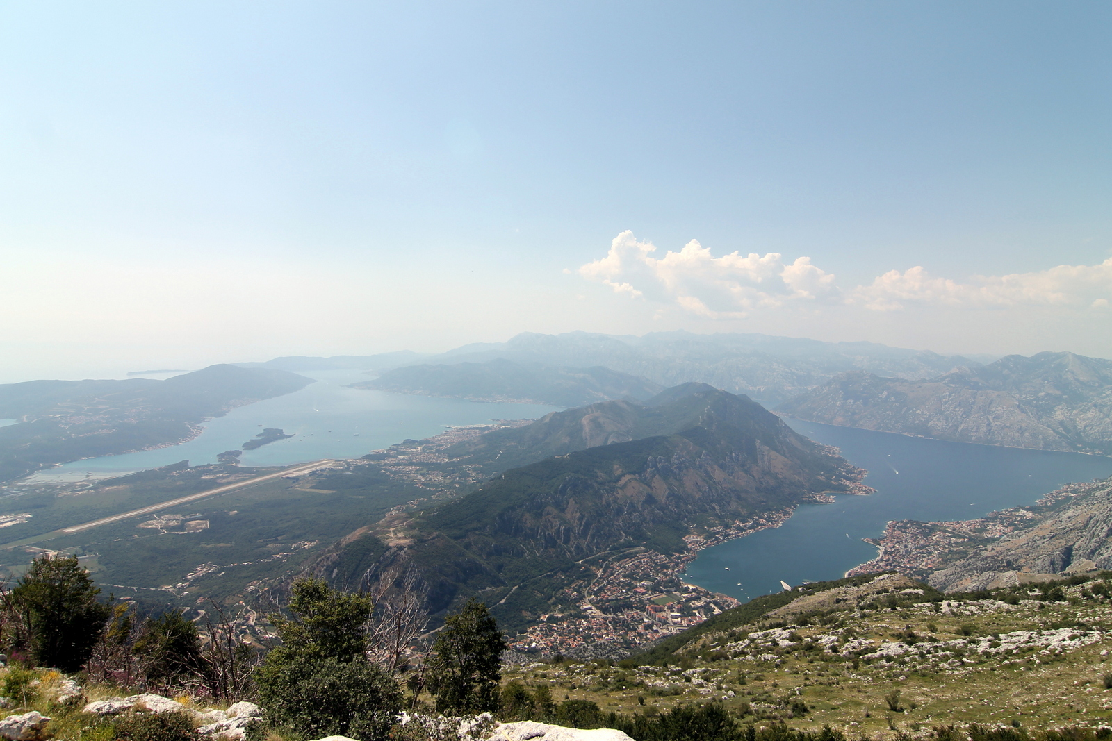 Vrmac (central), as observed from Mount Lovćen | |
| Highest point | |
| Elevation | 785 m (2,575 ft) |
| Coordinates | 42°26′56″N 18°43′41″E |
| Geography | |
 Vrmac Location in Montenegro | |
| Location | Montenegro |
| Parent range | Lovćen |
It is an extension of Mount Lovćen, and its highest peak is Sveti Ilija (Saint Elijah), which is 785 meters high. It is located north of town of Tivat, and encloses town of Kotor from the south. It is also the site of the Austro-Hungarian Fort Vrmac, built in 1860.
Vrmac Tunnel, which connects Kotor with the Adriatic Highway, goes through the mountain. Vrmac is a popular destination for hiking, orienteering and mountain biking.[1][2]
See also
- Fort Vrmac
- Vrmac Tunnel
References
- "Vrmac - pješački raj". gornjalastva.org. Archived from the original on 2016-04-23. Retrieved 2016-05-07.
- Vrmac Tunnel at Structurae
| Authority control |
|
|---|
This Montenegro location article is a stub. You can help Wikipedia by expanding it. |
На других языках
[de] Vrmac
Vrmac (Serbisch: Врмац, deutsch auch Vermac) ist eine bis zu 765 m[1] hohe Halbinsel in der Bucht von Kotor in Montenegro.- [en] Vrmac
[ru] Врмац
Врмац (черног. Vrmac / Врмац) — полуостров в Которском заливе Адриатического моря, в западной части Черногории. Наивысшая точка — вершина Святого Ильи (черног. Sveti Ilija / Свети Илија) высотой 766 метров.Текст в блоке "Читать" взят с сайта "Википедия" и доступен по лицензии Creative Commons Attribution-ShareAlike; в отдельных случаях могут действовать дополнительные условия.
Другой контент может иметь иную лицензию. Перед использованием материалов сайта WikiSort.org внимательно изучите правила лицензирования конкретных элементов наполнения сайта.
Другой контент может иметь иную лицензию. Перед использованием материалов сайта WikiSort.org внимательно изучите правила лицензирования конкретных элементов наполнения сайта.
2019-2026
WikiSort.org - проект по пересортировке и дополнению контента Википедии
WikiSort.org - проект по пересортировке и дополнению контента Википедии