geo.wikisort.org - Coast
The Skeleton Coast is the northern part of the Atlantic coast of Namibia and south of Angola from the Kunene River south to the Swakop River, although the name is sometimes used to describe the entire Namib Desert coast. The indigenous San people, formerly known as Bushmen, of the Namibian interior called the region "The Land God Made in Anger", while Portuguese sailors once referred to it as "The Gates of Hell". On the coast, the upwelling of the cold Benguela current gives rise to dense ocean fogs (called cassimbo by the Angolans) for much of the year. The winds blow from land to sea, rainfall rarely exceeds 10 millimetres (0.39 in) annually and the climate is highly inhospitable. There is a constant, heavy surf on the beaches. In the days before engine-powered ships and boats, it was possible to get ashore through the surf but impossible to launch from the shore. The only way out was by going through a marsh hundreds of kilometres long and only accessible via a hot and arid desert.
![A map from 1964-65 showing the Namibian homelands or Bantustans[1] when Namibia was under the rule of apartheid South Africa. The Skeleton Coast is the coastal region bordering the Atlantic Ocean to the west and Kaokoveld and Damaraland to the east.](http://upload.wikimedia.org/wikipedia/commons/thumb/d/dd/Namibia_homelands_78.jpeg/300px-Namibia_homelands_78.jpeg)

The coast is largely soft sand occasionally interrupted by rocky outcrops. The southern section consists of gravel plains, while north of Terrace Bay the landscape is dominated by high sand dunes. Skeleton Bay is now known as a great location for surfing. The Saltyjackal, a surf camp located in Swakopmund, Namibia, is currently the only group that runs guided surf trips along the Skeleton Coast.[2]
Etymology
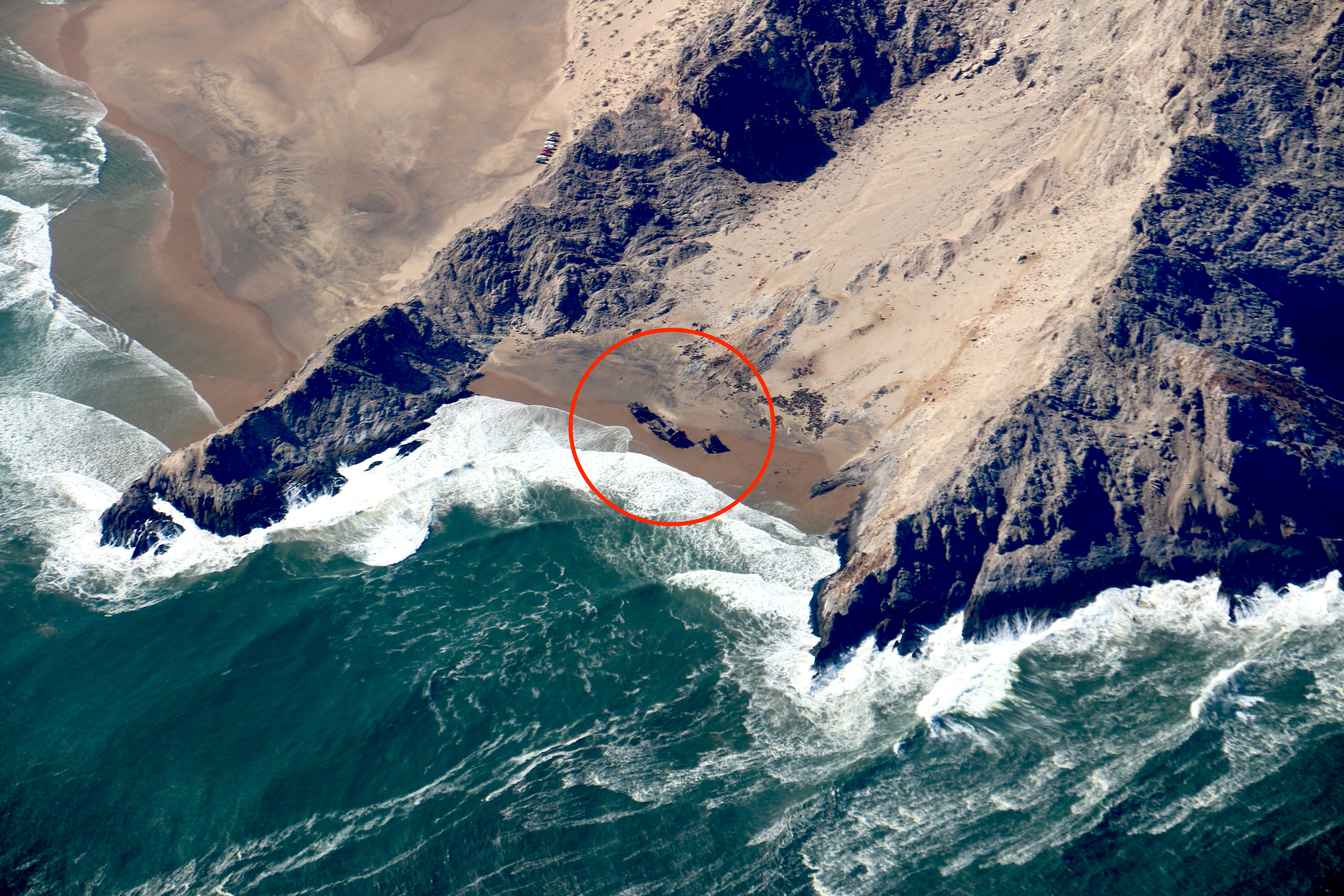
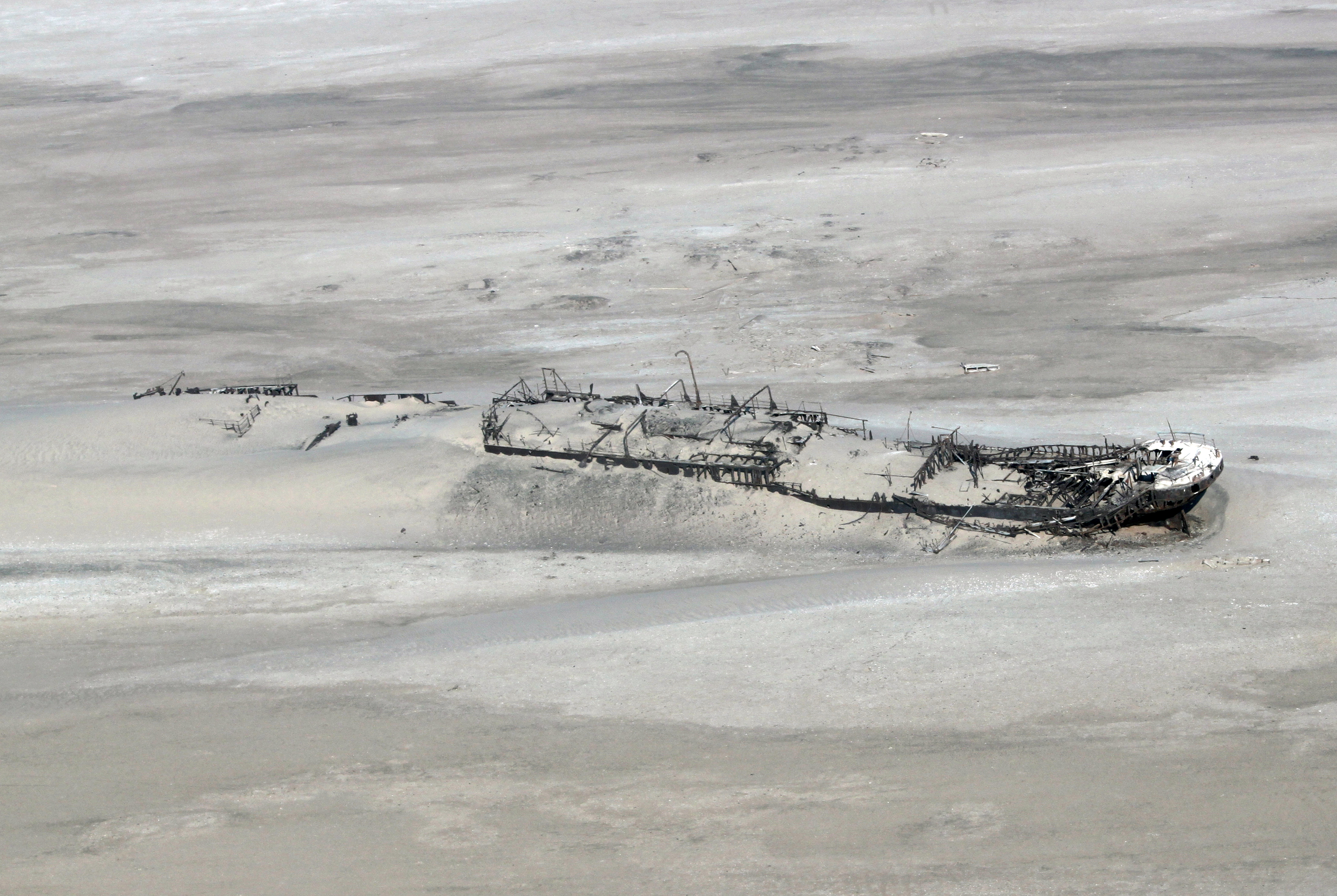
The area's name derives from the whale and seal bones that once littered the shore from the whaling industry, although in modern times the coast harbours the skeletal remains of the shipwrecks caught by offshore rocks and fog.[3] More than a thousand such vessels of various sizes litter the coast, notably the Eduard Bohlen, Benguela Eagle, Otavi, Dunedin Star and Tong Taw.
The name "Skeleton Coast" was coined by John Henry Marsh as the title for the book he wrote chronicling the shipwreck of the Dunedin Star. Since the book was first published in 1944, it has become so well known that the coast is now generally referred to as Skeleton Coast and is given that as its official name on most maps today. See § In popular culture, below.
History
One of the oldest shipwrecks in the Skeleton Coast region is the wreck near the town of Oranjemund which was wrecked during the 1530s. It is known to be one of the oldest discovered shipwrecks of the Iberian Atlantic tradition in Sub-Saharan Africa.[4] On Thursday, 22 March 2018, a Japanese registered fishing vessel, MVF Fukuseki Maru, got into trouble and ran aground near Durissa Bay, south of the Ugab River mouth, about 200 km from Walvis Bay, lying 2 km from the Skeleton Coast beach. All 24 foreign crew members were rescued by Namibian authorities.[5]
Past human occupation by Strandlopers is shown by shell middens of white mussels found along parts of the Skeleton Coast.
Wildlife
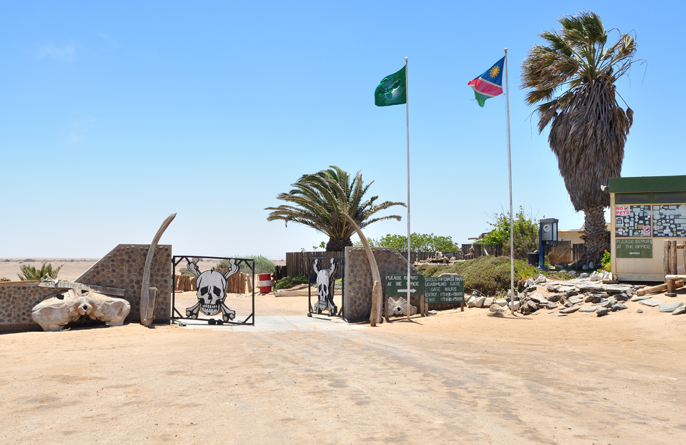
Namibia has declared the 16,000 square kilometres (6,200 sq mi) Skeleton Coast National Park over much of the area, from the Ugab River to the Kunene. The northern half of the park is a designated wilderness area. Notable features are the clay castles of the Hoarusib River, the Agate Mountain salt pans and the large seal colony at Cape Fria. The remainder of the coast is the National West Coast Recreation Area. The national park would be part of the proposed Iona – Skeleton Coast Transfrontier Conservation Area.
The coast has been the subject of a number of wildlife documentaries, particularly concerning adaptations to extreme aridity, including the 1965 National Geographic documentary Survivors of the Skeleton Coast.[6] Many of the plant and insect species of the sand dune systems depend on the thick sea fogs which engulf the coast for their moisture and windblown detritus from the interior as food. The desert bird assemblages have been studied in terms of their thermoregulation, coloration, breeding strategies and nomadism.
The riverbeds further inland are home to baboons, giraffes, lions, black rhinoceros, spotted and brown hyena, as well as springbok.[7] The animals get most of their water from wells dug by the baboons or elephants. The black rhinoceros population was the main reason why the CBBC show Serious Desert was filmed in the region.
In popular culture

- Skeleton Coast is a book by John Henry Marsh. The true story of the wrecking in 1942 of the British refrigerated cargo liner Dunedin Star and the eventual rescue of all her 106 passengers and crew, at the cost of a tug, an SAAF aircraft and the lives of two rescuers.
- Skeleton Coast is a novel by Clive Cussler that uses the shifting sands of the coastline as a prominent plot device in the fourth entry in the Oregon Files.
- The plot of the 1968 fiction film A Twist of Sand involves diamonds hidden in a shipwreck buried in the sand dunes of the Skeleton Coast.
- Much of season 1, episode 7 of Amazon's The Grand Tour was filmed on the Skeleton Coast.
- The final scenes of Golden Urchin by Madeleine Brent (a pseudonym of Peter O'Donnell) take place along the Skeleton Coast down to Swakopmund.
- The first episode of Wonders of the Universe featured the Skeleton Coast, and the shipwrecks there were utilized as part of an analogy by Brian Cox to demonstrate the effects of time.
- Drummer Billy Cobham has written an album inspired by his visit to the area, called Tales from the Skeleton Coast.
- Punk rock band The Lawrence Arms released their seventh LP, Skeleton Coast, named in reference to the region.
- Dude You’re Screwed - Season 2 Episode 1
References
- "Bantustan | Definition, History, Map, & Facts | Britannica".
- "Skeleton Bay – The Miracle Mile?". carvemag.com. Archived from the original on 2015-12-22.
- "The Shipwrecks of Skeleton Coast, Namibia". www.amusingplanet.com. Archived from the original on 2021-06-24.
- Chirikure, Shadreck; Sinamai, Ashton; Goagoses, Esther; Mubusisi, Marina (October 2010). "Maritime Archaeology and Trans-Oceanic Trade: A Case Study of the Oranjemund Shipwreck Cargo, Namibia". Journal of Maritime Archaeology. 5 (1): 40. doi:10.1007/s11457-010-9059-9. JSTOR 23747443. S2CID 162225466.
- "Japanese fishing vessel stuck near Walvis Bay | Namibia Economist". Archived from the original on 2021-11-05.
- "Survivors of the Skeleton Coast". IMDb.
- Harris, Lynn; Jones, Jennifer; Schnitzer, Kate (October 2012). "Monuments in the Desert: A Maritime Landscape in Namibia". Journal of Maritime Archaeology. 7 (1): 114. doi:10.1007/s11457-012-9087-8. JSTOR 43551372. S2CID 161362350.
External links
- Skeleton Coast
- Animals of the Skeleton Coast
- PBS Golden Seals of the Skeleton Coast
- Animals of the Skeleton Coast Adapted to a Desert Habitat
- The true story of the wrecking of the big British passenger liner Dunedin Star and the eventual rescue of her more than 100 passengers and crew
Authority control | |
|---|---|
| General |
|
| National libraries | |
| Other |
|
На других языках
- [en] Skeleton Coast
[ru] Берег Скелетов
Берег Скелетов (англ. Skeleton Coast, порт. Costa dos Esqueletos, нем. Skelettküste) — часть побережья Намибии, располагающаяся к северу от Свакопмунда и заканчивающаяся у устья реки Кунене в Анголе. Считается частью пустыни Намиб. Южнее бухты Торра-Бей преобладают песчаные равнины. Далее, по мере продвижения на север, появляются песчаные дюны.Другой контент может иметь иную лицензию. Перед использованием материалов сайта WikiSort.org внимательно изучите правила лицензирования конкретных элементов наполнения сайта.
WikiSort.org - проект по пересортировке и дополнению контента Википедии