geo.wikisort.org - Coast
Shoal Bay is the most eastern suburb of the Port Stephens local government area in the Hunter Region of New South Wales, Australia.[2] It is located on the southern shore of Port Stephens, adjacent to the bay of the same name at the entrance to the port.[7] It includes part of Tomaree National Park within its boundaries and, like other suburbs around Port Stephens, is a popular tourist destination, especially in summer months.[8] At the 2021 census the town of Shoal Bay had a population of 1,815 but the population increases significantly during tourist season.[1]
| Shoal Bay New South Wales | |||||||||||||||
|---|---|---|---|---|---|---|---|---|---|---|---|---|---|---|---|
 Shoal Bay, NSW in 2012 | |||||||||||||||
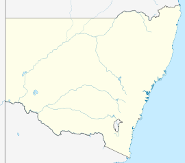  Shoal Bay | |||||||||||||||
| Coordinates | 32°43′37″S 152°10′21″E | ||||||||||||||
| Population | 1,815 (2021 census)[1] | ||||||||||||||
| • Density | 453.75/km2 (1,175.2/sq mi) [Note 1] | ||||||||||||||
| Postcode(s) | 2315 | ||||||||||||||
| Area | 4 km2 (1.5 sq mi)[Note 2] | ||||||||||||||
| Time zone | AEST (UTC+10) | ||||||||||||||
| • Summer (DST) | AEDT (UTC+11) | ||||||||||||||
| Location |
| ||||||||||||||
| LGA(s) | Port Stephens Council[2] | ||||||||||||||
| Region | Hunter[2] | ||||||||||||||
| County | Gloucester[3] | ||||||||||||||
| Parish | Tomaree[3] | ||||||||||||||
| State electorate(s) | Port Stephens[4] | ||||||||||||||
| Federal division(s) | Paterson[5] | ||||||||||||||
| |||||||||||||||
| |||||||||||||||
Heritage listings
Shoal Bay has a number of heritage-listed sites, including:
History
The Worimi people are the traditional owners of the Port Stephens area[11]
Notes
- This is the average density of the whole suburb. The population density of the inhabited portion of the suburb, which is only approximately 1 square kilometre (0.4 sq mi), is 1,838/km2 (4,760/sq mi).
- Area calculation is based on 1:100000 map 9332 PORT STEPHENS.
References
- Australian Bureau of Statistics (27 June 2017). "Shoal Bay (NSW) (State Suburb)". 2016 Census QuickStats. Retrieved 1 January 2020.
- "Suburb Search – Local Council Boundaries – Hunter (HT) – Port Stephens". New South Wales Division of Local Government. Retrieved 11 June 2008.
- "Shoal Bay (suburb)". Geographical Names Register (GNR) of NSW. Geographical Names Board of New South Wales. Retrieved 11 June 2008.
- "Port Stephens". New South Wales Electoral Commission. Retrieved 23 November 2019.
- "Paterson". Australian Electoral Commission. 19 October 2007. Archived from the original on 29 October 2009. Retrieved 11 June 2008.
- "Nelson Bay (Nelson Head)". Climate statistics for Australian locations. Bureau of Meteorology. Retrieved 11 June 2008.
- "Shoal Bay (bay)". Geographical Names Register (GNR) of NSW. Geographical Names Board of New South Wales. Retrieved 11 June 2008.
- "Shoal Bay". Land and Property Management Authority - Spatial Information eXchange. New South Wales Land and Property Information. Retrieved 11 June 2008.
- "Tomaree Head Fortifications". New South Wales State Heritage Register. Office of Environment & Heritage. H01821. Retrieved 18 May 2018.
- "Tomaree Holiday Lodge". New South Wales State Heritage Register. Office of Environment & Heritage. H00835. Retrieved 18 May 2018.
- "Aboriginal and Torres Strait Islander people". Port Stephens Council. Retrieved 8 September 2020.

External links

- "Port Stephens Visitor Centre". Port Stephens Council. Retrieved 11 June 2008.
- "Shoal Bay". Australian Explorer. Retrieved 11 June 2008.

Authority control | |
|---|---|
| General |
|
| National libraries | |
 | This Port Stephens Council geography article is a stub. You can help Wikipedia by expanding it. |
Другой контент может иметь иную лицензию. Перед использованием материалов сайта WikiSort.org внимательно изучите правила лицензирования конкретных элементов наполнения сайта.
WikiSort.org - проект по пересортировке и дополнению контента Википедии