geo.wikisort.org - Coast
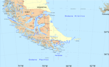
Punta Dúngeness is a headland at the eastern entrance of the Strait of Magellan on its north shore, opposite Cabo del Espiritu Santo in Tierra del Fuego. West of the Punta Dungeness lies the Bahía Posesión. Punta Dungeness marks the border between Chile and Argentina, and according to the Treaty of Peace and Friendship the line between Punta Dungeness and Cabo del Espiritu Santo marks the limits of each country's territorial waters and the border between the Pacific and Atlantic Ocean. It is the southernmost point on the mainland of Argentina, and the easternmost point on the mainland of Chile. There is a lighthouse on the Chilean side. This is the only place where the Atlantic Ocean touches the shores on the mainland of Chile, at the entrance to the Strait of Magellan.
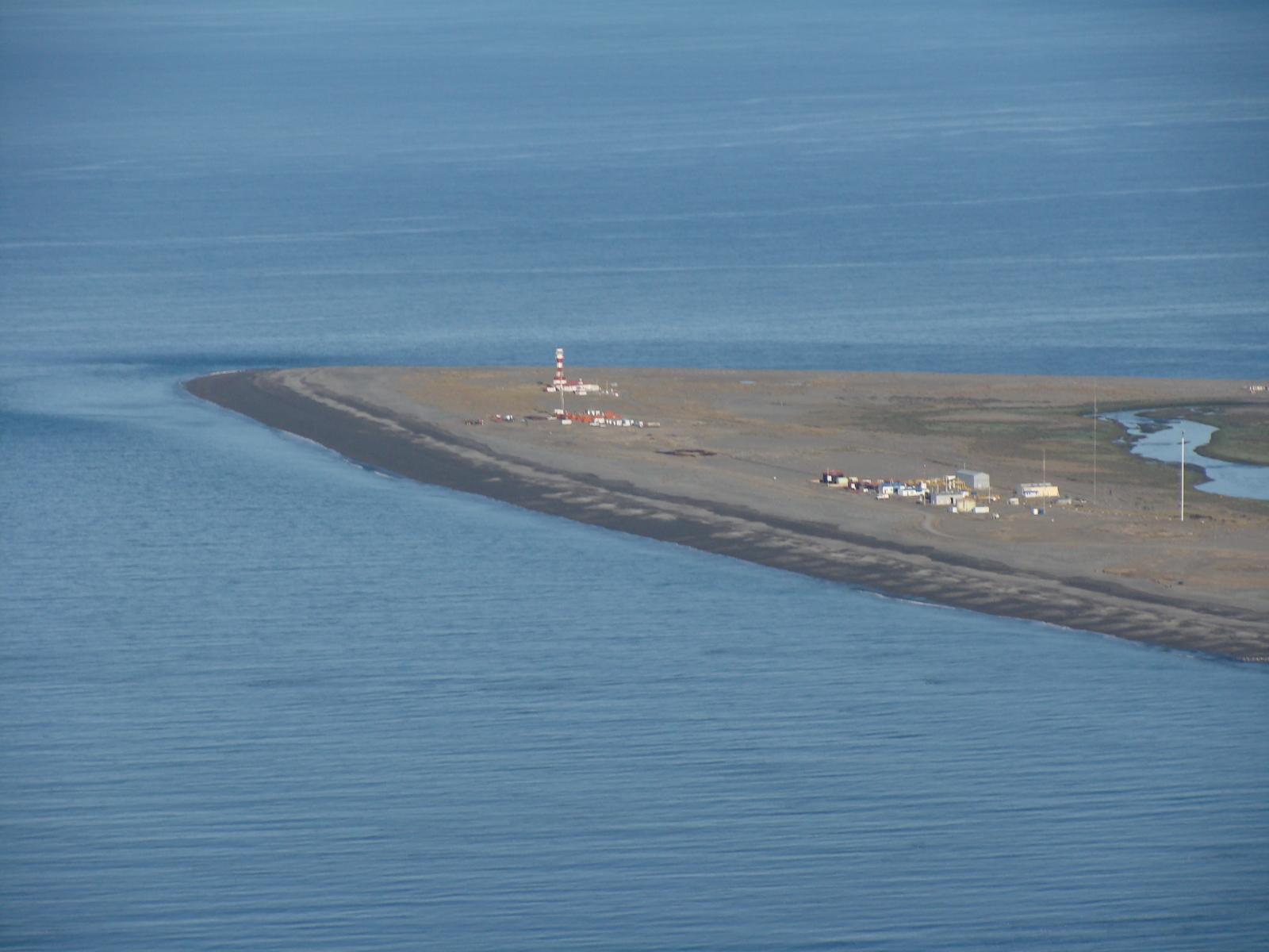
The headland was named after Dungeness on the south coast of England, to which it bears some resemblance. It was named on 17 December 1766 by the English navigator Samuel Wallis.
Climate
| Climate data for Punta Dúngeness | |||||||||||||
|---|---|---|---|---|---|---|---|---|---|---|---|---|---|
| Month | Jan | Feb | Mar | Apr | May | Jun | Jul | Aug | Sep | Oct | Nov | Dec | Year |
| Average high °C (°F) | 15.2 (59.4) |
14.9 (58.8) |
13.4 (56.1) |
10.7 (51.3) |
7.9 (46.2) |
5.9 (42.6) |
5.1 (41.2) |
5.5 (41.9) |
7.3 (45.1) |
10.3 (50.5) |
12.0 (53.6) |
14.0 (57.2) |
10.2 (50.4) |
| Daily mean °C (°F) | 11.5 (52.7) |
11.2 (52.2) |
9.9 (49.8) |
7.7 (45.9) |
5.2 (41.4) |
3.5 (38.3) |
2.8 (37.0) |
3.0 (37.4) |
4.5 (40.1) |
6.7 (44.1) |
8.3 (46.9) |
10.3 (50.5) |
7.1 (44.8) |
| Average low °C (°F) | 7.7 (45.9) |
7.4 (45.3) |
6.4 (43.5) |
4.6 (40.3) |
2.4 (36.3) |
1.1 (34.0) |
0.5 (32.9) |
0.8 (33.4) |
1.8 (35.2) |
3.5 (38.3) |
4.8 (40.6) |
6.5 (43.7) |
4.0 (39.2) |
| Average precipitation mm (inches) | 26.4 (1.04) |
18.6 (0.73) |
25.3 (1.00) |
24.0 (0.94) |
26.5 (1.04) |
21.9 (0.86) |
23.0 (0.91) |
18.5 (0.73) |
13.0 (0.51) |
11.9 (0.47) |
17.7 (0.70) |
27.0 (1.06) |
253.8 (9.99) |
| Average relative humidity (%) | 74 | 72 | 76 | 77 | 77 | 79 | 75 | 78 | 76 | 74 | 72 | 74 | 75 |
| Source: Bioclimatografia de Chile[1] | |||||||||||||
References
- Hajek, Ernst; Castri, Francesco (1975). "Bioclimatografia de Chile" (PDF) (in Spanish). Retrieved 23 April 2016.
External links
This Magallanes and Antártica Chilena Region location article is a stub. You can help Wikipedia by expanding it. |
This article about a place in Santa Cruz Province, Argentina is a stub. You can help Wikipedia by expanding it. |
На других языках
- [en] Punta Dúngeness
[es] Punta Dungeness
La punta Dungeness es una lengua de tierra que penetra en las aguas de la margen norte del estrecho de Magallanes, en la zona conocida como la boca oriental del mismo. Esta punta divide el territorio de la Región de Magallanes y Antártica Chilena en Chile (al occidente), de la Provincia de Santa Cruz en Argentina (al oriente de la misma). Es el punto más austral de la costa atlántica del área continental de América; a su vez, representa la frontera oriental del Estrecho de Magallanes,[2] y el límite bioceánico entre los océanos Pacífico y Atlántico. También es el punto más austral de la Argentina continental.Другой контент может иметь иную лицензию. Перед использованием материалов сайта WikiSort.org внимательно изучите правила лицензирования конкретных элементов наполнения сайта.
WikiSort.org - проект по пересортировке и дополнению контента Википедии