geo.wikisort.org - Coast
Point Barrow or Nuvuk is a headland on the Arctic coast in the U.S. state of Alaska, 9 miles (14 km) northeast of Utqiaġvik (formerly Barrow). It is the northernmost point of all the territory of the United States, at 71°23′20″N 156°28′45″W, 1,122 nautical miles (1,291 mi; 2,078 km) south of the North Pole. (The northernmost point on the North American mainland, Murchison Promontory in Canada, is 40 miles (64 km) farther north.) Point Barrow is an important geographical landmark, marking the limit between two marginal seas of the Arctic Ocean, the Chukchi Sea to the west and the Beaufort Sea to the east.[1]
Point Barrow
Nuvuk | |
|---|---|
Northernmost point of the United States | |
 Point Barrow Location within the state of Alaska | |
| Coordinates: 71°23′20″N 156°28′45″W | |
| Country | United States |
| State | Alaska |
| Borough | North Slope |
| Time zone | UTC-9 (AKST) |
| • Summer (DST) | UTC-8 (AKDT) |
It was named by English explorer Frederick William Beechey in 1826 for Sir John Barrow, a statesman and geographer of the British Admiralty. The water around it is normally ice-free for two or three months a year, but this was not the experience of the early explorers. Beechey could not reach it by ship and had to send a ship's boat ahead. In 1826 John Franklin tried to reach it from the east and was blocked by ice. In 1837 Thomas Simpson walked 50 miles west to Point Barrow after his boats were stopped by ice. In 1849 William Pullen rounded it in two whale boats after sending two larger boats back west because of the ice.
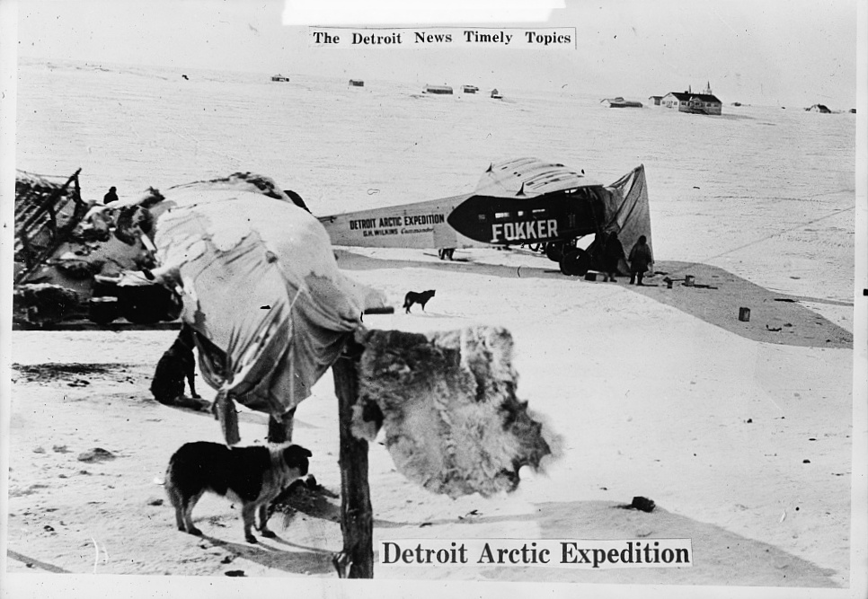
Point Barrow has been a jumping-off point for many Arctic expeditions, including the Wilkins-Detroit Arctic Expeditions and the April 15, 1928, Eielson-Wilkins flight across the Arctic Ocean to Spitsbergen.
It is 33 km (20.5 mi) northeast of the Rogers-Post Site, the scene of the airplane crash on August 15, 1935 that killed aviator Wiley Post and his passenger, the entertainer Will Rogers.
The "Shooting Station" is located a few miles southwest of Point Barrow. It is so named because between 1965 and 1972 it was a launch site for Nike-Cajun and Nike Apache sounding rockets. There is a nearby Global Atmosphere Watch atmospheric monitoring station.[2] It is immediately adjacent to the Birnirk site. There are still summer cabins constructed by locals and used for subsistence hunting and fishing in this area.
The term Point Barrow whales refers to gray whales that were trapped in the ice at Point Barrow in 1988, which attracted attention from the public worldwide. The Iñupiat do not hunt gray whales and joined in rescue operations which also involved Soviet icebreakers.[3]

Demographics
| Historical population | |||
|---|---|---|---|
| Census | Pop. | %± | |
| 1880 | 200 | — | |
| 1890 | 152 | −24.0% | |
| 1910 | 127 | — | |
| 1920 | 91 | −28.3% | |
| 1930 | 82 | −9.9% | |
| 1940 | 28 | −65.9% | |
| U.S. Decennial Census[4] | |||
Point Barrow first appeared on the 1880 U.S. census as the unincorporated Inuit village of "Kokmullit" (AKA Nuwuk).[5] All 200 residents were Inuit.[6] In 1890, it returned as Point Barrow, which also included the Refuge & Whaling Station and native settlements of Nuwuk, Ongovehenok and winter village on "Kugaru" (Inaru) River. It reported 152 residents, of which 143 were Native, 8 were "other race" and 1 was White.[7] It did not report in 1900, but appeared again from 1910-1940. It has not reported separately since.
Archaeological site

Archaeological evidence indicates that Point Barrow was occupied by the ancestors of the Iñupiat for almost 1,000 years prior to the arrival of the first Europeans. Occupation continued into the 1940s. The headland is an important archaeological site, yielding burials and artifacts associated with the Thule culture, including uluit and bola. The waters off Point Barrow are on the bowhead whale migration route and it is surmised that the site was chosen to make hunting easier.[8] There are also burial mounds in the area, at the nearby Birnirk site, associated with the earlier Birnirk culture, a pre-Thule culture first identified in 1912 by Vilhjalmur Stefansson while excavating in the area.[9]: 72
The settlement was called Nuvuk and it was near the "migration path of bowhead whales which would become the cultural and nutritional centre of Nuvuk life."[8]
See also
- Alaska North Slope
- Utqiaġvik, Alaska
- Iḷisaġvik College
- North Slope Borough
- Rogers-Post Site
- Umiak
References
- "The Northernmost Points In The United States". worldatlas.com. 25 April 2017. Retrieved October 10, 2019.
- Astronautics and Aeronautics, 1967. Washington D.C.: National Aeronautics and Space Administration. 1967. p. 28. ISBN 978-1287276234. Retrieved 20 February 2019.
- Mauer, Richard (1988-10-18). "Unlikely Allies Rush to Free 3 Whales". New York Times. Retrieved 2008-06-12.
- "U.S. Decennial Census". Census.gov. Retrieved June 6, 2013.
- "Geological Survey Professional Paper". 1949.
- http://www2.census.gov/prod2/decennial/documents/1880a_v1-17.pdf [bare URL PDF]
- http://www2.census.gov/prod2/decennial/documents/1890a_v8-01.pdf [bare URL PDF]
- Black, Richard (December 31, 2007). "Bodies point to Alaska's past". BBC. Retrieved November 11, 2017.
- Anderson, Douglas D. (1998). "Birnick culture". In Gibbons, Guy E.; Ames, Kenneth M. (eds.). Archaeology of Prehistoric Native America: an Encyclopedia. Taylor & Francis. pp. 941. ISBN 9780815307259.
External links
- Rocket launches at Point Barrow
- The papers of Henry W. Greist on Point Barrow at Dartmouth College Library
Authority control | |
|---|---|
| General |
|
| National libraries | |
| Other |
|
На других языках
[de] Point Barrow
Point Barrow ist die nördlichste Landspitze des US-Bundesstaates Alaska und somit der nördlichste Punkt der Vereinigten Staaten.- [en] Point Barrow
[es] Punta Barrow
Punta Barrow (en inglés, Point Barrow; en inuit, Nuvuk) es un cabo del océano Ártico, localizado en la costa septentrional de Alaska (EE. UU.). Es el punto más septentrional de los Estados Unidos.[ru] Барроу (мыс)
Мыс Ба́рроу (англ. Point Barrow) — крайняя северная точка Соединённых Штатов Америки и Аляски.Другой контент может иметь иную лицензию. Перед использованием материалов сайта WikiSort.org внимательно изучите правила лицензирования конкретных элементов наполнения сайта.
WikiSort.org - проект по пересортировке и дополнению контента Википедии