geo.wikisort.org - Coast
The Parry Peninsula on the north coast of Canada's Northwest Territories is bounded on the west by Franklin Bay, on the north by Amundsen Gulf, and on the east by Darnley Bay.The nearest settlement is Paulatuk. It is also home to the Cape Parry Migratory Bird Sanctuary on the northern extremity of the Parry Peninsula.[1]
 Parry Peninsula, Canada and inset showing Alaska. | |
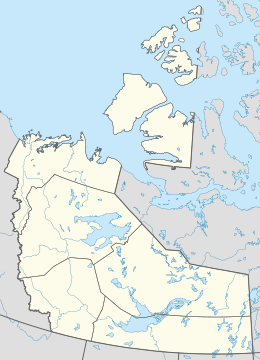 Parry Peninsula Location of the Parry Peninsula in the Northwest Territories | |
| Geography | |
|---|---|
| Location | Northwest Territories, Canada |
| Coordinates | 69.667°N 124.667°W |
| Adjacent bodies of water | Arctic Ocean |
| Administration | |
Canada | |
History
It is named for the Arctic explorer William Edward Parry. On the northern tip of the peninsula is Cape Parry. A headland, and a Distant Early Warning Line site on Parry Peninsula northern tip.[2]
See also
- Cape Parry
- Paulatuk
- Distant Early Warning Line
References
- "Cape Parry Migratory Bird Sanctuary". Environment and Climate Change Canada. Government of Canada. Retrieved 4 March 2016.
- Wilson, Larry. "Cape Parry NWT PIN-Main". Larry Wilson - Dew Line Adventures. Dew Line Adventures. Retrieved 4 March 2016.[permanent dead link]
Further reading
- Daniel Ernest Kerr; Geological Survey of Canada (1994). Ernest Kerr, Daniel (ed.). Late quaternary stratigraphy and depositional history of the Parry Peninsula-Perry River area, District of MacKenzie, Northwest Territories / (Book, Geology, Stratigraphy) (in English and French) (465 ed.). p. 34. ISBN 0-660-15411-0. Retrieved 4 March 2016.
This Canadian Northwest Territories location article is a stub. You can help Wikipedia by expanding it. |
На других языках
[de] Parry-Halbinsel
Die Parry-Halbinsel ist Teil der kanadischen Nordwest-Territorien. Sie liegt an deren Nordküste im Arktischen Ozean, grenzt im Westen an die Franklin Bay, im Norden an den Amundsen-Golf und im Osten an die Darnley Bay. Die nächstgelegene Siedlung ist Paulatuk.- [en] Parry Peninsula
Текст в блоке "Читать" взят с сайта "Википедия" и доступен по лицензии Creative Commons Attribution-ShareAlike; в отдельных случаях могут действовать дополнительные условия.
Другой контент может иметь иную лицензию. Перед использованием материалов сайта WikiSort.org внимательно изучите правила лицензирования конкретных элементов наполнения сайта.
Другой контент может иметь иную лицензию. Перед использованием материалов сайта WikiSort.org внимательно изучите правила лицензирования конкретных элементов наполнения сайта.
2019-2026
WikiSort.org - проект по пересортировке и дополнению контента Википедии
WikiSort.org - проект по пересортировке и дополнению контента Википедии