geo.wikisort.org - Coast
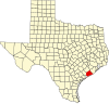
The Matagorda Peninsula (/ˈmætəˈɡɔːrdə/ (![]() listen)[1]) is a narrow spit of land on the southeastern coast of Texas in the United States.[2]
listen)[1]) is a narrow spit of land on the southeastern coast of Texas in the United States.[2]
The peninsula is in Matagorda County, Texas. The barrier island lies between Matagorda Bay, an estuary, and the Gulf of Mexico. The Texas Gulf Coast island has a water exchange of two to five tidal inlets suspending the tides in marginal sea. The Matagorda Ship Channel located on the peninsula produces a substantial tidal range of seawater bearing north-south of the barrier island.[3]
References
- "Matagorda Bay". Dictionary.com. Random House, Inc. Retrieved 9 November 2014.
- Merriam Webster's Geographical Dictionary, Third Edition. Springfield, Massachusetts: Merriam-Webster, 1997. ISBN 0-87779-546-0. p.718.
- "Matagorda Bay". GulfBase.org. Archived from the original on 24 September 2010. Retrieved 25 May 2010.
External links
- Kleiner, Diana J.; Leatherwood, Art. "Matagorda Peninsula". Handbook of Texas. Texas State Historical Association.
 | This article about a location in Matagorda County, Texas is a stub. You can help Wikipedia by expanding it. |
Текст в блоке "Читать" взят с сайта "Википедия" и доступен по лицензии Creative Commons Attribution-ShareAlike; в отдельных случаях могут действовать дополнительные условия.
Другой контент может иметь иную лицензию. Перед использованием материалов сайта WikiSort.org внимательно изучите правила лицензирования конкретных элементов наполнения сайта.
Другой контент может иметь иную лицензию. Перед использованием материалов сайта WikiSort.org внимательно изучите правила лицензирования конкретных элементов наполнения сайта.
2019-2026
WikiSort.org - проект по пересортировке и дополнению контента Википедии
WikiSort.org - проект по пересортировке и дополнению контента Википедии