geo.wikisort.org - Coast
Knipe Point (or Osgodby Point) is a rocky headland on the North Sea coast, between Cornelian Bay and Cayton Bay in North Yorkshire, England. From this point, and running south, is the steeply sloping clay-till cliff on top of which stood the NALGO holiday camp between 1933 and 1974; this is where Knipe Point Drive was later built. The Cayton Cliff is subject to continuing surface landslips, potentially major at times,[1] such as the one of 2008, known as the Knipe Point Landslide,[2] which received national media attention due to the loss of three homes.
| Knipe Point | |
|---|---|
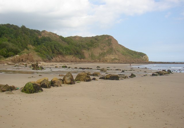 Knipe Point viewed from the beach at Cayton Bay | |
 Knipe Point Location within North Yorkshire | |
| OS grid reference | TA0685 |
| Civil parish |
|
| District |
|
| Shire county | |
| Region | |
| Country | England |
| Sovereign state | United Kingdom |
| Post town | SCARBOROUGH |
| Postcode district | YO11 |
| Dialling code | 01723 |
| Police | North Yorkshire |
| Fire | North Yorkshire |
| Ambulance | Yorkshire |
| UK Parliament |
|
History
Originally the first Trade Union holiday camp in the North of England, owned by NALGO it opened its doors in 1933. It had 124 wooden bungalows, accommodating 252 visitors. A dining hall with waiter service, a rest room along with recreation rooms for playing cards, billiards, a theatre for indoor shows and dancing was also provided. The new centre also provided Tennis courts, Bowling greens along with a children's play area. The visitors could walk to the beach where there was a sun terrace and beach house which also had a small shop. Click here to see photos of the NALGO camp from the 1930s.
One of the earliest visitors were the family of poet Philip Larkin[3] and during the Second World War it became a home for evacuated children from Middlesbrough.[4] To see a black and white film of the NALGO holiday camp at Knipe Point please see the site of the Yorkshire Film Archive here.[5] The NALGO camp closed in 1974[6] and was later sold.[7]
The history of the holiday camp can be found in Colin Ward and Dennis Hardy's book "Goodnight Campers!" Spon Press (1986) ISBN 0-7201-1835-2, 0720118360. To preview the book click here [8]
The site became permanent residential homes in 1985 when a planning restriction limiting the site to holiday homes was overruled following an appeal by the owner of the site.[9]
Current owners
A private housing estate consisting of bungalows with views onto the Cayton Bay Site of Special Scientific Interest (SSSI) to view photos of the SSSI click here.[10]
The community is self-regulated by the Knipe Point Owners' Association which negotiated the purchase of the freehold of the land in 2002. This is held by another residents' company, Knipe Point Freeholders Limited,[11] which maintains equality through each member having 500 shares. The members lease their homes to themselves for a nominal ground rent of £1. About half are permanent residents.[12]
Knipe Point landslide
Three homes were demolished in 2008 after an ancient landslide[13] was re-activated due to a prolonged season of heavy rain. To see photos of the demolition click here.[14]
The landslipping behaviour was investigated through a ground investigation and a geomorphological assessment, which identified groundwater movements through the coastal slope as the critical control on triggering of events.[15] There is a great deal of speculation, including suggestions that the site has been affected by the building of a new bypass or that the construction of extensions to the bungalows triggered the failure.[16]
On 15 December 2009 Defra announced that it was awarding Pathfinder Status to Scarborough Borough Council to enable it to add to its programme of work a means of exploring new approaches to planning for, and managing, adaptation to coastal change in partnership with the Knipe Point Drive community. This will run until spring 2011.[17] Landslide report
References
- "PDZ 11 White Nab to Filey Brigg" (PDF). Cell 1 Shoreline Management Plan 2007. Scarborough Borough Council. Retrieved 18 October 2010.
- "Cayton Bay / Knipe Point landslide - report on options". Professor David Petley, Wilson Professor of Hazard and Risk. Blogspot. Retrieved 25 October 2010.
- "Philip Larkin's family papers". Brynmor Jones Library. Hull University. Retrieved 18 October 2010.
- "Vacuees, By Bill Martin". Matlon School Drama Programme. Malton School. Archived from the original on 28 July 2011. Retrieved 13 October 2010.
- "Cayton NALGO Holiday Camp (1950)". National Film Archive. Retrieved 30 May 2020.
- "Ralph's NALGO postcard site". NALGO Cayton Bay. Archived from the original on 14 July 2013. Retrieved 18 October 2010.
- "Butlins Memories". British Holiday Camps: A Brief History. Butlins Memories. Retrieved 18 October 2010.
- Denis Hardy; C. Ward (1 January 1990). Goodnight Campers!: The history of the British holiday camp -. Taylor & Francis. ISBN 9780720118353. Retrieved 24 December 2015.
- "Scarborough Planning Portal". Retrieved 1 September 2010.
- Humphrey Bolton (18 September 2006). "Pond by the beach, Osgodby". Geograph Britain and Ireland. Retrieved 24 December 2015.
- "Company Information". www.einpay.com. Mavida Finance UK. Retrieved 13 October 2010.
- "Front line battle in my back yard". Yorkshire Post. Johnston Press Digital Publishing 10 August 2009. Retrieved 13 October 2010.
- P. R. Fish; R. Moore; J. M. Carey. "Landslide geomorphology of Cayton Bay, North Yorkshire, UK". Proceedings of the Yorkshire Geological Society, 56, 5-14. Yorkshire Geological Society 2006. Retrieved 19 October 2010.
- "Landslip at Knipe Point". BBC North Yorkshire. 12 May 2008. Archived from the original on 26 March 2010.
- "Case Study C: Knipe Point" (PDF). Coastal Issues 2. Environment Agency 2009. Archived from the original (PDF) on 11 April 2011. Retrieved 19 October 2010.
- "Landslide report". Retrieved 30 May 2020.
- "Coastal Change Pathfinders". Defra 2009. Archived from the original on 4 March 2010. Retrieved 25 October 2010.
External links
- Landslide at Knipe Point, Cayton Bay, North Yorkshire British Geological Survey
- Dave's Landslide Blog Blogspot
Knipe Point in the Media
- Landslip homes torn down as bulldozers move in to Cayton Bay - April 2008 Yorkshire Post
- Landslide leaves homes on the edge of a cliff - April 2008 Telegraph
- Homes teeter on seaside land slip - April 2008 BBC
- Homes on edge - April 2008 Scarborough Evening News
- Landslip: homes should never have been built - April 2008 Scarborough Evening News
Другой контент может иметь иную лицензию. Перед использованием материалов сайта WikiSort.org внимательно изучите правила лицензирования конкретных элементов наполнения сайта.
WikiSort.org - проект по пересортировке и дополнению контента Википедии