geo.wikisort.org - Coast
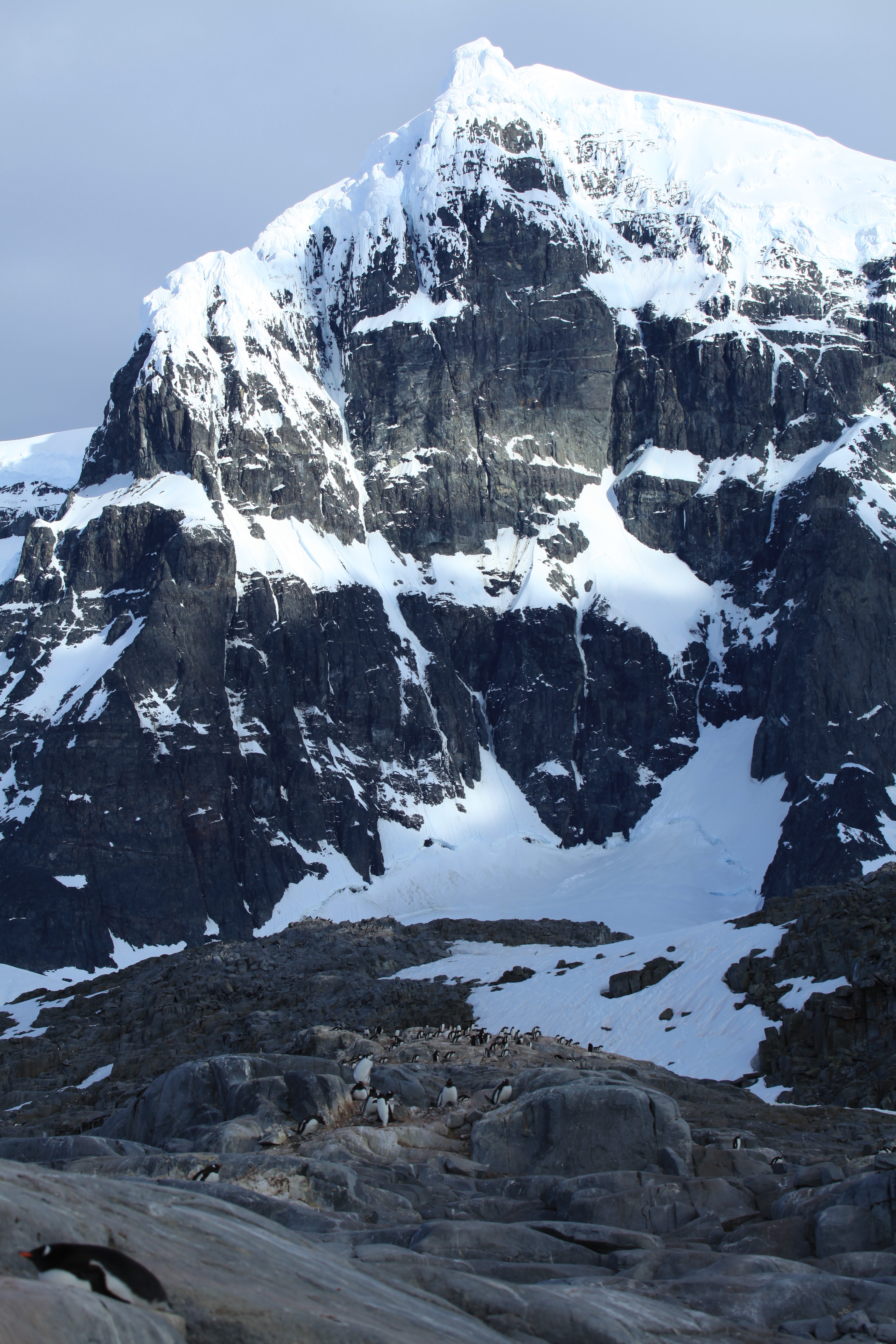
Jougla Point (64°50′S 63°30′W) is a point forming the west side of the entrance to Alice Creek in Port Lockroy, lying on the west side of Wiencke Island, in the Palmer Archipelago, Antarctica. It was discovered and named by the French Antarctic Expedition, 1903–05, under Jean-Baptiste Charcot, who considered it to be a peninsula. Because of its small size the term point is considered more appropriate.[1]
References
- "Jougla Point". Geographic Names Information System. United States Geological Survey. Retrieved 2013-04-08.
External links
![]() This article incorporates public domain material from the United States Geological Survey document: "Jougla Point". (content from the Geographic Names Information System)
This article incorporates public domain material from the United States Geological Survey document: "Jougla Point". (content from the Geographic Names Information System)
This Palmer Archipelago location article is a stub. You can help Wikipedia by expanding it. |
На других языках
[de] Jougla Point
Der Jougla Point (französisch Presqu'île Jougla ‚Jougla-Halbinsel‘) ist eine Landspitze an der Westküste der Wiencke-Insel im westantarktischen Palmer-Archipel. Sie bildet die Westseite der Einfahrt zum Alice Creek im Port Lockroy.- [en] Jougla Point
Текст в блоке "Читать" взят с сайта "Википедия" и доступен по лицензии Creative Commons Attribution-ShareAlike; в отдельных случаях могут действовать дополнительные условия.
Другой контент может иметь иную лицензию. Перед использованием материалов сайта WikiSort.org внимательно изучите правила лицензирования конкретных элементов наполнения сайта.
Другой контент может иметь иную лицензию. Перед использованием материалов сайта WikiSort.org внимательно изучите правила лицензирования конкретных элементов наполнения сайта.
2019-2026
WikiSort.org - проект по пересортировке и дополнению контента Википедии
WikiSort.org - проект по пересортировке и дополнению контента Википедии