geo.wikisort.org - Coast
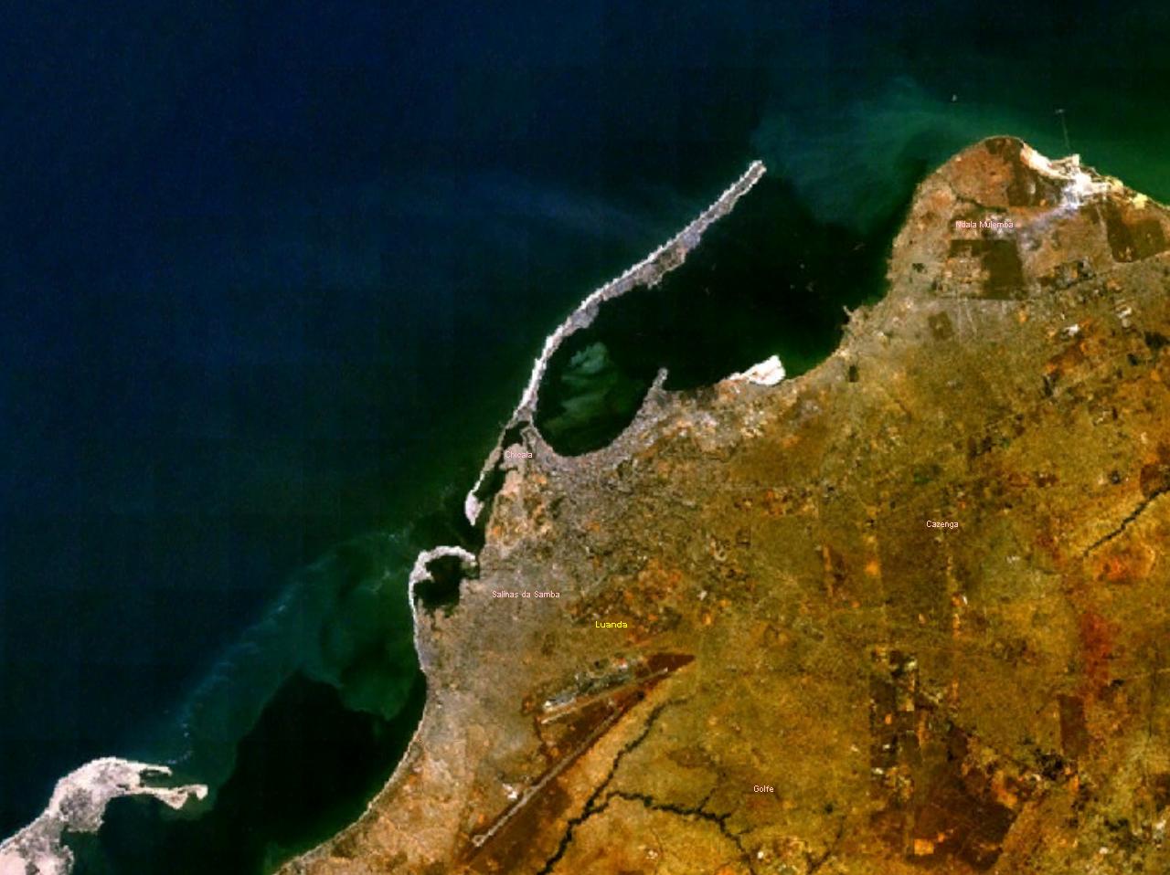
Ilha do Cabo (English: Cape Island) typically known as Ilha de Luanda (English: Island of Luanda) is a spit[1] off the shore of Luanda, the capital of Angola, a country on the continents' southwestern coast. It consists of a low sandy strip formed by sedimentation. In administrative terms, the peninsula belongs to the municipality of Ingombota in the Luanda Province.
Ilha do Cabo
Ilha de Luanda | |
|---|---|
 Ilha de Cabo, a sandspit off the shore of Luanda | |
| Location | Luanda Province, Angola |
History
When Paulo Dias de Novais, a Portuguese navigator, arrived here in 1575 with several hundred soldiers and settlers, the island was inhabited by the Axi-lwanda, a subgroup of the Ambundu people which was tributary to the Kongo Empire. The island was an important location to collect zimbo, the shells that constituted the currency of the Kongo king before the arrival of the Portuguese.[2] The Portuguese settled here for a while, gaining control of the currency, before they decided to establish themselves on the mainland, opposite the island. They started to use the name of the African inhabitants as a name for the island and the town, spelling it first "Loanda" and then "Luanda".
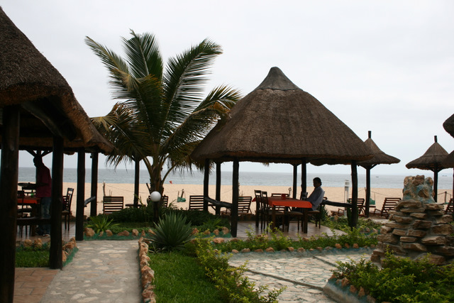
The Ilha, as it is called colloquially by the population, is connected with the city through a narrow passage[3] and is located at the foot of the Fortress of São Miguel. This is an area where residents can get away from the stresses of the capital, especially on weekends. A wide variety of hotels and clubs with bars and restaurants, as well as flea markets and marinas attract visitors.
The first church built by the Portuguese in Angola, the church of Nossa Senhora do Cabo is located here.[4] It was erected by some 40 settlers in 1575, before they moved to the mainland in 1576, founding the present capital of Luanda.
Culture
The "União Mundo da Ilha" (a carnival group),[5] was founded in 1968 by residents of the island. The group has about 150 members that aim at Varina and Semba as their main style of dance.
The Clube Náutico da Ilha de Luanda sports club is situated on the island.
Well-known dishes from this area are Mufete and Muzongué (a type of broth).[2]
References
- "Map of Luanda". Archived from the original on 2013-04-19. Retrieved 2013-03-01.
- Ilha de Luanda e suas tradições (retrieved - 27/09/2010)
- Ponte que liga marginal à Ilha de Luanda será inaugurada recuperado 18 de agosto 2011 (in Portuguese)
- Igreja da Nossa Sra. do Cabo (in Portuguese)
- Angop: União Mundo da Ilha abre desfile da classe A do Carnaval de Luanda retrieved February 10, 2011 (Portuguese)
External links
![]() Media related to Ilha do Cabo at Wikimedia Commons
Media related to Ilha do Cabo at Wikimedia Commons
На других языках
[de] Ilha do Cabo
Die Ilha do Cabo (deutsch: „Kap-Insel“) oder Ilha de Luanda (deutsch: „Insel von Luanda“) ist eine schmale Nehrung[1] mit 9 Kilometer Länge und zwischen 200 und 500 Meter Breite, die in südwest-nordöstlicher Richtung zwischen dem Atlantischen Ozean und der Bucht von Luanda in Angola liegt.- [en] Ilha de Luanda
Другой контент может иметь иную лицензию. Перед использованием материалов сайта WikiSort.org внимательно изучите правила лицензирования конкретных элементов наполнения сайта.
WikiSort.org - проект по пересортировке и дополнению контента Википедии