geo.wikisort.org - Coast
Heros Peninsula (Bulgarian: полуостров Херос, romanized: poluostrov Heros, IPA: [poɫuˈɔstrof ˈxɛros]) is the partly ice-free 8.9 km wide peninsula projecting from Foyn Coast, Antarctic Peninsula 13 km southeastwards into Cabinet Inlet. It ends in Spur Point to the southeast.
The feature is named after the Thracian god Heros (the Thracian Rider).
Location
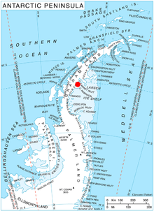
Heros Peninsula is centred at 66°33′00″S 63°54′00″W. British mapping in 1974.
Maps
- British Antarctic Territory: Graham Land. Scale 1:250000 topographic map. BAS 250 Series, Sheet SQ 19–20. London, 1974.
- Antarctic Digital Database (ADD). Scale 1:250000 topographic map of Antarctica. Scientific Committee on Antarctic Research (SCAR). Since 1993, regularly upgraded and updated.
References
- Heros Peninsula. SCAR Composite Antarctic Gazetteer.
- Bulgarian Antarctic Gazetteer. Antarctic Place-names Commission. (details in Bulgarian, basic data in English)
External links
- Heros Peninsula. Copernix satellite image
This article includes information from the Antarctic Place-names Commission of Bulgaria which is used with permission.
This Foyn Coast location article is a stub. You can help Wikipedia by expanding it. |
На других языках
[de] Heros-Halbinsel
Die Heros-Halbinsel (bulgarisch полуостров Херос .mw-parser-output .Latn{font-family:"Akzidenz Grotesk","Arial","Avant Garde Gothic","Calibri","Futura","Geneva","Gill Sans","Helvetica","Lucida Grande","Lucida Sans Unicode","Lucida Grande","Stone Sans","Tahoma","Trebuchet","Univers","Verdana"}poluostrow Cheros) ist eine 13 km lange und 8,9 km breite Halbinsel an der Foyn-Küste des Grahamlands auf der Antarktischen Halbinsel. Sie ragt in südöstlicher Richtung in das Cabinet Inlet hinein und endet im Spur Point.- [en] Heros Peninsula
Текст в блоке "Читать" взят с сайта "Википедия" и доступен по лицензии Creative Commons Attribution-ShareAlike; в отдельных случаях могут действовать дополнительные условия.
Другой контент может иметь иную лицензию. Перед использованием материалов сайта WikiSort.org внимательно изучите правила лицензирования конкретных элементов наполнения сайта.
Другой контент может иметь иную лицензию. Перед использованием материалов сайта WikiSort.org внимательно изучите правила лицензирования конкретных элементов наполнения сайта.
2019-2025
WikiSort.org - проект по пересортировке и дополнению контента Википедии
WikiSort.org - проект по пересортировке и дополнению контента Википедии