geo.wikisort.org - Coast
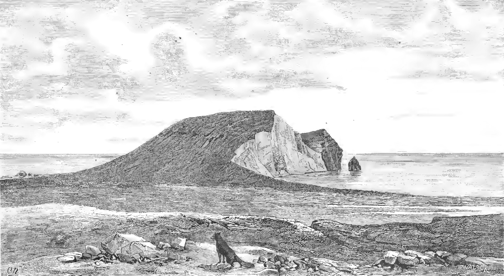
Eggøya ("Egg Island") is a peninsula of Jan Mayen island of the Arctic Ocean. It is located on the southern side, in the central part of the island, east of Sørlaguna, and defines the northeastern extension of the bay Rekvedbukta. To the west of the peninsula is the bay Eggøybukta, and to the east is the bay Jamesonbukta. The highest peak at the peninsula has a height of 217 m.a.s.l.[1] Eggøya consists of the northern part of an old volcanic crater, and small hydrothermal vents are still present.[2] The outer part of the peninsula forms the semicircular bay of Kraterbukta, facing south-southeast with steep slopes.[3][4] To the south of the peninsula is a small islet, Eggøykalven.[1]
Name history
The name "Eggøya" indicates that the peninsula used to be an island. The oldest reference given by Orvin is Joan Blaeu's Atlas Major sive Cosmographia Blaviana from 1662, with the Dutch: Eyer Eylandt of vogel klippen. In the 1801 publication Histoire des peches, des decouvertes et des etablissements des hollandais dans les mers du nord by Bernhard de Reste, the peninsula was called Terre aux æufs. In his Jan Mayen description from 1820, William Scoresby used the name Egg Island. Carl Vogt's map Karte der Insel Jan Mayen from 1863 used the name Eierinsel. In his 1878 report from an expedition to Jan Mayen, Henrik Mohn used the name forms Ægoen, Eg-Øen and Æg-Øen. In his article "Jan Mayen Island" from 1922, James Wordie used the name Egg Bluff Crater.[2]
Incidents
In November 1940, during World War II, the ship HNoMS Fridtjof Nansen wrecked off Eggøya, when it hit an uncharted subsea rock, which was later named Nansenflua.[1][5] The crew of 66 entered the lifeboats and reached the shore during darkness, two boats to the west of Eggøya, and two to the east. The ship had been on a mission to interrupt German plans to establish a weather station on Jan Mayen. Later, when a small garrison of Norwegian troops was established with headquarters near Nordlaguna, a guard's cottage was built on the northern slope of Eggøya.[6]
Historical maps
 Insel Eyer Eylandt of Vogel klippen (Old Dutch) on Joan Blaeu's map of 1662
 Scoresby's map of 1820 with Egg Island
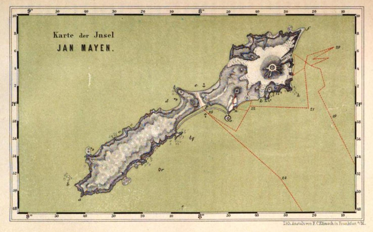
 Carl Vogt 1863: Island turning peninsula
 Eier Insel on German-language map drawn by Henrik Mohn is already a peninsula.


References
- Arctic Pilot: Sailing directions Svalbard–Jan Mayen. Vol. 7. Stavanger: The Norwegian Hydrographic Service and The Norwegian Polar Institute. 1988. p. 406. ISBN 82-90653-06-9.
- Orvin, Anders K. (1960). "The place-names of Jan Mayen". Skrifter. 120. Norsk Polarinstitutt: 19–20.
{{cite journal}}: Cite journal requires|journal=(help) - "Kraterbukta (Jan Mayen)". Norwegian Polar Institute. Retrieved 6 August 2013.
- Orvin 1960: p. 40
- "Nansenflua (Jan Mayen)". Norwegian Polar Institute. Retrieved 4 August 2013.
- Barr, Susan (1991). "Jan Mayen 1940–45: Øya X". Jan Mayen. Norges utpost i vest. Øyas historie gjennom 1500 år (in Norwegian). Oslo: Schibsted. pp. 145–184. ISBN 82-516-1353-1.
На других языках
[de] Eggøya
Eggøya (deutsch auch Eierinsel)[2] ist eine Halbinsel auf der zu Norwegen gehörenden Insel Jan Mayen im Nordatlantik. Sie liegt an der Südostküste der Insel zwischen den Buchten Jamesonbukta und Eggøybukta sowie östlich der Sørlaguna. Eggøya ist der Rest eines erodierten Vulkankraters, von dem nur der nördliche Rand übriggeblieben ist. Er umschließt halbkreisförmig die Meeresbucht Kraterbukta und bildet ein steiles Kliff, das in seinem höchsten Punkt 217 m erreicht.[3] Weniger als 100 Meter westlich von Eggøyodden, der Südwestspitze Eggøyas, liegt die kleine Felseninsel Eggøykalven.- [en] Eggøya
Другой контент может иметь иную лицензию. Перед использованием материалов сайта WikiSort.org внимательно изучите правила лицензирования конкретных элементов наполнения сайта.
WikiSort.org - проект по пересортировке и дополнению контента Википедии