geo.wikisort.org - Coast
Cape Three Points is a small peninsula in the Western Region of Ghana on the Atlantic Ocean. It forms the southernmost tip of Ghana.
This article needs additional citations for verification. (July 2014) |

Location
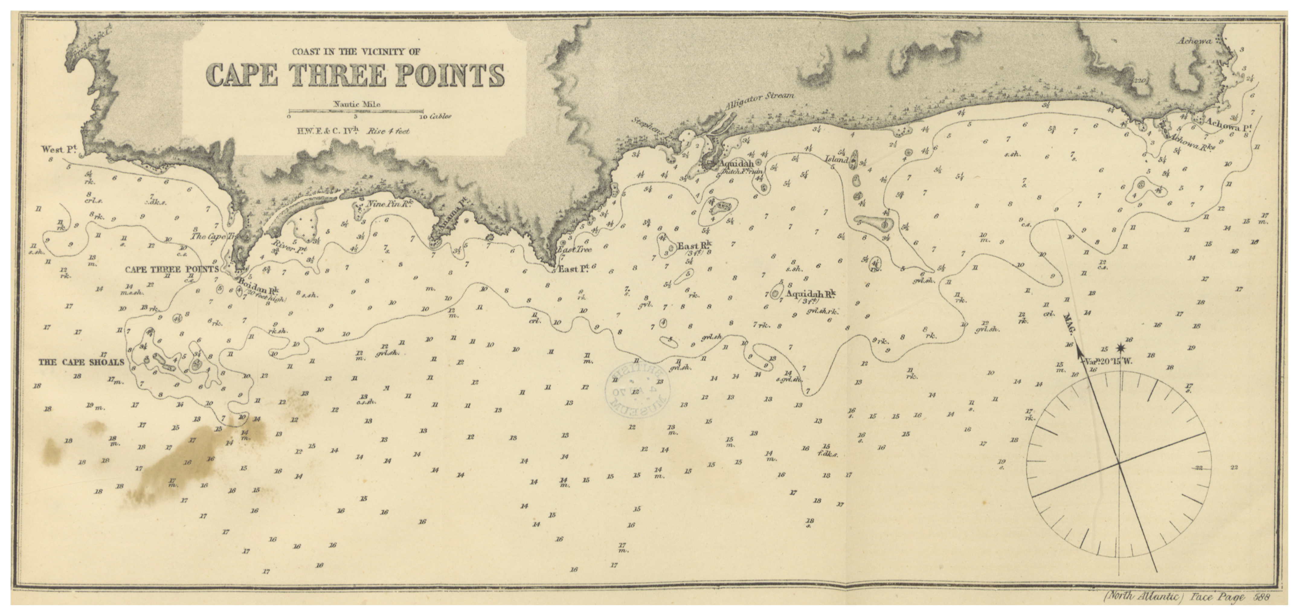
Cape Three Points is located between the coastal village of Dixcove and town of Princes Town, Ghana. Cape Three Points is known as the "land nearest nowhere" because it is the land nearest to a location in the sea known as Null Island, which is at 0 latitude and 0 longitude (the distance is about 570 km).[1]
Lighthouse

Cape Three Points is best known for its lighthouses, the first of which was constructed in 1875 by the British as a navigational aid for trading vessels sailing through the Gulf of Guinea. The original structure has since become a ruin; however a larger and improved lighthouse was completed in 1925, and is still functioning today.[1]
References
- Cape Three Points. Ghanawestcoast.com. Archived 2013-03-28 at the Wayback Machine
| Authority control |
|
|---|
На других языках
- [en] Cape Three Points
[ru] Три-Пойнтс (мыс)
Три-Пойнтс[1][2] (англ. Cape Three Points) — мыс на побережье Гвинейского залива, в части известной как Золотой Берег (Берег Мина[pt])[3], крайняя южная точка Ганы[1]. Расположен на территории муниципального района Аанта-Уэст[en] в Западной области, к юго-востоку от устья реки Анкобры и города Принсес-Таун, к юго-западу от Аквида[en] и Диксков[en][2].Другой контент может иметь иную лицензию. Перед использованием материалов сайта WikiSort.org внимательно изучите правила лицензирования конкретных элементов наполнения сайта.
WikiSort.org - проект по пересортировке и дополнению контента Википедии