geo.wikisort.org - Coast
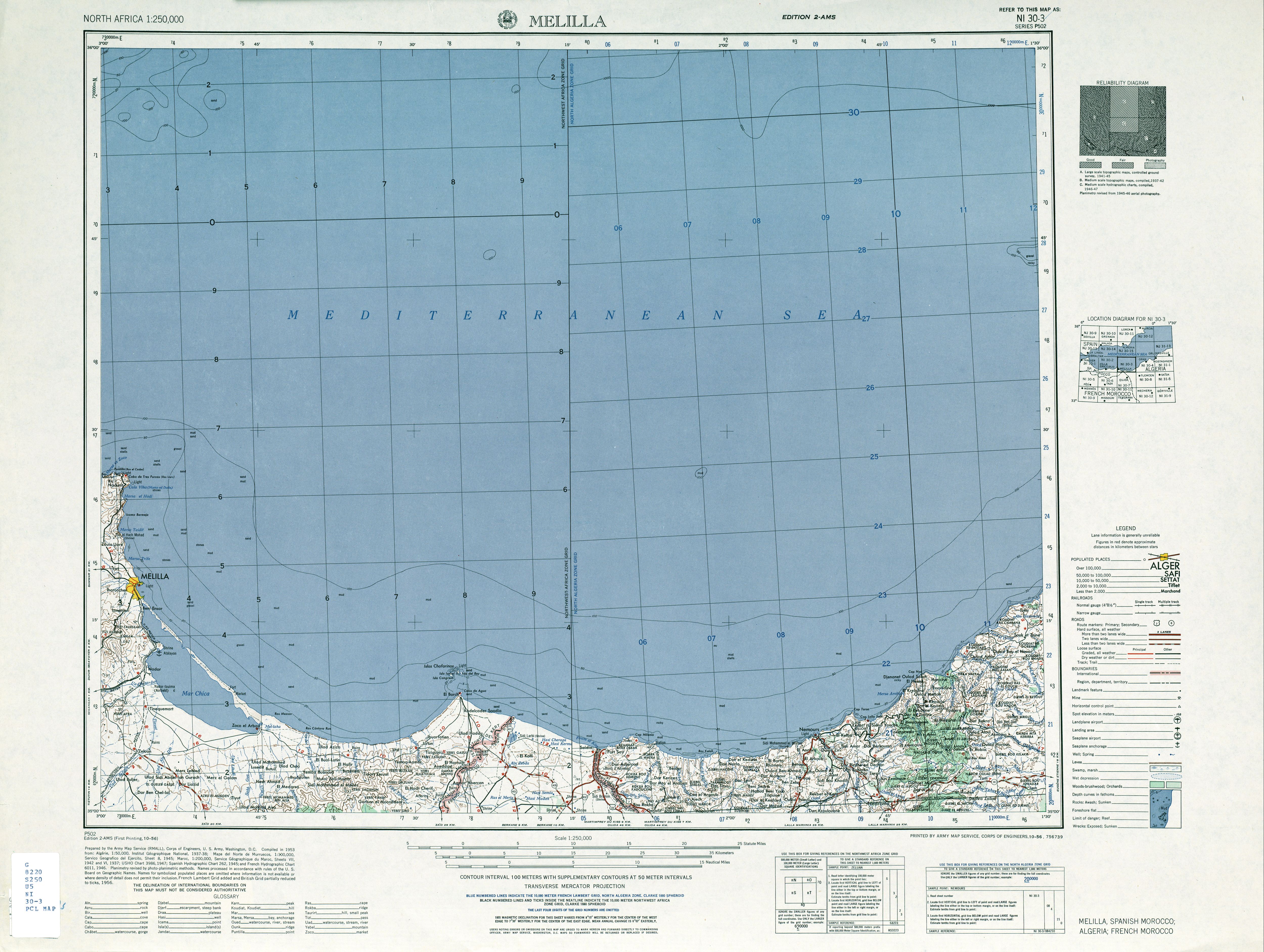
Cape Three Forks or Cape Tres Forcas is a headland on the Mediterranean coast of northeastern Morocco.


Geography
The cape is a large mountainous promontory of North Africa into the Mediterranean Sea. For centuries, this cape has provided both a nautical landmark and a maritime hazard for ships in the Alboran Sea. The Spanish exclave of Melilla surrounds a smaller cape on the eastern side of the peninsula.
Names

In antiquity, the cape was known to the Phoenicians and Carthaginians as Rusadir (Punic: 𐤓𐤔𐤀𐤃𐤓, ršʾdr),[1] giving its name to a nearby port (now Melilla). The name meant "Powerful"[2] or "High Cape",[3] but can also be understood as "Cape of the Powerful One", in reference to Baal, Tanit, and other important Punic god.[4][5] It was known to the Romans as Cape Metagonites (Latin: Metagonites Promontorium).[6][7]
Cape Three Forks is known in Spanish as Cabo de Tres Forcas, in French as Cap des Trois Fourches, and in Arabic as Ras Tleta Madari, all meaning "Cape of the Three Forks".
It is also known in Arabic as Ras Uarc.[8]
History
On 26 August 1923 the Spanish battleship España ran aground and eventually wrecked on the cape.[9][10]
Lighthouse
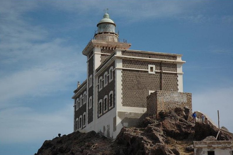
A lighthouse is located in the north end of the cape. It is a gray tower on white two-story dwelling.
Maraboutism
At least 11 locations in the Cape Three Forks have been identified as places of pious reflection, either small hermitages, bushes or trees, five of them featuring the tomb of the marabout.[11]
Ecology
| Designations | |
|---|---|
Ramsar Wetland | |
| Official name | Cap des Trois Fourches |
| Designated | 15 January 2005 |
| Reference no. | 1473[12] |
Cape Three Forks is a Ramsar designated site with no. 1473. It hosts different species, some of them threatened, such as the monk seal, two species of limpets (Patella ferruginea and Patella nigra), the loggerhead turtle, the fin whale and two species of dolphin (Tursiops truncatus and Delphinus delphis). The main activities taking place in the area are fishing and tourism.[13]
References
Citations
- Head et al. (1911), p. 889.
- Mora Serrano (2011), p. 25.
- Cath. Enc. (1913), s.v. "Rusaddir".
- Juárez, Roberto (3 September 2016), "Significado de Rusaddir", Melilla: Ciudad Desconocida. (in Spanish)
- López Pardo (2005), pp. 137–8.
- Ptol., Geogr., Bk. IV, Ch. i, §12.
- Dict. Gr. & Rom. Bio. & Myth. (1870), s.v. "Rusadir".
- "Melilla", North Africa, P502, NI 30-3, Washington: U.S. Army Map Service, 1953.
- Yate, Asamblea de Capitanes de (1978). La Armada española (in Spanish). Editorial San Martín. ISBN 978-84-7140-172-4.
- Alvarez, José E. (2001-01-30). The Betrothed of Death: The Spanish Foreign Legion During the Rif Rebellion, 1920-1927: The Spanish Foreign Legion During the Rif Rebellion, 1920-1927. ABC-CLIO. ISBN 978-0-313-07341-0.
- Gámez Gómez, Sonia (2011). "Morabitismo en la Guelaya. Los santuarios del Cabo Tres Forcas" (PDF). Akros (10): 19–27. ISSN 1579-0959.
- "Cap des Trois Fourches". Ramsar Sites Information Service. Retrieved 25 April 2018.
- Ramsar Convention (2005-06-28). "The Annotated Ramsar List: Morocco". Archived from the original on 2013-01-07.
Bibliography
- Head, Barclay; et al. (1911), "Mauretania", Historia Numorum (2nd ed.), Oxford: Clarendon Press, pp. 887–890.
- James, Edward Boucher (1870), "Rusadir", Dictionary of Greek and Roman Biography and Mythology, vol. III, Boston: Little, Brown, & Co.
- López Pardo, Fernando (2005), "La Fundación de Rusaddir y la Época Púnica", Historia de Melilla, Colección Historia de Melilla, No. 17, Melilla, pp. 167–189. (in Spanish)
- Mora Serrano, Bartolomé (2011), "Coins, Cities, and Territories: The Imaginary Far West and South Iberian and North African Punic Coins", Money, Trade, and Trade Routes in Pre-Islamic North Africa, London: British Museum, pp. 21–32.
- Petrides, Sophron (1913), "Rusaddir", Catholic Encyclopedia, vol. Vol. XIII, New York: Encyclopedia Press.
External links
| Authority control |
|
|---|
Другой контент может иметь иную лицензию. Перед использованием материалов сайта WikiSort.org внимательно изучите правила лицензирования конкретных элементов наполнения сайта.
WikiSort.org - проект по пересортировке и дополнению контента Википедии