geo.wikisort.org - Coast
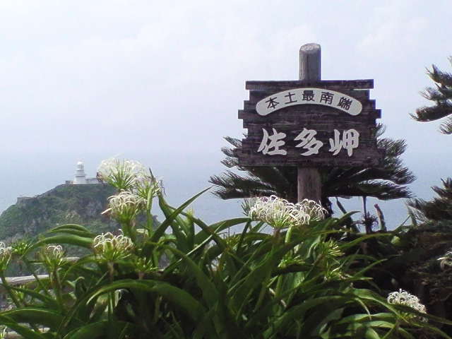
Cape Sata (佐多岬, Sata Misaki) is a cape at the southern tip of the Ōsumi Peninsula of Kyūshū island, Japan, and is the southernmost point of the island, just south of 31 degrees latitude.
This article does not cite any sources. (March 2008) |
Cape Sata
(佐多岬, Sata Misaki) | |
|---|---|
Cape | |
 Cape Sata | |
 Cape Sata | |
| Coordinates: 30°59′39″N 130°39′38.3″E | |
| Location | Kyūshū island, Japan |
| Offshore water bodies | Sea of Japan |
Cape Sata is home to a lighthouse built in 1871, designed by the Scotsman Richard Henry Brunton.
Prior to 2013, the land was under the jurisdiction of a private company, and cost 300 yen to enter with open hours between 9 a.m. and 5 p.m.
However, Sata is now free to enter, and its abandoned restaurant and observation deck have since been torn down.
Alan Booth's 1986 book The Roads to Sata details his walk from Cape Sōya at the northern tip of Hokkaidō south to Cape Sata.
Gallery
 Monument at latitude 31°N
 Cape Santa Observatory
 Cape Sata lighthouse from Sata-misaki Observation Park
 Mount Kaimon on the Satsuma Peninsula over the sea
 Satamisaki Road Park


See also
- Extreme points of Japan
This Kagoshima Prefecture location article is a stub. You can help Wikipedia by expanding it. |
Другой контент может иметь иную лицензию. Перед использованием материалов сайта WikiSort.org внимательно изучите правила лицензирования конкретных элементов наполнения сайта.
WikiSort.org - проект по пересортировке и дополнению контента Википедии