geo.wikisort.org - Coast
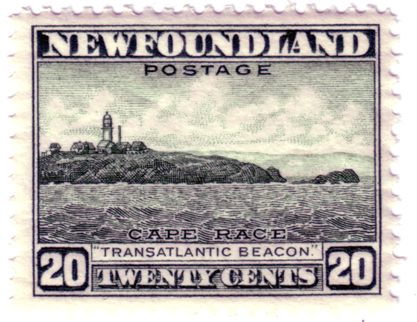
Cape Race is a point of land located at the southeastern tip of the Avalon Peninsula on the island of Newfoundland, in Newfoundland and Labrador, Canada. Its name is thought to come from the original Portuguese name for this cape, "Raso", meaning flat or low-lying. The Cape appeared on early sixteenth century maps as Cabo Raso and its name may derive from a cape of the same name at the mouth of the Tagus River in Portugal. The cape was the location of the Cape Race LORAN-C transmitter until the system was decommissioned in 2010. It is also home to the Cape Race Lighthouse, notable for having received the distress call from the RMS Titanic.


Geography
Dense fog, rocky coasts, and its proximity to trans-Atlantic shipping routes have resulted in many shipwrecks near Cape Race over the years. One of the most famous was the SS Arctic. Cape Race is a flat, barren point of land jutting out into the Atlantic Ocean, its cliffs rising almost vertically to 30.5 metres (100 ft) above sea level. On average it is shrouded in fog on 158 days of the year.[citation needed]
Climate
| Climate data for Cape Race Climate ID: 8401000; WMO ID: 71800; coordinates 46°39′36″N 53°04′35″W; elevation: 26.5 m (87 ft); 1991–2020 normals, extremes 1982–present | |||||||||||||
|---|---|---|---|---|---|---|---|---|---|---|---|---|---|
| Month | Jan | Feb | Mar | Apr | May | Jun | Jul | Aug | Sep | Oct | Nov | Dec | Year |
| Record high °C (°F) | 12.7 (54.9) |
9.4 (48.9) |
11.4 (52.5) |
22.6 (72.7) |
20.8 (69.4) |
25.6 (78.1) |
27.8 (82.0) |
27.8 (82.0) |
28.2 (82.8) |
22.2 (72.0) |
16.9 (62.4) |
12.2 (54.0) |
28.2 (82.8) |
| Average high °C (°F) | 1.1 (34.0) |
0.8 (33.4) |
1.4 (34.5) |
4.4 (39.9) |
8.1 (46.6) |
11.9 (53.4) |
16.2 (61.2) |
17.9 (64.2) |
15.9 (60.6) |
11.9 (53.4) |
7.6 (45.7) |
3.7 (38.7) |
8.4 (47.1) |
| Daily mean °C (°F) | −2.4 (27.7) |
−2.6 (27.3) |
−1.8 (28.8) |
1.4 (34.5) |
4.7 (40.5) |
8.4 (47.1) |
12.9 (55.2) |
14.8 (58.6) |
12.4 (54.3) |
8.4 (47.1) |
4.3 (39.7) |
0.4 (32.7) |
5.1 (41.1) |
| Average low °C (°F) | −5.9 (21.4) |
−6.1 (21.0) |
−4.9 (23.2) |
−1.7 (28.9) |
1.3 (34.3) |
5.0 (41.0) |
9.6 (49.3) |
11.7 (53.1) |
8.9 (48.0) |
5.0 (41.0) |
1.0 (33.8) |
−3.0 (26.6) |
1.7 (35.1) |
| Record low °C (°F) | −33.0 (−27.4) |
−26.1 (−15.0) |
−21.0 (−5.8) |
−15.0 (5.0) |
−9.4 (15.1) |
−6.1 (21.0) |
−1.1 (30.0) |
0.6 (33.1) |
−3.3 (26.1) |
−10.0 (14.0) |
−13.9 (7.0) |
−21.1 (−6.0) |
−33.0 (−27.4) |
| Average precipitation mm (inches) | 98.9 (3.89) |
87.3 (3.44) |
93.1 (3.67) |
98.9 (3.89) |
83.7 (3.30) |
84.0 (3.31) |
116.4 (4.58) |
99.5 (3.92) |
95.0 (3.74) |
109.7 (4.32) |
137.6 (5.42) |
111.1 (4.37) |
1,215.2 (47.84) |
| Source 1: Environment Canada[1] | |||||||||||||
| Source 2: Meteostat[2] | |||||||||||||
History
In 1583, having claimed the port of St John's for Queen Elizabeth I, Sir Humphrey Gilbert, on board the ship Squirrel, and accompanied by the ships Golden Hind and Delight, passed by Cape Race on his way back to England. Squirrel would sink en route, taking Gilbert with her. From 1859 to 1866, the New York City Associated Press kept a newsboat at Cape Race to meet ocean liners passing by on their way from Europe so that news could be telegraphed to New York.[3][4] These news items carried the byline "via Cape Race". In 1904, the first wireless station in Newfoundland was built at Cape Race. On the night Titanic sank, wireless operator Jack Phillips was sending telegraphs to Cape Race for relay to New York City. When Cyril Evans, wireless operator of the Leyland Line SS Californian, sent an iceberg warning to the RMS Titanic, only a few miles away, Phillips was so annoyed with the loud signal (due to the proximity) and responded "Keep out, Shut up, I'm working with Cape Race." This would become a famous incident, as the bored and angry Evans soon switched off the wireless and went to sleep, and Titanic hit an iceberg only fifteen minutes later. After Titanic's distress call, Cape Race played a major role in relaying news of the sinking to other ships and land locations.
Marconi's station (MCE) was rebuilt on the same site and opened as a "wireless interpretation centre" to commemorate the 100th anniversary of Titanic's sinking in 2012.[5]
References
- Rowlett, Russ. "Lighthouses of Canada: Southeastern Newfoundland". The Lighthouse Directory. University of North Carolina at Chapel Hill. Retrieved July 24, 2008.
- http://commons.wikimedia.org/wiki/File:Amerika14April1912.JPG
- Environment Canada—Station Results - Historical Data Cape Race. Retrieved 26 March 2022.
- "Climate of Cape Race 1991-2020". Meteostat. Retrieved March 26, 2022.
- "News Yacht off Cape Race—European News.; ST. JOHNS, N. F., Thursday, Nov. 5" (PDF).
- (April 1902). The Great Newspapers of the United States: The New York Evening Newspapers, The Bookman (New York), p. 160
- Steve Bartlett (2012-04-13). "'Struck iceberg. Send help right away.' – Local". The Telegram. Archived from the original on 2015-02-23. Retrieved 2015-02-23.
External links
На других языках
[de] Kap Race
Das Kap Race ist eine Landzunge an der südöstlichen Spitze der Halbinsel Avalon auf der kanadischen Insel Neufundland.- [en] Cape Race
[it] Capo Race
Capo Race è una piccola località situata nell'isola di Terranova, appartenente al Canada. Il suo nome si pensa derivi dall'originale nome in lingua portoghese di questo capo, "Raso" ("nudo"). Il Capo è apparso per la prima volta sulle mappe del sedicesimo secolo come Capo Raso, ed il suo nome potrebbe essere derivato da un capo con lo stesso nome alla foce del fiume Tago in Portogallo.[ru] Кейп-Рейс
Кейп-Рейс (англ. Cape Race) — мыс, расположенный на острове Ньюфаундленд, в юго-восточной части полуострова Авалон. Считается, что название произошло от португальского Raso (пустыня). На географических картах мыс впервые появился в XVI веке.Другой контент может иметь иную лицензию. Перед использованием материалов сайта WikiSort.org внимательно изучите правила лицензирования конкретных элементов наполнения сайта.
WikiSort.org - проект по пересортировке и дополнению контента Википедии