geo.wikisort.org - Coast
Cape Maobitou is a cape in the township of Hengchun in Pingtung County, Taiwan. It lies within Kenting National Park and forms the western boundary of South Bay. It is one of the southernmost points on Taiwan Island, sits opposite to the Cape Eluanbi in the southeast.
Cape Maobitou
貓鼻頭 | |
|---|---|
Cape | |
 Cape Maobitou (2011) | |
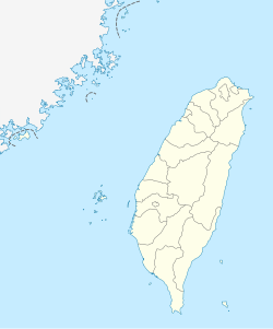 Cape Maobitou Location in Taiwan | |
| Coordinates: 21°55′11″N 120°44′22″E | |
| Location | Hengchun, Pingtung County, Taiwan |
| Cape Maobitou | |||||||||||||
|---|---|---|---|---|---|---|---|---|---|---|---|---|---|
 Maobitou (2017) | |||||||||||||
| Traditional Chinese | 貓鼻頭 | ||||||||||||
| Simplified Chinese | 猫鼻头 | ||||||||||||
| Literal meaning | Cat's Nose Cat Cape | ||||||||||||
| |||||||||||||
| Former names | |||||||||||||
|---|---|---|---|---|---|---|---|---|---|---|---|---|---|
 Waves at Maobitou (2009) | |||||||||||||
| Maobi | |||||||||||||
| Traditional Chinese | 貓鼻 | ||||||||||||
| Simplified Chinese | 猫鼻 | ||||||||||||
| Literal meaning | Cat's Nose Cat Cape | ||||||||||||
| |||||||||||||
Name

Māobítou is the pinyin romanization of the Mandarin pronunciation of the Chinese name, written 貓鼻頭 in traditional characters and 猫鼻头 in simplified characters. It literally means "Cat Nose Head" but bítou is a simply a clarifying dialectical variation of bí, itself a dialectical name for a headland.
Maobitou or Maobi was formerly known as Niauphi,[1] from the Hokkien form of the name.
![[1]](#cite_note-FOOTNOTECampbell1896[[:c:File:1896_map_of_Taiwan.png|map]]-1)
Transportation
The cape is located near Taiwan's Highway 26.
See also
- Geography of Taiwan
- Kenting National Park
- Cape Eluanbi
References
Citations
Bibliography
- Campbell, William (1896), "The Island of Formosa: Its Past and Future", Scottish Geographical Magazine (PDF), vol. 12, No. 8, pp. 385–399, doi:10.1080/00369229608732903.
Текст в блоке "Читать" взят с сайта "Википедия" и доступен по лицензии Creative Commons Attribution-ShareAlike; в отдельных случаях могут действовать дополнительные условия.
Другой контент может иметь иную лицензию. Перед использованием материалов сайта WikiSort.org внимательно изучите правила лицензирования конкретных элементов наполнения сайта.
Другой контент может иметь иную лицензию. Перед использованием материалов сайта WikiSort.org внимательно изучите правила лицензирования конкретных элементов наполнения сайта.
2019-2026
WikiSort.org - проект по пересортировке и дополнению контента Википедии
WikiSort.org - проект по пересортировке и дополнению контента Википедии