geo.wikisort.org - Coast
Cape Gray is a rocky cape which forms the east side of the entrance to Commonwealth Bay, part of the George V Coast of Antarctica. The cape is actually a small rocky island which is joined to the icecap of the mainland by an ice ramp. It was discovered by the Australasian Antarctic Expedition (1911–14) under Douglas Mawson, who named it for Percival Gray, second officer on the expedition ship Aurora.[1]
| Cape Gray | |
|---|---|
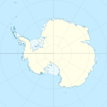 | |
| Coordinates | 66°51′S 143°22′E |
References
- "Gray, Cape". Geographic Names Information System. United States Geological Survey. Retrieved 2012-05-06.
![]() This article incorporates public domain material from the United States Geological Survey document: "Gray, Cape". (content from the Geographic Names Information System)
This article incorporates public domain material from the United States Geological Survey document: "Gray, Cape". (content from the Geographic Names Information System)
This George V Land location article is a stub. You can help Wikipedia by expanding it. |
На других языках
[de] Kap Gray
Das Kap Gray ist ein Kap an der ostantarktischen Georg-V.-Küste. Es liegt an der Ostseite der Einfahrt zur Commonwealth-Bucht. Das Kap ist eigentlich eine kleine Felseninsel, die über eine Eisbrücke mit dem kontinentalen Eisschild verbunden ist.- [en] Cape Gray
Текст в блоке "Читать" взят с сайта "Википедия" и доступен по лицензии Creative Commons Attribution-ShareAlike; в отдельных случаях могут действовать дополнительные условия.
Другой контент может иметь иную лицензию. Перед использованием материалов сайта WikiSort.org внимательно изучите правила лицензирования конкретных элементов наполнения сайта.
Другой контент может иметь иную лицензию. Перед использованием материалов сайта WikiSort.org внимательно изучите правила лицензирования конкретных элементов наполнения сайта.
2019-2026
WikiSort.org - проект по пересортировке и дополнению контента Википедии
WikiSort.org - проект по пересортировке и дополнению контента Википедии