geo.wikisort.org - Coast
The Cap de Creus (Cabo de Creus in Spanish) is a peninsula and a headland located at the far northeast of Catalonia, some 25 kilometres (16 mi) south from the French border. The cape lies in the municipal area of Cadaqués, and the nearest large town is Figueres, capital of the Alt Empordà and birthplace of Salvador Dalí. Cap de Creus is the easternmost point of Catalonia and therefore of mainland Spain and the Iberian Peninsula.
This article may be expanded with text translated from the corresponding article in Spanish. (January 2012) Click [show] for important translation instructions.
|


The area is now a Natural Park.[1]
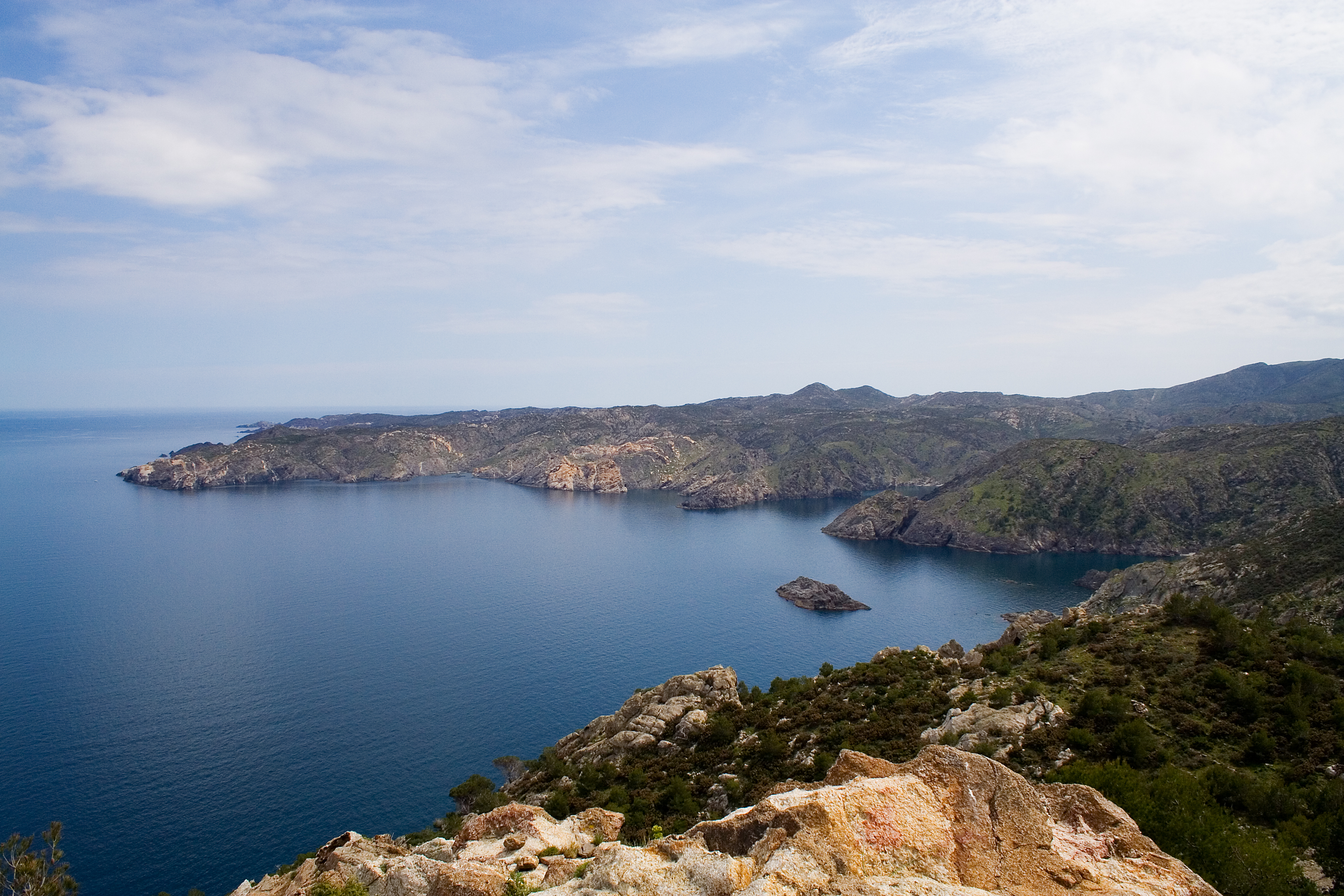
The peninsula has an area of 190 square kilometres (73 sq mi) of an extraordinary landscape value; a windbeaten very rocky dry region, with almost no trees, in contrast with a seaside rich in minuscule creeks of deep blue sea to anchor. Mountains are the eastern foothills of the Pyrenees, the natural border between France and Spain. The region is frequently swept by awful north wind "tramontana" (beyond mountains) which has caused many naval disasters. Cadaqués is the most well known village, home of artists and writers, with sophisticated atmosphere, near Port Lligat where Dalí built his home in a paradise small bay. (Dalí depicted the peninsula in his paintings The Persistence of Memory and The Great Masturbator.)[2] El Port de la Selva, with a little fishing harbour, is less exploited, with good gastronomic resources and pleasant terraces.
Sant Pere de Rodes stands out at 500 metres (1,600 ft) of altitude, with views of the Cap and the Pyrenees. It is an 11th-century monastery whose first structures date from about 750 AD.
One legend tells that the Cap de Creus was hewn by Hercules.[citation needed]
References
- Cap de Creus Natural Park
- Ian Gibson, "The Shameful Life of Salvador Dalí", W.W. Norton & Company, 1987. ISBN 0-393-04624-9. Page 71, pages 256 - 257, plate XIV
External links
Authority control | |
|---|---|
| General |
|
| National libraries | |
This article about a location in Catalonia is a stub. You can help Wikipedia by expanding it. |
На других языках
- [en] Cap de Creus
[es] Cabo de Creus
El cabo de Creus (en español: cabo de Cruces; en catalán: Cap de Creus) es el punto más oriental de la península ibérica, situado al norte del golfo de Rosas. Es un promontorio abrupto y rocoso de 67,2 m de elevación que se alza sobre el mar Mediterráneo en el nordeste de España, en la provincia de Gerona. El paraje que lo rodea fue declarado parque natural en 1998 debido a su riqueza geológica. El parque natural esta gestionado por la Generalidad de Cataluña.[ru] Креус
Креус[1] (исп. Cabo de Creus) — мыс и крайняя восточная точка материковой Испании и Пиренейского полуострова.Другой контент может иметь иную лицензию. Перед использованием материалов сайта WikiSort.org внимательно изучите правила лицензирования конкретных элементов наполнения сайта.
WikiSort.org - проект по пересортировке и дополнению контента Википедии