geo.wikisort.org - Coast
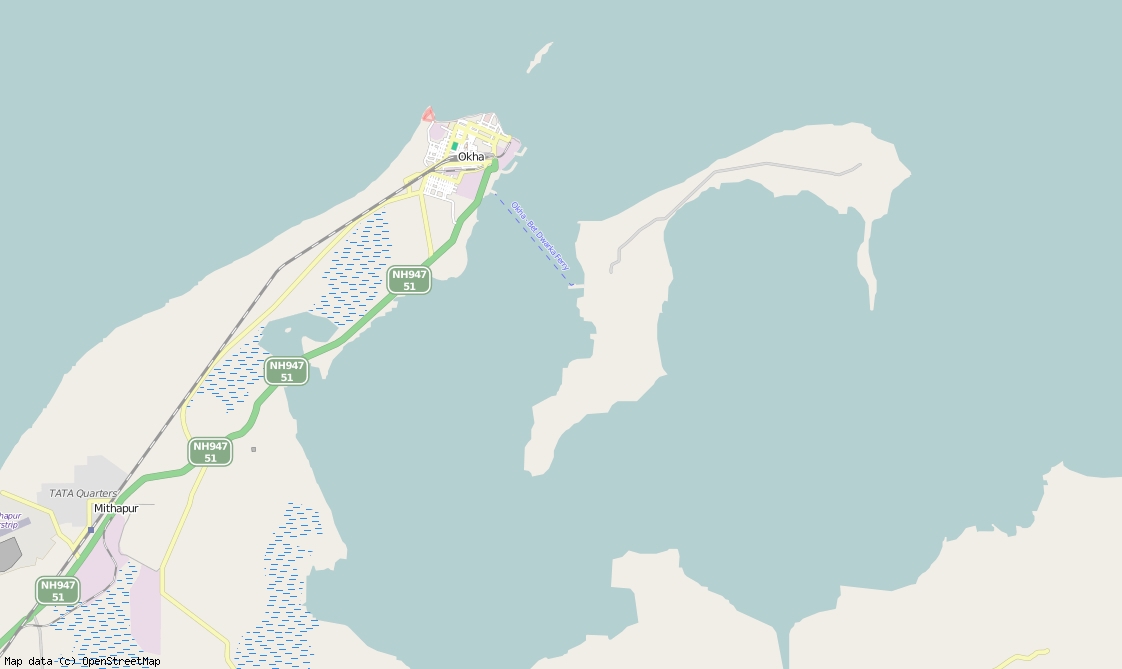
Bet Dwarka (also spelled Beyt Dwarka) or Shankhodhar is an inhabited island at the mouth of the Gulf of Kutch situated 3 km (2 mi) off the coast of Okha, Gujarat, India. Northwest to southeast, the island measures 13 km (8 mi) long with an average east–west width of 4 km (2 mi). It is a strip of sandstone situated 30 km (19 mi) north of the town of Dwarka.[1][2]
This article may require copy editing for grammar, style, cohesion, tone, or spelling. (February 2022) |
Bet Dwarka | |
|---|---|
Island | |
 Map of Bet Dwarka | |
 Bet Dwarka Location in Gujarat, India  Bet Dwarka Bet Dwarka (India) | |
| Coordinates: 22°26′58″N 69°7′2″E | |
| Country | India |
| State | Gujarat |
| District | Devbhoomi Dwarka district |
| City | Dwarka |
| Area | |
| • Total | 11 km2 (4 sq mi) |
| Population (2011) | |
| • Total | 15,000 |
| • Density | 1,400/km2 (3,500/sq mi) |
| Languages | |
| • Official | Gujarati, Hindi |
| Time zone | UTC+5:30 (IST) |
| Vehicle registration | GJ-37 |
| Website | gujaratindia |
History of city
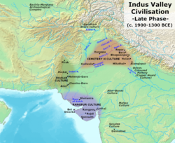
Bet Dwarka is considered as a part of the ancient city of Dvārakā. In Indian epic literature, it is the abode of Krishna, found in the Mahabharata and Skanda Purana. Gujarati scholar Umashankar Joshi suggested that Antardvipa in Sabha Parva of Mahabharata can be identified as Bet Dwarka, as the Yadavas of Dwarka are said to have travelled to it by boat. It derives its name Shankhodhar from the fact that the island is a large source of conch shells (Shankh). Archaeological remains found under the sea suggest the existence of a settlement during Late Harappan period of Indus Valley civilization, or immediately after it. It can be reliably dated to the time of the Maurya Empire. It was a part of Okha Mandal or Kushdwip area. Dwarka is mentioned in a copper inscription of Simhaditya, the minister of Vallabhi under Maitraka, dated 574 AD. He was the son of Varahdas, the king of Dwarka.[1]
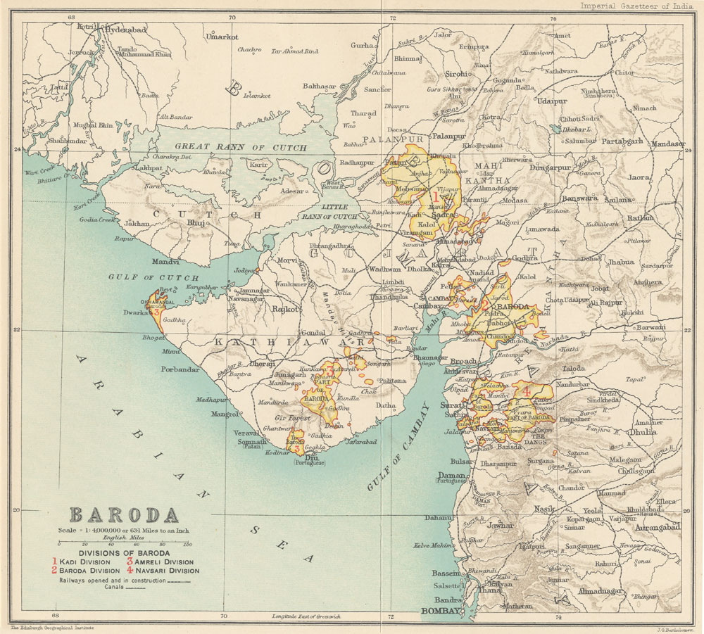
The island, along with Okhamandal region, was under Gaekwad of Baroda State. During the Indian rebellion of 1857, the Vaghers captured this region. Later by joint offensive of the British, Gaekwad and other princely state troops ousted the rebels and recaptured the region in 1859.[3][4][5]
After Indian Independence in 1947, it was integrated into the Saurashtra State. Later, Saurashtra merged with Bombay State under the state re-organization plans. When Gujarat was created from bifurcation of Bombay State, Bet Dwarka was under the jurisdiction Jamnagar district of Gujarat. Later, Devbhoomi Dwarka district was created from the Jamnagar district in 2013, and as such became part of it.
Archeology
During investigations undertaken in the 1980s, the remains of earthen pots and other artifacts of Late Harappan period were found. In 1982, a 580 meter long protection wall dated 1500 BC was found, which is believed to be damaged and submerged following a sea storm. The artifacts recovered include a Late Harappan seal, an inscribed jar and a mold of a copper-smith, and a copper fishhook. The shipwrecks and stone anchors found during excavations suggested the historic trade relation with Romans. The temples on the island were built around end of eighteenth century.[1][2][6]
Places of worship
Dhwarkadhish Temple and Shri Keshavraiji Temple are major temples of Krishna. Hanuman Dandi, Vaishnav Mahaprabhu Bethak, and a Gurudwara are also pilgrimage places. A small temple of Abhaya mata is situated south of the island.
Access
Bet Dwarka can be reached by ferry service from Okha. The first sea bridge of Gujarat is under construction between Okha and Bet Dwarka. The 2 km (1 mi) long sea bridge is estimated to cost ₹400 crore.[7]
The bet is surrounded by several sand beaches. The southeast most end of bet is known as Dunny Point, which is three side surrounded by sea. It is the first place in Gujarat developed for ecotourism. The temporary camps are set up for tourism during summer.
Gallery
 Hanuman Dandi temple
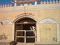 Shri Keshavraiji Temple Main Gate
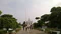 Gurudwara Bet Dwarka
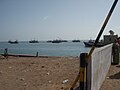 Sea from Bet Dwarka


See also
References
- Rao, S. R.; Gaur, A. S. (July 1992). "Excavations at Bet Dwarka" (PDF). Marine Archeology. Marine Archeological Centre, Goa. 3: 42–. Retrieved 1 January 2015.
- Gaur, A. S. (25 February 2004). "A unique Late Bronze Age copper fish-hook from Bet Dwarka Island, Gujarat, west coast of India: Evidence on the advanced fishing technology in ancient India" (PDF). Current Science. IISc. 86 (4): 512–514. Archived from the original (PDF) on 4 January 2015. Retrieved 1 January 2015.
- Ramanlal Kakalbhai Dharaiya (1970). Gujarat in 1857. Gujarat University. p. 120.
- Achyut Yagnik (24 August 2005). Shaping Of Modern Gujarat. Penguin Books Limited. pp. 105–109. ISBN 978-81-8475-185-7.
- "Gujarat During The Great Revolt: The Rebellion In Okhmandal". People's Democracy. October 7, 2007. Archived from the original on 16 January 2015. Retrieved 15 January 2015.
- Gaur, A.S.; Sundaresh and Sila Tripati (2004). "An ancient harbour at Dwarka: Study based on the recent underwater explorations". Current Science. 86 (9).
- "Nitin Gadkari approves construction of sea-link to connect Okha, Bet Dwarka". The Indian Express. 2016-05-31. Retrieved 2017-07-18.
Bibliography
- S. R. Rao (1991). "Further excavations of the submerged city of Dwarka". Recent Advances in Marine Archaeology: Proceedings of the second Indian Conference on Marine Archaeology of Indian Ocean Countries, January 1990. Marine Archaeology. National Institute Of Oceanography. pp. 51–59.
- Gaur, A.S., Sundaresh, P. Gudigar, Sila Tripati, K.H. Vora and S.N. Bandodkar (2000) Recent underwater explorations at Dwarka and surroundings of Okha Mandal, Man and Environment, XXV(1): 67–74.
- Gaur, A.S. and Sundaresh (2003) Onshore Excavation at Bet Dwarka Island, in the Gulf of Kachchh, Gujarat, Man and Environment, XXVIII(1): 57–66.
| Authority control |
|
|---|
Другой контент может иметь иную лицензию. Перед использованием материалов сайта WikiSort.org внимательно изучите правила лицензирования конкретных элементов наполнения сайта.
WikiSort.org - проект по пересортировке и дополнению контента Википедии