geo.wikisort.org - Küste
Die Pennell-Küste ist ein Küstenabschnitt zwischen Kap Williams und Kap Adare im ostantarktischen Viktorialand. Im Süden und Osten, jenseits des Kap Adare, schließt sich die Borchgrevink-Küste an, und im Westen die Oates-Küste.
| Pennell-Küste | ||
|---|---|---|
| ||
| Lage | Viktorialand, Ostantarktika | |
| Gewässer | Somow-See und Robertson Bay (Südlicher Ozean) | |
| Von | Kap Williams 70° 30′ 0″ S, 164° 9′ 0″ O | |
| Bis | Kap Adare 71° 20′ 6″ S, 170° 8′ 23″ O | |

Der Name wurde im Jahre 1961 von der neuseeländischen Ortsnamenkommission für die Antarktis (NZ-APC) im Andenken an Harry Pennell (1882–1916) empfohlen. Dieser war Kommandeur der Terra Nova, dem Expeditionsschiff der Terra-Nova-Expedition (1910–1913). Pennell führte ozeanographische Arbeiten in der Ross-See durch. Im Februar 1911 erforschte er diesen Küstenabschnitt, nachdem er die Nordgruppe der Expedition unter Victor Campbell (1875–1956) am Kap Adare abgesetzt hatte.[1]
Der Name Pennell-Küste steht sowohl für den Küstenabschnitt selbst, als auch für das Hinterland südwärts bis zur Wasserscheide an den Southern Cross Mountains und westwärts bis zu den Usarp Mountains.
Im Gebiet der Pennell-Küste befindet sich der 250 Kilometer lange Rennick-Gletscher, die Anare Mountains und nördliche Ausläufer der Bowers Mountains und der Admiralitätsberge. Das Inland wird von zahlreichen kleineren Gebirgszügen bestimmt, darunter das Freyberg Mountains und das Concord Mountains.
 Westteil mit der Ob’ Bay (1967)
 Mittelteil mit der Yule Bay (1968)
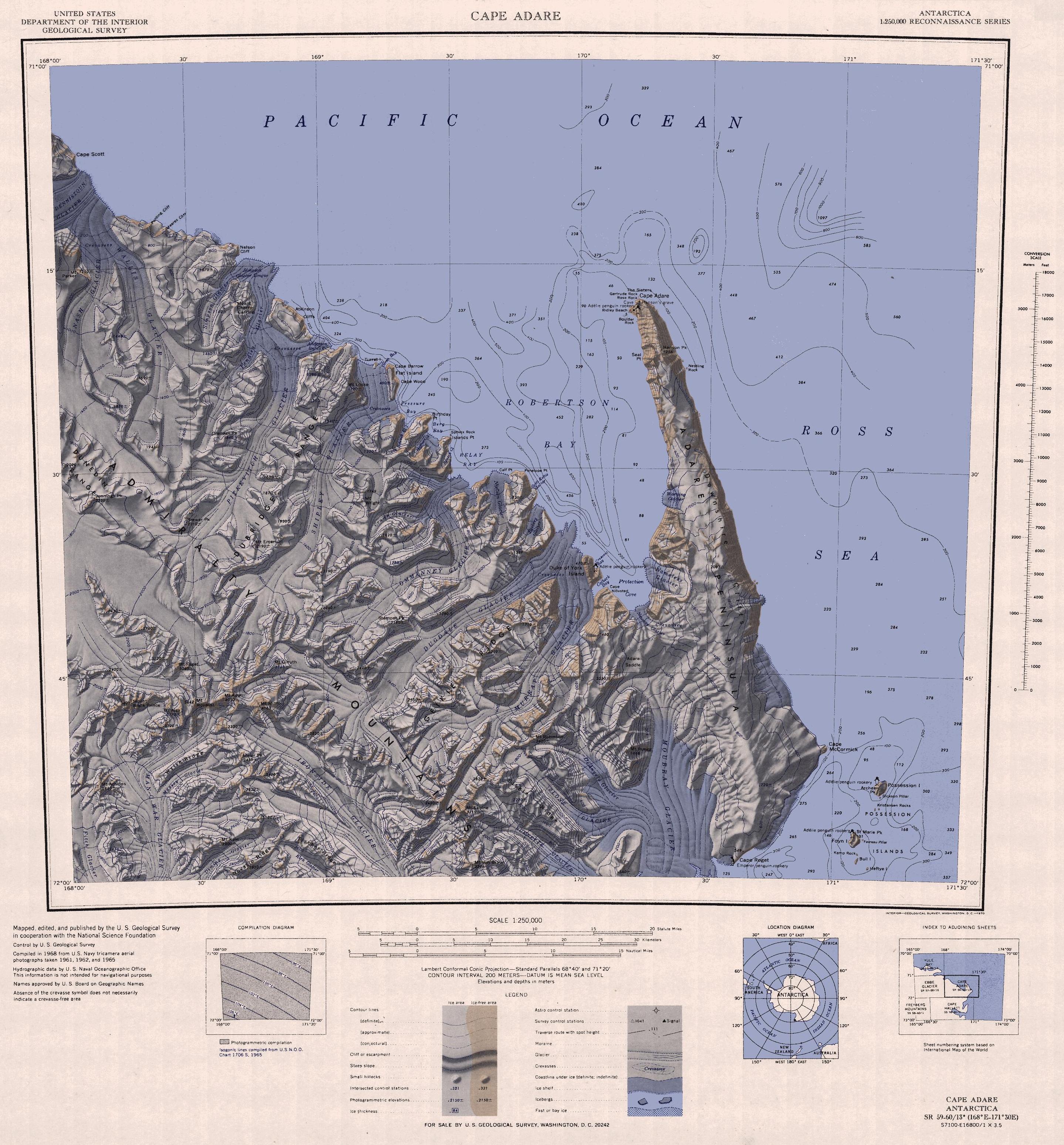
 Ostteil mit der Robertson Bay (1968)


Weblinks
- Pennell Coast im Geographic Names Information System des United States Geological Survey
Einzelnachweise
- John Stewart: Antarctica – An Encyclopedia. Bd. 2, McFarland & Co., Jefferson und London 2011, ISBN 978-0-7864-3590-6, S. 1198 f. (englisch)
На других языках
- [de] Pennell-Küste
[en] Pennell Coast
Pennell Coast is that portion of the coast of Antarctica between Cape Williams and Cape Adare. To the west of Cape Williams lies Oates Coast, and to the east and south of Cape Adare lies Borchgrevink Coast. Named by New Zealand Antarctic Place-Names Committee (NZ-APC) in 1961 after Lieutenant Harry Pennell, Royal Navy, commander of the Terra Nova, the expedition ship of the British Antarctic Expedition, 1910–13. Pennell engaged in oceanographic work in the Ross Sea during this period. In February 1911 he sailed along this coast in exploration and an endeavor to land the Northern Party led by Lieutenant Victor Campbell.[it] Costa di Pennell
La costa di Pennell (centrata alle coordinate .mw-parser-output .geo-default,.mw-parser-output .geo-dms,.mw-parser-output .geo-dec{display:inline}.mw-parser-output .geo-nondefault,.mw-parser-output .geo-multi-punct{display:none}.mw-parser-output .latitude,.mw-parser-output .longitude{white-space:nowrap}.mw-parser-output .geo{}body.skin-vector .mw-parser-output #coordinates{font-size:85%;line-height:1.5em;position:absolute;right:0;top:0;white-space:nowrap}71°00′S 167°00′E) è una porzione della costa della Terra della Regina Vittoria, in Antartide. In particolare, la costa di Pennell si estende tra capo Adare (71°17′S 170°14′E), all'estremità settentrionale della penisola Adare, a sud-est, e capo Williams (70°30′S 164°09′E) all'estremità orientale del ghiacciaio Lillie, a nord-ovest, e confina, a sud-est, con la costa di Borchgrevink e, a nord-est, con la costa di Oates. Da notare il fatto che il suo confine sud-orientale, il capo Adare, un promontorio di basalto nero, segna l'inizio dei monti Transantartici, la grande catena montuosa che idealmente separa l'Antartide Orientale dall'Antartide Occidentale.[1]Tra le formazioni presenti su questa costa spicca il ghiacciaio Rennick che, con i suoi 320 km di lunghezza è uno dei più estesi di tutto l'Antartide e del mondo intero.Другой контент может иметь иную лицензию. Перед использованием материалов сайта WikiSort.org внимательно изучите правила лицензирования конкретных элементов наполнения сайта.
WikiSort.org - проект по пересортировке и дополнению контента Википедии