geo.wikisort.org - River
The Zeegenbach is a stream in Franconia, Germany, in the Franconian Jura region, and is about 13 kilometres (8 mi) long. The Zeegenbach lies about 15 kilometres (9 mi) south-west from Bamberg by the town of Strullendorf.
| Ziegenbach | |
|---|---|
 Mouth of the Zeegenbach | |
| Location | |
| Country | Germany |
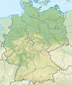
| State | Bavaria |
| District | Bamberg |
| Reference no. | DE: 242952 |
| Physical characteristics | |
| Source | |
| • location | east of the village Zeegendorf, in the karsts of the Franconian Switzerland |
| • coordinates | 49°52′24″N 11°04′38″E |
| Mouth | |
• location | north of Pettstadt in the Regnitz |
• coordinates | 49.8416°N 10.9391°E |
| Length | 13 km (8.1 mi) [1] |
| Basin features | |
| Progression | Regnitz→ Main→ Rhine→ North Sea |
Name
In official maps, the Zeegenbach is sometimes also called the Ziegenbach. In other, non-official maps, the lower course of the stream is sometimes called the Strullendorfer Bach, or the "Strullendorf stream".[2]
Course
The Zeegenbach has its source east of the village Zeegendorf, in the karsts of the Franconian Switzerland. Through the "Zeegenbachtal" valley flows the stream of the same name in the direction of Strullendorf. Here a multitude of small sources feeds the stream. On its course lies the villages of Zeegendorf, Mistendorf, Leesten, Wernsdorf and Amlingstadt, all of which belong to the community of Strullendorf.
West from Strullendorf, the Zeegenbach crosses the Rhine–Main–Danube Canal. North of Pettstadt, the Zeegenbach flows into the Regnitz.
See also
References
- Complete table of the Bavarian Waterbody Register by the Bavarian State Office for the Environment (xls, 10.3 MB)
- ADAC Freizeitatlas Bayern 1:100 000, ADAC Verlag München, ISBN 3-8264-1388-1 (2nd Edition from 2006). (in German)
На других языках
[de] Zeegenbach
Der Zeegenbach ist ein ca. 12 km langes Fließgewässer im Fränkischen Jura, ca. 15 km südwestlich von Bamberg bei Strullendorf. Er ist ein rechter und östlicher Zufluss der Regnitz. Sein Einzugsgebiet gehört zu dem des Mains.- [en] Zeegenbach
[ru] Цегенбах
Цегенбах (нем. Zeegenbach) — река в Германии, протекает по Верхней Франконии (земля Бавария). Правый приток Регница.Другой контент может иметь иную лицензию. Перед использованием материалов сайта WikiSort.org внимательно изучите правила лицензирования конкретных элементов наполнения сайта.
WikiSort.org - проект по пересортировке и дополнению контента Википедии