geo.wikisort.org - River
The Soufrière River (French la Soufrière) is a river in the Soufrière Quarter on the island country of Saint Lucia.[1] The French term "Soufrière" is a generic one referring to "Sulphury" volcanic peaks called La Soufrière or Soufrière Hills on each of St. Vincent, St. Lucia, Dominica, Guadeloupe.[2][3][4]
| Soufrière river | |
|---|---|
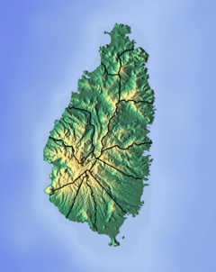 Location of mouth | |
| Location | |
| Country | Saint Lucia |
| Region | Soufrière Quarter |
| Physical characteristics | |
| Mouth | Soufrière Bay, Caribbean Sea |
• location | Soufrière, Saint Lucia |
• coordinates | 13°51′21″N 61°03′38″W |
Coarse
The Soufrière River empties into Soufrière Bay on the Caribbean Sea. A river separates the town of Soufrière from the Fond Beniere area.[5] A section of the river above the town was canalised and realigned in 1972; the river was realigned again in 1994.[6][7]
Tributaries of the Soufrière River in the interior include the Jeremy and Migny rivers.
See also
References
- William W. Dressler Hypertension and culture change: acculturation and disease in the West Indies 1982 - 158 pages "The Soufriere River separates the town from Fond Bernier. Fond Bernier is often referred to as "the part of Soufriere that St. Croix built." This refers to the fact that in the early 1950s many male residents of Soufriere migrated to .."
- Archiv für Meteorologie, Geophysik und Bioklimatologie Volumes 29-30 1980 " Most islands of this arc have an active eruptive form: The "Soufrières" of St. Vincent, St. Lucia, Dominica, Guadeloupe and Mt. Pelée on Martinique. The highest point of the lesser Antilles is the soufrière of Guadeloupe with the.."
- Lugo, Ariel E. and Sandra Brown (eds.), Watershed Management in the Caribbean, 1985. Institute of Tropical Forestry, page 35.
- "Soufrière River". National Geospatial Intelligence Agency. Retrieved August 3, 2021.
- Dressler, William W. (1982). Hypertension and culture change: acculturation and disease in the West Indies. Redgrave. p. 24. ISBN 9780913178706.
- Jordan, Peter (1985). Schistosomiasis--the St. Lucia Project. CUP Archive. p. 265. ISBN 9780521303125.
- "Saint Lucia ReefFix Exercise" (PDF). Organization of American States. 2010. pp. 8–9.
На других языках
[de] Soufrière River
Der Soufrière River (französisch la Soufrière, dt.: Schwefelfluss) ist ein Fluss an der Westküste der Karibikinsel St. Lucia.[1] Der Name bezieht sich auf die Schwefelvorkommen an den Vulkanen der Insel.[2]- [en] Soufrière River
Текст в блоке "Читать" взят с сайта "Википедия" и доступен по лицензии Creative Commons Attribution-ShareAlike; в отдельных случаях могут действовать дополнительные условия.
Другой контент может иметь иную лицензию. Перед использованием материалов сайта WikiSort.org внимательно изучите правила лицензирования конкретных элементов наполнения сайта.
Другой контент может иметь иную лицензию. Перед использованием материалов сайта WikiSort.org внимательно изучите правила лицензирования конкретных элементов наполнения сайта.
2019-2025
WikiSort.org - проект по пересортировке и дополнению контента Википедии
WikiSort.org - проект по пересортировке и дополнению контента Википедии