geo.wikisort.org - River
The Namana (Russian: Намана; Yakut: Намана) is a river in Yakutia (Sakha Republic), Russia. It is the 17th longest tributary of the Lena with a length of 444 kilometres (276 mi).[1] Its drainage basin area is 16,900 square kilometres (6,500 sq mi).[2]
| Namana Намана | |
|---|---|
 Basin of the Lena | |
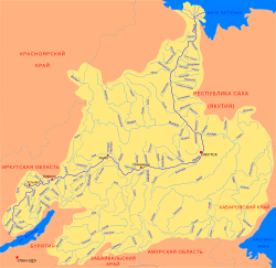
 Mouth location in Yakutia, Russia | |
| Location | |
| Country | Russia |
| Physical characteristics | |
| Source | |
| • location | Lena Plateau |
| • coordinates | 62°20′05″N 120°20′58″E |
| • elevation | 252 m (827 ft) |
| Mouth | Lena |
• location | Balagannakh |
• coordinates | 60°39′08″N 121°13′29″E |
• elevation | 121 m (397 ft) |
| Length | 444 km (276 mi) |
| Basin size | 16,900 km2 (6,500 sq mi) |
| Discharge | |
| • average | 28.6 m3/s (1,010 cu ft/s) |
| Basin features | |
| Progression | Lena→ Laptev Sea |
There are no settlements located by the river, but there is industrial production of table salt in the basin. Balagannakh village is located near the mouth of the Namana in the Lena.[1] The river flows near a landfill where there have been leaks leading to oil pollution of its waters.[3]
Course
The Namanа is a left tributary of the Lena flowing through uninhabited territory. It is formed at the confluence of the Usttaakh and Orguy rivers in the Lena Plateau. It heads across the plateau through a narrow valley, meandering increasingly. After descending into the floodplain it flows in a roughly southern direction within a wide basin dotted with lakes. Finally it meets the left bank of the Lena 2,044 kilometres (1,270 mi) from its mouth, 50 kilometres (31 mi) northeast of the city of Olyokminsk. The river basin is fed by rain and snow. Floods are common in the summer period.[1][4][5]
Tributaries
The largest tributaries of the Namana are the Dyeberelekh, Sarsan and Yulagir from the right; and the Yoksyondyo, Bas-Yurekh, Ulakhan-Arbay, the 276 km (171 mi) long Keyikte (Кэйиктэ), Kuchugui-Nygydyakh, Mukhta and Dielimde (Anabyl) from the left. The river freezes between the end of October and May.[1][5]
Flora
The vegetation of the Namana basin is mainly larch taiga, mostly not dense. The snow cover in the river basin lasts between November and April.[1]
See also
References
- Water of Russia - Намана
- "Река Намана in the State Water Register of Russia". textual.ru (in Russian).
- In Yakutia, information on oil pollution of the Namana River is being checked (in Russian)
- Google Earth
- Намана / Great Soviet Encyclopedia: in 30 vols. / Ch. ed. A.M. Prokhorov. - 3rd ed. - M. Soviet Encyclopedia, 1969-1978.
External links
- Подлёдная рыбалка. Намана-2019. Небольшой репортаж Fishing in the Namana
- Намана-2 (ice fishing in the Namana)
- Fishing & Tourism in Yakutia
На других языках
[de] Namana
Die Namana (russisch und jakutisch Намана) ist ein 422 km (mit Quellflüssen 444 km)[3][4] langer linker Nebenfluss der Lena in der Republik Sacha (Jakutien) in Russland.- [en] Namana
[it] Namana
La Namana è un fiume della Siberia orientale (Jacuzia-Sacha), affluente di sinistra della Lena.[ru] Намана
Намана́ — река в Якутии, левый приток Лены. Длина реки — 422[2] км. Площадь водосборного бассейна — 16 500[2] км². Является 17-м по длине притоком Лены[3].Другой контент может иметь иную лицензию. Перед использованием материалов сайта WikiSort.org внимательно изучите правила лицензирования конкретных элементов наполнения сайта.
WikiSort.org - проект по пересортировке и дополнению контента Википедии