geo.wikisort.org - River
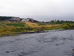
The Muna (Russian: Муна) is a river in the southwestern part on the Kola Peninsula, Murmansk Oblast, Russia. The Muna is a tributary to the river Umba. It is 40 kilometres (25 mi) long, and has a drainage basin of 988 square kilometres (381 sq mi).[1] Its source is Lake Munozero, about 30 km east of Lake Kanozero. From there it flows towards the west, following a winding course through a sparsely populated, hilly landscape dominated by forests and bogs. A substantial tributary, the Inga, flows into the Muna from the north. The Muna's outlet is at the eastern bank of Lake Kanozero, about 8 km southeast of where the river Umba falls into the same lake.
| Muna | |
|---|---|
 | |
| Location | |
| Country | Russia |
| Physical characteristics | |
| Source | Lake Munozero |
| • coordinates | 67°04′29″N 34°40′36″E |
| Mouth | Lake Kanozero |
• coordinates | 67.0647°N 34.1611°E |
| Length | 40 km (25 mi) |
| Basin size | 988 km2 (381 sq mi) |
| Basin features | |
| Progression | Lake Kanozero→ Umba→ White Sea |
References
- "Река Муна in the State Water Register of Russia". textual.ru (in Russian).
- Topographical map 1:200000 (Map) (1992 ed.). Russian Federation, Murmansk Oblast. § 22.
На других языках
[de] Muna (Umba)
Die Muna (russisch Муна) ist ein 40 km langer Nebenfluss der Umba im Südwesten der Halbinsel Kola in der russischen Oblast Murmansk.- [en] Muna (Umba)
[ru] Муна (река, впадает в Канозеро)
Муна — река в Мурманской области России. Протекает по территориям Терского района и городского округа город Кировск с подведомственной территорией.Текст в блоке "Читать" взят с сайта "Википедия" и доступен по лицензии Creative Commons Attribution-ShareAlike; в отдельных случаях могут действовать дополнительные условия.
Другой контент может иметь иную лицензию. Перед использованием материалов сайта WikiSort.org внимательно изучите правила лицензирования конкретных элементов наполнения сайта.
Другой контент может иметь иную лицензию. Перед использованием материалов сайта WikiSort.org внимательно изучите правила лицензирования конкретных элементов наполнения сайта.
2019-2025
WikiSort.org - проект по пересортировке и дополнению контента Википедии
WikiSort.org - проект по пересортировке и дополнению контента Википедии