geo.wikisort.org - River
The Lungkha (Russian: Лунгха; Yakut: Луҥха) is a river in Yakutia (Sakha Republic), Russia. It is the 14th longest tributary of the Lena with a length of 508 kilometres (316 mi) —533 kilometres (331 mi) counting its Yychaky tributary.[1] Its drainage basin area is 10,300 square kilometres (4,000 sq mi).[2]
| Lungkha Лунгха / Луҥха | |
|---|---|
 Basin of the Lena | |
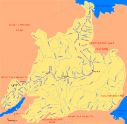
 Mouth location in Yakutia, Russia | |
| Location | |
| Country | Russia |
| Physical characteristics | |
| Source | |
| • location | Lena Plateau |
| • coordinates | 62°58′31″N 124°45′10″E |
| • elevation | 240 m (790 ft) |
| Mouth | Lena |
• coordinates | 64°10′12″N 126°42′27″E |
• elevation | 57 m (187 ft) |
| Length | 508 km (316 mi) |
| Basin size | 10,300 km2 (4,000 sq mi) |
| Discharge | |
| • average | 24 m3/s (850 cu ft/s) |
| Basin features | |
| Progression | Lena→ Laptev Sea |
A331 highway passes close to the river near its origin. The villages of Oyun-Unguokhtakh, Argas and Taas-Tumus are located by the river. The last 72 kilometres (45 mi) stretch of the Lungkha is navigable.[1]
Course
The Lungkha is a left tributary of the Lena. It is formed at the confluence of the Yychaky and Yulagir rivers in the northern part of the Lena Plateau. It flows in a roughly northeastern direction roughly parallel to the Tyugyuene to the east. In its middle course it descends into the Central Yakutian Lowland where it meanders within a wide floodplain parallel to the lower course of the Vilyuy further north. Finally it meets the left bank of the Lena 1,132 kilometres (703 mi) from its mouth and 30 kilometres (19 mi) upstream from the mouth of the Vilyuy. The river basin is fed by rain and snow. Floods are common in the summer period.[1][3][4]
Tributaries
The largest tributaries of the Lungkha are the Tohoron and Khatyng-Yurekh, both from the right. The river freezes between October and May.[1][2][4]
Flora and fauna
The vegetation of the Lungkha basin is marked by middle taiga landscape. The snow cover in the river basin lasts an average of 220 days yearly.
The main fish species in the river are pike, ide and perch.[1]
See also
References
- Water of Russia - Лунгха
- "Река Лунгха in the State Water Register of Russia". textual.ru (in Russian).
- Google Earth
- Лунгха / Great Soviet Encyclopedia: in 30 vols. / Ch. ed. A.M. Prokhorov. - 3rd ed. - M. Soviet Encyclopedia, 1969-1978.
External links
На других языках
[de] Lungcha
Die Lungcha (russisch Лунгха, auch Лунха, Luncha; jakutisch Луҥха) ist ein 508 km[3][4] langer linker Nebenfluss der Lena in der Republik Sacha (Jakutien) in Russland.- [en] Lungkha
[it] Lungcha
La Lungcha (in russo: Лунгха?; anche conosciuto come Luncha) è un fiume della Siberia Orientale (Sacha-Jacuzia), affluente di sinistra della Lena.[ru] Лунгха
Лунгха́[2] (якут. Луҥха) — река в Якутии, левый приток Лены (1132 км от устья). Длина реки составляет 508 км. Площадь водосборного бассейна — 10 300 км²[3].Другой контент может иметь иную лицензию. Перед использованием материалов сайта WikiSort.org внимательно изучите правила лицензирования конкретных элементов наполнения сайта.
WikiSort.org - проект по пересортировке и дополнению контента Википедии