geo.wikisort.org - Reservoir
Lake Ribnica (Serbian: Рибничко језеро, romanized: Ribničko jezero) is a lake in Serbia.
| Lake Ribnica | |
|---|---|
 Lake Ribnica | |
 Lake Ribnica | |
| Location | Zlatibor, Central Serbia, Serbia |
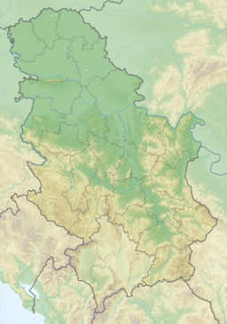
| Coordinates | 43°40′56″N 19°40′37″E |
| Type | Reservoir |
| Native name | |
| Primary outflows | Crni Rzav |
| Surface area | 10 square kilometres (3.9 sq mi) |
Geography
Lake Ribnica is located in the Zlatibor mountains, in the west of Central Serbia an in the municipality of Cajetina. It is found 8 kilometres (5.0 mi) from the town of Kraljeve Vode, also known as Zlatibor, the tourist centre of the mountain. It is located on the route which runs to Mount Tornik and the monastery of Uvac. Its geographic coordinates are 43°40′56″N 19°40′37″E.[1] It covers around 10 kilometres (6.21 mi).[2]
Characteristics
Lake Ribnica is an artificial lake, built in 1971 due to the construction of a dam on the Crni Rzav, the "Black Rzav", one of the arms of the Rzav in Zlatibor ; the dam provides food and drinking water for the towns of Kralje Vode (Zlatibor) and Čajetina.[1] The lake is abundant in fish, particularly gudgeon, trout, tench and silurus.[2]
See also
- List of lakes in Serbia
References
- "Ribničko jezero". www.zlatiborskiokrug.net (in Serbian). Retrieved 27 August 2008.
- "Geography". www.zlatibor.com. Retrieved 23 August 2008.
This Zlatibor District, Serbia location article is a stub. You can help Wikipedia by expanding it. |
На других языках
- [en] Ribnica Lake
[fr] Lac de Ribnica
Le lac de Ribnica (en serbe cyrillique : Рибничко језеро, et en serbe latin : Ribničko jezero) est un lac de Serbie.Другой контент может иметь иную лицензию. Перед использованием материалов сайта WikiSort.org внимательно изучите правила лицензирования конкретных элементов наполнения сайта.
WikiSort.org - проект по пересортировке и дополнению контента Википедии