geo.wikisort.org - Reservoir
Lag da Laus (Romansh) is a small lake within the municipality of Sumvitg in the Grisons, Switzerland.
| Lag da Laus | |
|---|---|
 | |
 Lag da Laus  Lag da Laus  Lag da Laus | |
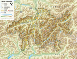
| Location | Sumvitg, Grisons |
| Coordinates | 46°42′10″N 8°54′57″E |
| Type | on rockslide debris |
| Primary inflows | from underground |
| Primary outflows | nameless, disappears |
| Basin countries | Switzerland |
| Max. length | 250 m (820 ft) |
| Max. width | 100 m (330 ft) |
| Surface elevation | 1,614 m (5,295 ft) |
| Frozen | December to March |
| Islands | none |
| Settlements | none |
 | |
There is no real tributary to the lake and the outflow will disappear in the underground after some distance as the area consists of landslide debris. The area of the landslide can easily be spotted from the Disentis direction.
Several hiking paths or mountain bike routes lead to the area. Some people swim on hot summer days although water temperature is less than 17 degrees Celsius. In the bottom of the valley a multi day hike[1] leads along the river Rhine.
References
- (in English) Hiking Switzerland on Senda Sursilvana along the river Rhine Archived 2016-03-11 at the Wayback Machine
| Wikimedia Commons has media related to Lag da Laus. |
This article related to a lake in Graubünden is a stub. You can help Wikipedia by expanding it. |
На других языках
[de] Lag da Laus
Der Lag da Laus (rätoromanisch im Idiom Sursilvan, wörtlich «Traubenkirschsee») ist ein See in der Surselva im schweizerischen Kanton Graubünden.- [en] Lag da Laus
Текст в блоке "Читать" взят с сайта "Википедия" и доступен по лицензии Creative Commons Attribution-ShareAlike; в отдельных случаях могут действовать дополнительные условия.
Другой контент может иметь иную лицензию. Перед использованием материалов сайта WikiSort.org внимательно изучите правила лицензирования конкретных элементов наполнения сайта.
Другой контент может иметь иную лицензию. Перед использованием материалов сайта WikiSort.org внимательно изучите правила лицензирования конкретных элементов наполнения сайта.
2019-2025
WikiSort.org - проект по пересортировке и дополнению контента Википедии
WikiSort.org - проект по пересортировке и дополнению контента Википедии