geo.wikisort.org - Montagne
Beinn Ìme /ˌbɛn ˈiːmə/ (gaelico scozzese: Beinn Ime) [1] è la montagna più alta delle Alpi Arrochar, nelle Highlands meridionali della Scozia.
| Beinn Ìme | |
|---|---|
 | |
| Stato | |
| Area di consiglio | Argyll e Bute |
| Altezza | 1 011 m s.l.m. |
| Prominenza | 696 m |
| Catena | Alpi Arrochar |
| Coordinate | 56°14′12.52″N 4°49′01.71″W |
| Mappa di localizzazione | |
 Beinn Ìme | |
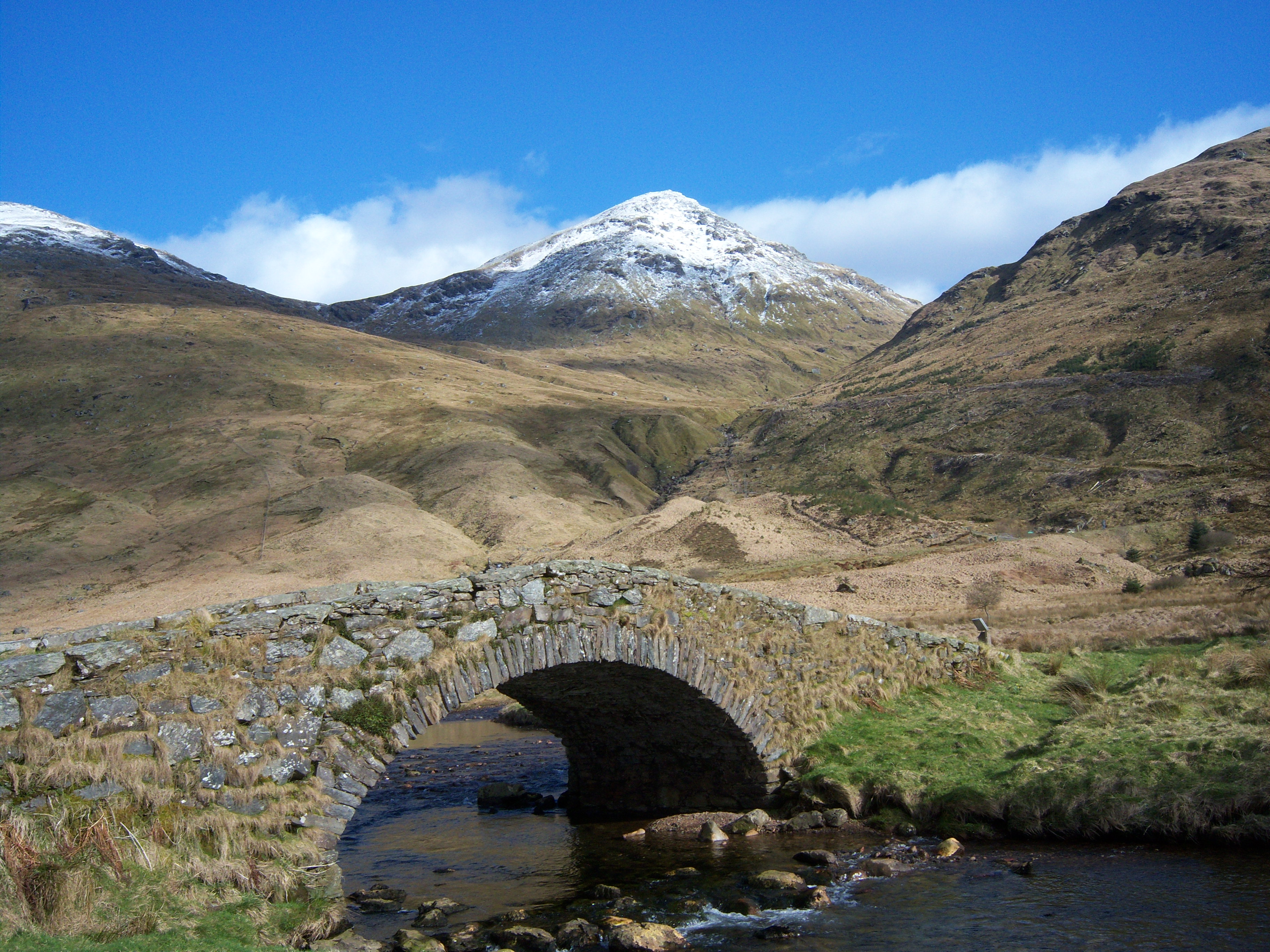
Descrizione
Ci sono tre vie di salita. Da Succoth, si può seguire lo stesso percorso utilizzato per raggiungere il Cobbler prima di prendere la biforcazione a destra vicino alla base delle principali falesie del Cobbler e continuare su per la valle, attraverso il bealach e su per la cresta orientale di Ben Ome. In alternativa, la vetta può essere raggiunta dal passo di Rest and be thankful e dal lato Loch Lomond, utilizzando la strada privata che porta a Loch Sloy.
Il Beinn Ìme separa il paesaggio del Lob Lomond nel Dunbartonshire a est e le Argyll Highlands di Loch Fyne e Loch Goil a nord, ovest e sud ovest.
Il Beinn Ìme è il punto di riferimento per l'ingresso nella contea di Argyll.
Galleria d'immagini
 Beinn Ime visto dal Corbett Beinn Luibhean, a 1,5 km a sud-ovest
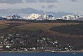 Il Beinn Ìme è la cima innevata al centro, con Cobbler di fronte e Beinn Narnain più a est (a destra)


Note
- G.M. Miller, BBC Pronouncing Dictionary of British Names (Oxford UP, 1971), p. 8.
Altri progetti
 Wikimedia Commons contiene immagini o altri file su Beinn Ìme
Collegamenti esterni
- Panorama della vetta generato dal computer Descrizione Beinn Ime
На других языках
[de] Beinn Ìme
Der Beinn Ìme ist ein 1.011 m (3.317 ft) hoher Berg in Schottland. Sein gälischer Name bedeutet ungefähr Butterhügel.[1] Der Berg ist die höchste Erhebung der Arrochar Alps. Diese Berggruppe liegt zwischen dem nördlichen Ende von Loch Long und dem Westufer von Loch Lomond in den südlichen Highlands im Loch Lomond and the Trossachs National Park. Der Beinn Ìme ist als Munro eingestuft.[en] Beinn Ìme
Beinn Ìme (Scottish Gaelic: Beinn Ìme) is the highest mountain in the Arrochar Alps, in the Southern Highlands of Scotland. There are three usual routes of ascent. From Succoth, one may follow the same path that is used to reach The Cobbler before taking the right fork near the base of the Cobbler's main crags and continuing up the glen, across the bealach and up Ben Ìme's eastern ridge. Alternatively, the summit can be reached from the pass of Rest and be Thankful and from the Loch Lomond side, using the private road that leads to Loch Sloy. Beinn Ìme separates the Dunbartonshire landscape of Loch Lomond in the East and the Argyll Highlands of Loch Fyne and Loch Goil anywhere north, west, south west. Beinn Ìme is the landmark to the entrance to Argyll.- [it] Beinn Ìme
Другой контент может иметь иную лицензию. Перед использованием материалов сайта WikiSort.org внимательно изучите правила лицензирования конкретных элементов наполнения сайта.
WikiSort.org - проект по пересортировке и дополнению контента Википедии