geo.wikisort.org - Montagne
Le mont Adelung est une montagne d'Ouzbékistan.
Cet article est une ébauche concernant la montagne et l’Ouzbékistan.
Vous pouvez partager vos connaissances en l’améliorant (comment ?) selon les recommandations des projets correspondants.
| Mont Adelung | ||

| ||
| Géographie | ||
|---|---|---|
| Altitude | 4 301 m | |
| Massif | Monts Pskem | |
| Coordonnées | 42° 07′ 26″ nord, 70° 58′ 07″ est | |
| Administration | ||
| Pays | ||
| Province | Tachkent | |
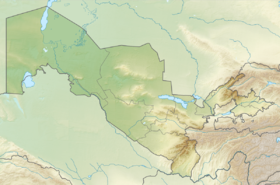
| Géolocalisation sur la carte : Ouzbékistan
| ||
| modifier |
||
Toponymie
En russe, le nom de la montagne est Гора Аделунга (Gora Adelounga). Elle est également désignée sous le nom d'Adelunga Toghi.
Géographie
Le mont Adelung est situé dans les monts Pskem, au nord-est de la province de Tachkent, en Ouzbékistan. Avec 4 301 m d'altitude, elle constitue le point culminant de cette province, mais pas du pays (ce dernier est situé au Khazret Sultan, à 4 643 m d'altitude).
Annexes
Liens externes
- (en) Adelunga Toghi, Uzbekistan (PeakBagger)
 Portail de la montagne
  Portail de l’Ouzbékistan
На других языках
[de] Adelunga Togʻi
Der Adelunga Togʻi (auch Adelunga Toghi) ist ein Berg mit 4301 m Höhe im Talas-Alatau, einer zum Tienschan gehörenden Gebirgskette. Er liegt in Usbekistan an der Nordostgrenze zu Kirgisistan.[en] Mount Adelung
Mount Adelung (Russian: Гора Аделунга) is the highest peak in Pskem Range (Russian: Пскемский хребет) in the extreme north-east of the Tashkent Region, Uzbekistan.[1] Mount Adelung is the highest point of Tashkent Province at 4,301 meters, just 2 meters higher than the nearby Mount Beshtor, located a little further to the south-west in the same range, and it is often erroneously identified in various web sources as the "highest point in Uzbekistan". In fact, this honor goes to the Khazret Sultan, a peak with an altitude of 4,643 m in Surxondaryo Region, in the Uzbek part of the Gissar Range, on the border with Tajikistan, which was formerly known as Peak of the 22nd Congress of the Communist Party.[2][3]- [fr] Mont Adelung
[ru] Аделунга
Пик Аделунга (узб. Adelunga choʻqqisi) — горная вершина Пскемского хребта (в его северо-восточной части)[1], на границе Узбекистана и Киргизии. Имеет высоту 4301 м над уровнем моря.Текст в блоке "Читать" взят с сайта "Википедия" и доступен по лицензии Creative Commons Attribution-ShareAlike; в отдельных случаях могут действовать дополнительные условия.
Другой контент может иметь иную лицензию. Перед использованием материалов сайта WikiSort.org внимательно изучите правила лицензирования конкретных элементов наполнения сайта.
Другой контент может иметь иную лицензию. Перед использованием материалов сайта WikiSort.org внимательно изучите правила лицензирования конкретных элементов наполнения сайта.
2019-2025
WikiSort.org - проект по пересортировке и дополнению контента Википедии
WikiSort.org - проект по пересортировке и дополнению контента Википедии