geo.wikisort.org - Mountains
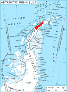
Mount Pénaud is a mountain rising to ca. 1050 m in the east part of Chavdar Peninsula, Danco Coast on the west side of Graham Land, Antarctica, 8.55 km east-southeast of Cape Herschel. It surmounts Tumba Ice Cap to the northwest and Samodiva Glacier to the northeast.
This article needs additional citations for verification. (May 2017) |
The peak was roughly charted by Captain Henry Foster in January 1829 and called 'Mount Herschel' after Sir J. F. W. Herschel. The mountain was photographed from the air by FIDASE, 1956–57 and, in association with the names of pioneers of aviation grouped in this area, named by the UK Antarctic Place-Names Committee Mount Pénaud after Alphonse Pénaud (1850–80), French aircraft designer, 1871–80.
Maps
- Antarctic Digital Database (ADD). Scale 1:250000 topographic map of Antarctica. Scientific Committee on Antarctic Research (SCAR). Since 1993, regularly upgraded and updated.
References
- Mount Pénaud. SCAR Composite Gazetteer of Antarctica
This Danco Coast location article is a stub. You can help Wikipedia by expanding it. |
На других языках
[de] Mount Pénaud
Mount Pénaud (in Chile Monte Barrera) ist ein rund 1050 m hoher Berg ostsüdöstlich des Kap Sterneck an der Danco-Küste des Grahamlands auf der Antarktischen Halbinsel.- [en] Mount Pénaud
Другой контент может иметь иную лицензию. Перед использованием материалов сайта WikiSort.org внимательно изучите правила лицензирования конкретных элементов наполнения сайта.
WikiSort.org - проект по пересортировке и дополнению контента Википедии