geo.wikisort.org - Bergen
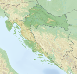
Der Berg Hum ist mit einer Höhe von 587 Metern die höchste Erhebung auf der Insel Vis in Kroatien; er liegt im Osten der Insel nahe dem Ort Komiža.
| Hum | ||
|---|---|---|
 | ||
| Höhe | 587 m. i. J. | |
| Lage | Insel Vis, Kroatien | |
| Koordinaten | 43° 1′ 56″ N, 16° 6′ 57″ O | |
| ||
Da vom Hum aus ein guter Überblick besteht, errichtete die Armee am Gipfel eine militärische Radarstation. Weil dort oben eine Militärstation aufgebaut wurde, wurde sie auch vermint.
На других языках
- [de] Hum (Vis)
[en] Mount Hum (Vis)
Mount Hum (Croatian pronunciation: [xûːm]) is a mountain located on the island of Vis, Croatia. It is the highest elevation point of Vis with its 587 metres (1,926 ft). A military radar station is located on the top and the peak is not accessible to civilians.[1]Текст в блоке "Читать" взят с сайта "Википедия" и доступен по лицензии Creative Commons Attribution-ShareAlike; в отдельных случаях могут действовать дополнительные условия.
Другой контент может иметь иную лицензию. Перед использованием материалов сайта WikiSort.org внимательно изучите правила лицензирования конкретных элементов наполнения сайта.
Другой контент может иметь иную лицензию. Перед использованием материалов сайта WikiSort.org внимательно изучите правила лицензирования конкретных элементов наполнения сайта.
2019-2025
WikiSort.org - проект по пересортировке и дополнению контента Википедии
WikiSort.org - проект по пересортировке и дополнению контента Википедии