geo.wikisort.org - Isla
Texa es una pequeña isla perteneciente al grupo de las Hébridas Interiores, en Escocia. Se encuentra localizada al sur de Islay. Ocupa una superficie de 48 ha y alcanza su altura máxima a 48 msnm, en Ceann Garbh. La isla se encuentra actualmente deshabitada, pero alberga una población de cabras salvajes.
| Control de autoridades |
|---|
| Texa | ||
|---|---|---|
 | ||
| Ubicación geográfica | ||
| Región | Islas Hébridas Interiores | |
| Coordenadas | 55°37′00″N 6°08′30″O | |
| Ubicación administrativa | ||
| País | Reino Unido | |
| División | Argyll and Bute | |
| Características generales | ||
| Superficie | 48 ha | |
| Longitud | 1,3 km | |
| Anchura máxima | 600 m | |
| Punto más alto | () | |
| Población | ||
| Población | 0 hab. () | |
| Mapa de localización | ||
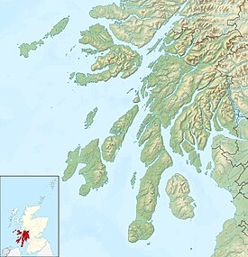 Texa Ubicación (Argyll and Bute). | ||
На других языках
[de] Texa
Texa (gälisch: Teacsa) ist eine schottische Insel. In Joan Blaeus Atlas aus dem Jahre 1654 wird der Name der Insel als Ylen Teghza angegeben.[en] Texa
Texa (Scottish Gaelic: Teacsa) is a small island 700 metres (3⁄8 mile) directly south of Islay, in the Inner Hebrides, Scotland. It reaches a height of 48 metres (157 feet) at its highest point, Ceann Garbh. It is part of the parish of Kildalton on Islay. The distilleries of Laphroaig and Lagavulin are nearby on the Islay coast, as well as Port Ellen. It is currently uninhabited, but is home to wild goats, as well as otters.- [es] Texa
[fr] Texa
Texa est une île du Royaume-Uni située en Écosse.[it] Texa
Texa (in lingua gaelica irlandese Teacsa) è un'isola della Scozia situata a sud di Islay, tra le Ebridi Interne.Текст в блоке "Читать" взят с сайта "Википедия" и доступен по лицензии Creative Commons Attribution-ShareAlike; в отдельных случаях могут действовать дополнительные условия.
Другой контент может иметь иную лицензию. Перед использованием материалов сайта WikiSort.org внимательно изучите правила лицензирования конкретных элементов наполнения сайта.
Другой контент может иметь иную лицензию. Перед использованием материалов сайта WikiSort.org внимательно изучите правила лицензирования конкретных элементов наполнения сайта.
2019-2025
WikiSort.org - проект по пересортировке и дополнению контента Википедии
WikiSort.org - проект по пересортировке и дополнению контента Википедии