geo.wikisort.org - Coast
Schmidt Peninsula (Russian: Полуостров Шмидта) is a peninsula in Sakhalin Oblast, Russian Federation. It is the northernmost point of Sakhalin Island and is located north of Okha town.
Полуостров Шмидта | |
|---|---|
 Location of the Schmidt Peninsula in Sakhalin | |
 Schmidt Peninsula Location in the Far Eastern Federal District | |
| Geography | |
| Location | Sakhalin Oblast, |
| Coordinates | 54°08′N 142°44′E |
| Adjacent bodies of water | Sea of Okhotsk |
| Length | 70 km (43 mi) |
| Width | 45 km (28 mi) |
| Highest elevation | 623 m (2044 ft) |
| Highest point | Mt Three Brothers |
| Administration | |
Russia | |
| Federal subject | Sakhalin Oblast |
History
The indigenous Nivkh people of northern Sakhalin called the peninsula Mif-Tyongr (Миф-тёнгр), meaning "head of the earth." The name Schmidt Peninsula was chosen by geologist N. Tikhonovich in 1908, in honor of fellow geologist Fyodor Schmidt who had visited Sakhalin in 1866. Previously it had been named "Saint Elizabeth Peninsula" in certain maps. Cape Elizabeth and Cape Mary, the two main headlands of the peninsula, had been named in 1805 by Russian Navy Admiral Ivan Kruzenshtern (1770–1846).[1]
Geography
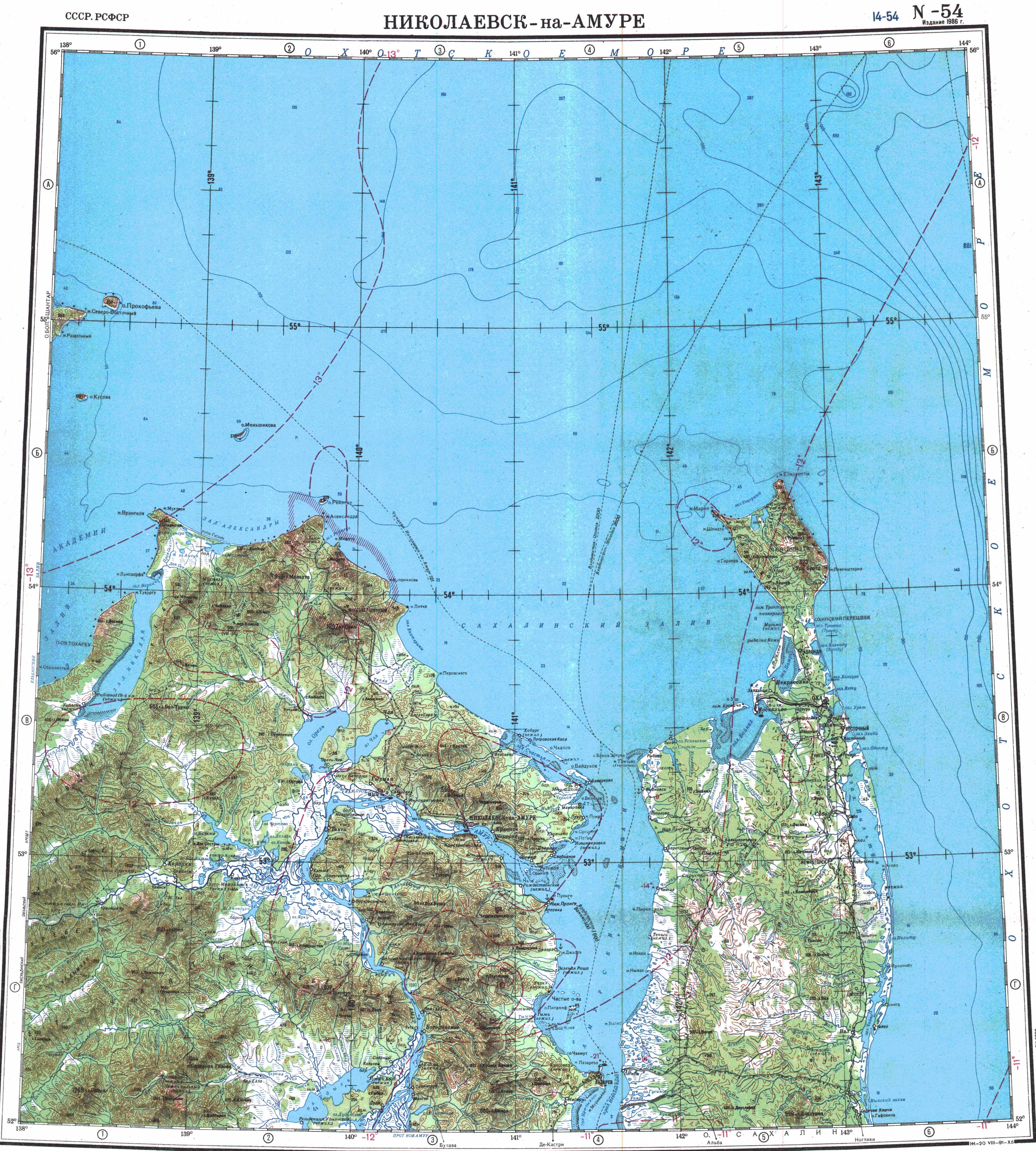
The Schmidt Peninsula is the northern extremity of Sakhalin Island. There are two roughly parallel mountain ranges stretching in a NNW/SSE direction. The mountains are covered with larch and spruce forests and are separated by a swampy valley. Cape Elizabeth is at the northern end of the Eastern Range and Cape Mary (мыс Марии), the northwestern headland, at the northern end of the lower Western Range. Severny Bay lies between them.[2] To the west lies the Sakhalin Gulf and to the east and north the Sea of Okhotsk. The highest point of the peninsula is 623 m (2,044 ft) high Mount Three Brothers (гора Три Брата), rising in the eastern range.[3][4][5]
 |
 |
References
- Трёхтомный отчет «Путешествия вокруг света в 1803, 1804, 1805 и 1806 гг. на кораблях „Надежде“ и „Неве“»
- "Топографска карта N-54; M 1:1 000 000 - Topographic USSR Chart (in Russian)". Retrieved 19 January 2022.
- "Полуостров Шмидта". Great Soviet Encyclopedia.
- National Geospatial-Intelligence Agency. (2014). Sailing Directions (Enroute): East Coast of Russia. U.S. Government
- Google Earth
External links
 Media related to Schmidt Peninsula (Sakhalin) at Wikimedia Commons
This Sakhalin Oblast location article is a stub. You can help Wikipedia by expanding it. |
На других языках
- [en] Schmidt Peninsula (Sakhalin)
[ru] Полуостров Шмидта
Полуо́стров Шми́дта — северная оконечность острова Сахалин длиной около 50 км.Другой контент может иметь иную лицензию. Перед использованием материалов сайта WikiSort.org внимательно изучите правила лицензирования конкретных элементов наполнения сайта.
WikiSort.org - проект по пересортировке и дополнению контента Википедии